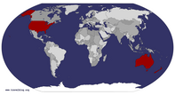
Page 8 of rocket Travel Blog Posts


Oceania » Australia » New South Wales » Broken Hill April 24th 2012

Geo: -31.9592, 141.467Today's Challenge - The first to spot a white horse gets a free round of drinks at the next outback pub.It's Rods Birthday today and he checks his phone for Birthday wishes. Brooke is up in Brisbane and sends a big Birthday wish, she asks what we are up to today. We leave Gilgandra at 7.30am in heavy fog again but it doesn't take long to clear to a superb day. We weave our way through some very scenic country but there is not a white horse in sight.Three hours into the drive we take a picture of a big road sign welcoming us the the NSW Outback, low and behold, one minute later we spot a highway patrol car pulling over a speeding driver. "Nice welcome" we both say.As we enter Cobar, Debi ... read more
We stop for a break outside of Cobar
Welcome to Cobar
Lunch at Little Topar

Oceania » Australia » New South Wales » Gilgandra April 23rd 2012

Geo: -31.7117, 148.663We departed sunny Brisbane at 5.15am. Its still dark, so how do we know its sunny? We are looking forward to the biggest road trip we have ever undertaken and this one will make Route 66 look like a drive to the local store. We estimate we will travel approximately 12,000 km in 26 days and only cross one long section of road twice, that being the Eyre Highway across the Nullarbor Plain.Today's Challenge - To check the theory that every town must have a Chinese restaurant before they are valid to apply for a Post Office.At 100 km we have driven through very heavy fog and now the sun is just starting to peek through, so I reach for my new sunny's. We are already sick of counting the headlights pearing through the ... read more
Debi at the information centre in Coonararabran
Orana Windmil Motel, Gilgandra
First nights accommodation, Gilgandra

Oceania » Australia » Queensland » Brisbane May 7th 2011

Geo: -27.4676, 153.028Today we spend our last day in Las Vegas before flying to LAX then home to Brisbane on a late night flight. We decide to have one last American classic before heading out to the Airport, a burger, a hot dog and a bucket of iced Corona's. It is a hot day and the beers go down well.We cab it to the Airport and low and behold there are pokies all over the place, one last chance to steal your money before leaving. We board a small United Airline jet and shortly after arrive in Los Angeles. We do some duty free shopping and head to the Alaskin Airlines lounge which is Virgin Australia's partner facility. They have the cheek to charge us $45 a head then only offer lousy snacks and a max ... read more
Boarding our United Airlines flight to LAX
Our Virgin Australia flight arrives at LAX

North America » United States » Nevada » Las Vegas May 4th 2011

Geo: 36.0846, -115.1721st May - Today Debi and I renew our wedding vows after 36 years of marriage at an Elvis Chapel. We start the morning with a glass of champagne and were picked up by a white Limo and taken to the chapel some 15 minutes east of the strip. It was a great ceremony, Debi looked great and we had lots of fun. We had a special dinner that night at Bobby Flay's restaurant "Mesa".2nd May - Booked a hop on hop off tour of the strip today had lots of fun (Vegas is one crazy city). After lunch I retrieved the car from the hotel valet and drove it down the strip then returned it to the Airport. Why is it when you return a hire car you can never find a service ... read more
Our tour Bus
The pool at the Flamingo
Margarita-Ville

North America » United States » Nevada » Las Vegas April 30th 2011

Geo: 36.0846, -115.172This morning we have breakfast in front of a big open fire as the weather is chilly. We are heading to Vegas today with only one stop (Hoover Dam). Our sat nav tells us it is a four and a half hour trip and we skip the remaining R66 components of the journey as Deb is busting to get to the Sin City. We exit the I40 at Kingman and reduce our speed by 10 mph as highway 93 begins to narrow.Three and a half hours into todays trip the Hoover Dam approaches along with strong wind warnings. As we drive past the dam wall in the distance to our right, we wonder if we missed the exit however we spot it some 5 miles on and join a long line of traffic on ... read more
The Hoover Dam
Our hotel is over there somewhere
Try navigating these on entry to our hotel


Geo: 36.0262, -112.13628th April - Today we head for the Grand Canyon and the weather is sunny but cool as we are still at a high altitude. We do a 3 hour run to Williams which is another R66 town and here we drop into Bearazona which is a drive through wildlife park. Before entering the bear enclosure we are warned that they like to take a swipe at side mirrors and keep them as souvenirs. Luckily none attempt to do this. On leaving the park we head to downtown for some lunch at the R66 diner which has quite an atmosphere and have baby back ribs and a cold beer, (nice lunch). Now we are off to the Grand Canyon which is an hour off the I40. We arrive around 3.00pm and check into our ... read more
Berazona and one of its residents
The El Tovor Hotel
One of the Canyon  views toward the east

North America » United States » Arizona » Holbrook April 27th 2011

Geo: 34.9017, -110.16You may notice my blogs are somewhat late, this is mainly due to poor Internet connections and priority on planning the next days activities, however I will try to catch up.This morning we leave Santa Fe and head towards the Ancient Acoma Pueblo known as Sky City. We bypass Albuquerque and the Rio Grand and exit towards the Sky City mesa, its a beautiful drive with rock formations and great scenery. We catch a shuttle and drive to the top of a huge rock formation lined with adobe houses, said to be the oldest continually inhabited city in the USA. This mesa-top village has no power or water and this is how the inhabitants want it to stay. The only sign of modern conveniences are lots of porta loo's perched on the edge of ... read more
Sky City In the background
Ladders on the adobe houses at Sky City
The Wig Wam Motel at Holbrook

North America » United States » New Mexico » Santa Fe April 26th 2011

Geo: 35.6915, -105.93725 April - We rise to good but windy weather. The car got blown around as we climbed to 5000 ft on the I40. We were followed by a big red truck (reminded me of the movie Duel) but we managed to shake him as we exited to Santa Rosa where we drove some more R66 and stopped at a cool Motor Museum, even Debi liked it. Inside was my all time favorite a 1957 F Body Chevy Camaro.We then made our way to Santa Fe where the landscape changed dramatically, lots of flat top hills and long gullies where you might expect to see Indians waiting to ambush a wagon train. As we approached the city the dwellings were all "adobe" style and we found out later that this is the only allowed ... read more
La Fonda Hotel Santa Fe
View from our room at La Fonda Hotel
A bronze sculpture along Canyon Road

North America » United States » New Mexico » Tucumcari April 24th 2011

Geo: 35.1786, -103.725Today is my birthday yeah!!!After leaving Weatherford in light rain and fog we drive some more R66 until we reach the Apache Trading Post where the road gets swallowed by the I40. Next stop is Clinton which has a fabulous museum and some good photo opps but of cause it is Sunday and it is closed, we take a few good pictures and head towards the Texas border and the small town of Texola. Next is Shamrock and the U-Drop Inn Conoco Station a definite photo opp. As we drive through Texas the weather clears and we spot miles upon miles of wind generators. R66 is very hard to follow here as it is mostly dirt track so we stick to the interstate. The Texan landscape becomes sparse much like outback Australia, as be ... read more
Broasted Chicken Drive Through Clinton
The Big Texan Steak Ranch Texas
The Texan Panhandle

North America » United States » Oklahoma » Weatherford April 23rd 2011

Geo: 35.5261, -98.7072After another night of storms we woke to find that Saint Louis had been hit by a Tornado (lucky we were 3 hours west), it seems we have been outrunning them for quite a while now. We head back to the I40 and make our way to Tulsa.The weather starts to clear as we decide to do some more R66 and exit into Reno, here we drive quite a few miles on the historic route and pass the Fort Reno Gates. Back onto the I40, we exit again, drive some more historic road and pull up at Stroud where we were considering staying the night. Still to early in the day, we have lunch and head toward Oklahoma City and it is still raining. On taking another wrong exit we catch some traffic but ... read more
Weatherford R66 Signage
The Mark Hotel (nice accommodation)
A wet morning on R66 West of Weatherford


Tot: 0.156s; Tpl: 0.008s; cc: 19; qc: 66; dbt: 0.0825s; 1; m:domysql w:travelblog (10.17.0.13); sld: 1; ; mem: 1.2mb