Advertisement
Published: June 24th 2017

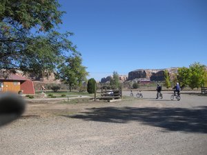
 Cottonwood campground
checking out the bicyclesGeo: 37.2844, -109.551
Albuquerque to Bluff
Up and on the road to Albuquerque to pick up Stefan and Marianne at the Route 66 Hostel where they were waiting for us and ready to get on the road. The Balloon Festival was going on when we left and we did get to see a few balloons as we headed out. Made good time with a grocery shopping trip in Farmington and got to Bluff and the Cottonwood campground at around 5:00pm.
Stefan and Marianne are staying in one of our tents using borrowed sleeping bags and pads. Marianne said she would rather tent camp than sleep in the camper with us which worked out just fine. Got their tent set up and walked to the Cottonwood Restaurant for dinner. The restaurant used bandannas as napkins and you were urged to take them with you. First souvenirs for them!
The next day we went for a bike ride to see if we could find where the swinging bridge used to cross the San Juan river. We had read it had been washed away in a flood and not repaired. Did not find the place where it crossed but did enjoy the ride and day. Rode through town and stopped at the Tourist Information center where they gave us a map of some of the places to see rock art. One of the guys in there gave us some information about how to find some of the places. Butler Wash is on one side of Comb Ridge which evidently has many rock art sites around.
Butler Wash - Monarch Canyon
Ate lunch and then headed out to find the Monarch Canyon cliff dwellings. Two false starts before we found the path out to the cliff dwellings. Pretty amazing to see them from a distance and imagine how these people lived. Walked up to the ruins but did not walk around inside but did enjoy the rock art and pottery and other fragments left in place.
Valley of the Gods
Got packed up and headed toward Valley of the Gods. Stopped for some pictures of Comb Ridge from a different viewpoint. Unhooked the car for the ride in. The road was in very good shape and we got to our regular campsite. Marianne was a little apprehensive as we turned down the narrow path to get to the campsite. Got the truck fairly level and had lunch then all took a break. Had Kebabs .dinner using our new grill that Stefan and Robert had put together.
The next day we rode our bicycles along the road until we got to a nice wash and hiked down it until we got to the end and then hiked back along the upper ridge. There were some nice flowers, shapes, colors and the ravens followed us along the path. Was a nice day and back to the campsite for sunset and dinner, rusti by Marianne.
Kachina Bridge - Natural Bridges
Broke camp the next day and headed toward Natural Bridges. This is a small campground and unfortunately, it was full. We soon discovered on this trip, October is a favorite time for Europeans to come to the West as well as many people from around the United States.
Even though we were not able to camp, we drove the scenic route and saw two of the bridges and hiked down to the Kachina Bridge. It was another beautiful day and we enjoyed a picnic before setting off down the trail. Got to enjoy some rock art, beautiful bridge and just being outside.
That evening we found the road that heads up to Bear Ears and drove up until we found a place that looked good for camping. Got ourselves set up and had fajitas, a fire and lots of laughs before calling it an evening.
The next morning we drove further up the road toward the Bear Ears and enjoyed some spectacular vistas across the valley. Turned back around and headed toward Capital Reef.
Trail of the Ancients - Hite Marina to Capital Reef
Drive down to the Hite Marina for lunch before heading into the incredible road to Capital Reef. Had a picnic down near the water and were surprised to see as much water as there was. According to the lady at the gas station, they had released some of the water down to Lake Mead.
Enjoyed the drive from Hite Marina to Capital Reef. The canyon walls close in in some places and the colors are brilliant as we drove along. Got to the visitor center at Capital Reef where we found out, campground full. Did a quick look through the visitor center, and then headed out in search of a place to camp. The nearest campgrounds were not really near and we ended up in Torrey at a RV park. All were tired so was a fairly early evening and the most wonderful HOT showers the next morning.
Calf Creek
Drove from Torrey toward Escalante. The aspens were in full color and we had to stop a few times for pictures and at one place we found some downed wood that was a perfect length for fires. Took a detour to a reservoir where Robert and Laura had camped many years ago and had our lunch and enjoyed the birds. We also had to stop at overlook back down into the valley and see all the amazing colors.
Got to Calf Creek and there was a perfect campsite on the other side of the creek but right next to it but up higher so no danger of flash flood. Did a short hike back to register and read about the possible mountain lion in the area. Back to the campsite for a nice dinner of brussel sprouts, steak, salad and wine and plans for hike to the falls while enjoying the fire.
Got a fairly early start toward the falls while it was still fairy cool. The trail is fairly level with a few places where you do climb up and then down again but was fairly easy going. We had a trail guide that pointed out the various places of interest including the rock art on the wall across the creek. Studied them for awhile and saw the main ones and then some others that were further on around the wall.
Got to the falls and cooled down in the mist of the falls and ate our lunch. The trip back was faster than the trip there! Back to the campsite where we fixed tacos, rice and guacamole. Sat around the fire and enjoyed relaxing and doing a lot of laughs.
Grand Staircase Escalante - Zion - Smithsonian Road
Next morning got packed up and on the road toward Zion via the drive up the Grand Staircase Escalante road. It is such a stunning road complete with switchbacks and jaw dropping scenery. Did a few stops for pictures as we proceeded along the way.
Got to the entrance to the tunnel into Zion National Park. There was a sign saying the campground was full but we headed in anyway because this was the direction we were heading and would see what was happening after we got through the tunnel. We have kept up with the paper indicating we can go through the tunnel without an escort with our mirrors in which makes it a bit unnerving. There was an oversized vehicle ahead of us that was straddling the middle of the road and we followed suit!
Got through and continued on through the park. Love that ride. Got to area near the visitor center and campgrounds and now a sign saying there was no parking available in the park. Really crowded!
Drove to Springdale and checked the RV park; could take our camper but no place to put up the tent so we headed on toward Smithsonian Road. This is a road that climbs up and over to intersect with roads leading to Lake Powell.
We unhooked the vehicles and set off up the road. The road has had some bad places in spots but this time was the worst! Huge trenches, dips, and rocks. Stefan got out of the truck and was helping Robert scout the best route to take. The truck was swaying from side to side and looked pretty hairy! Because the car has such a smaller wheel base, we were able to creep up without much difficulty. Think this was one of scariest rides Marianne has been on! Finally found a place where we could
be level and they could pitch their tent.
Got set up enjoyed the sunset, built a fire and had wok food for dinner. All relaxed after the grueling ride. Seems the off road vehicles are pretty much responsible for the mess the road is in. This makes their rides so thrilling!
The next day we proceeded on out the Smithsonian Road heading toward Kanab
and Lake Powell.
Advertisement
Tot: 0.073s; Tpl: 0.013s; cc: 10; qc: 19; dbt: 0.0302s; 1; m:domysql w:travelblog (10.17.0.13); sld: 1;
; mem: 1.1mb


