Advertisement
Published: October 16th 2015

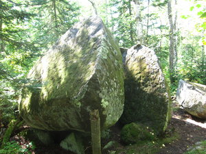
 IMG_3105
Jeremy's RockI am in the process of typing up my notes from my trip journal. They are organized by date, day of my trip and finally hiking day. I will be adding posts as I get the notes typed. This post has the first three days.
9/19/15 Day 1 Hiking Day 1
Stayed at Ella’s (VRBO) in Grand Marais after the Mountain Stage concert last night at North House Folk School. We packed and left by 8am, arriving at Otter Lake Road SHT parking lot around 10am. Maureen and I walked a little over a mile to the northern terminus of the SHT where it connects to the Border Route Hiking Trail. On a beautiful sunny day, we took pictures and signed the trail log book at a spot called 270 degree lookout. It was a beautiful view where you could see the Pigeon River and into Canada. I decided to adopt a trail name and go by Capt Blaze for the trip when writing in trail logs. We returned to the car and I grabbed my pack and we said our good-byes and I hit the trail about 11am. The first mile has been converted to a muddy mess
of a logging access road. The long grass over the next few miles cleaned all the mud off my boots. The initial portion of trail was pretty level and I was making good time. A big climb after Andy Lake Road led to a large maple forest. I took a break at the elevation high point for the SHT – it would be all downhill from here – ya right. My next break was at about 7 miles at Jackson Creek camp, which has a large glacial erratic next to it named Jeremy’s Rock. Continued past Jackson Lake Road and stopped at Hellasious overlook with great views of Lake Superior. I decided to camp at Woodland Caribou camp and met Heidi, Tom and July from the Twin Cities. We had a great conversation over dinner and then hit the tents early. This being a small campsite with only two tent pads made for setting up my tent in a lumpy spot so it was not the most comfortable night. Made it 11 miles down the trail from the car for a total of 13 miles hiked that day.
9/20/15 Day 2 Hiking Day 2
Woke up at Woodland
Caribou camp and had breakfast and chatted with camp mates. I was packed up and was ready to go by a little after 8am, before my camp mates. We talked about staying at the same camp again but my desire to make more miles was on my mind. The trail was rugged the first few miles. I stopped for a break at North Carlson Pond camp which was not a very nice campsite. Just after crossing the Arrowhead Trail and a big beaver dam, I encountered three women from Ely who were walking the SHT one section at a time by using two cars to do day hikes and staying in motels. Their goal was to cover the whole SHT in one year, starting at Jay Cooke Park near Duluth and working north. They were nearing their goal. Seem like lots of people have their story and preference of how to hike the SHT. Common theme is a love of the trail. I stopped at Hazel camp for lunch making good time. This being the last campsite before Magney State Park, I decided push on. There was a long road hike which made for sore feet by the time I

 IMG_3130
Devil's Kettlereached Magney. I was very tired as I walked through a deserted State Park. Since it was late in the day, I was able to see Devil's Kettle by myself. I arrived at the campground just before dark and set up and ate dinner late. It had been a beautiful sunny day with west winds and mid 60s temps. Covered 19 miles today.
9/21/15 Day 3 Hiking Day 3
Woke up at Magney State Park to another nice morning. Packed up and hit the trail before 8am. I felt pretty good after the long day yesterday except for sore feet and blisters so I planned an easier day, only about 11 miles. I climbed the first hill and found lots of mud on top. Descended to Lake Superior and found no beach due to high wave action on the first portion of the SHT called the Lakewalk. I had to go back and walk along Hwy 61. I found my way back to the beach but the going was really slow. I eventually came to another spot with no beach and went back to Hwy 61. Had lunch in the shade by the beach on a warm day.

 IMG_3151
No beach to walk on at the LakewalkWas able to get first cell phone coverage and left a voice mail update with Maureen. I also got text updates from my daughter Heather that the Twins took a couple on the chin in their quest for the playoffs. Headed up the hill toward Kadunce River, encountering very few people on the trail. I wrote in the trail log at Kadunce and admired the new bridge, which was placed by helicopter. I did come across a large youth group at the parking area near Kimball Creek. I ended up camping at Kimball Creek camp. Luckily I didn’t stay at Kadunce River camp since that is where the large group was headed. I had good reception for listening to baseball and Monday night football. The sound of the river was very relaxing and sleep came easy this night.
Advertisement
Tot: 0.06s; Tpl: 0.01s; cc: 11; qc: 29; dbt: 0.0297s; 1; m:domysql w:travelblog (10.17.0.13); sld: 1;
; mem: 1.1mb


