Advertisement
Published: August 3rd 2023

 PXL_20230802_084713695
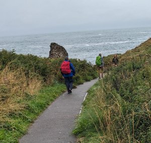
The weather view as we started our days walk. Wednesday 2 August 2024, day 16 on Pembrokeshire Coastal Path. Trefin to Pwll Deri.
Alltrails app. Did not start correctly so data is incomplete. 2.5 miles to Abercastle 290 feet elevation gain. 6.8 miles and 1040 feet elevation gain to Pwll Deri YHA. What recorded was 4 hours 4 minutes 7.35 miles 873 feet elevation gain. The Garmin seems right on today
Garmin Forerunner 25. 4 hours and 55 minutes walking. 9.78 miles and 1628 feet elevation gain.
After 0830 breakfast at the Ferryboat Inn BNB, Tony picked us up for our drop off at Trefin. I went through the same routine of starting the all trails app and my Garmin. But about 1.45 miles and 45 minutes into the walk I discovered it was not recording our track, elevation or distance. I got it started but at our first split at Abercastle it would not connect to the next track which I had downloaded.
At 0950 we started walking. We had some pretty good climbs to start. Gary waited at Abercastle for Chuck and I to catch up and use the WC.
We started in a light rain. Then it stopped and started to clear.

 PXL_20230802_084730741
A nice home and bridge beside the pathEventually we were in bright sunshine. Because of the rain the path was the most slippery of anytime so far. To make it tougher it was only a shoes width wide and in a trough with ferns, gorse and heather overgrowing the sides.
At the beach at Abermawr we stopped to watch the surfers and enjoy a sandwich. My guess was we had 4 more miles to our pickup point. The rock barrier is high above the beach here and the path traverses the top of the rocks.
In about a half hour the sun disappeared. The trail turned steeply up. As we traversed high on a cliff we came to a very steep rock hillside we had to climb. Now the fog and mist moved in. We continued to pick our way up over then down and the fog and mist rolled in from the sea.
Happy we were when the trail dumped onto the road to the YHA Pwll Deri. Our taxi from Fishguard was on time. The driver Colin was an interesting guy.
By 1518 we were back at the Ferryboat Inn and glad for a room and shower that was waiting without

 PXL_20230802_084811167
The ruins of the old mill at Trefin having to setup or checkin.
Advertisement
Tot: 0.06s; Tpl: 0.011s; cc: 6; qc: 24; dbt: 0.0406s; 1; m:domysql w:travelblog (10.17.0.13); sld: 2;
; mem: 1.1mb

 PXL_20230802_084713695
 PXL_20230802_084730741
 PXL_20230802_084811167


