Advertisement
Published: June 27th 2017

 IMG_7800
Starting the day off with a climbGeez, suddenly there are only 2 riding days left. How did that happen?
What I have learned so far (not all-inclusive):
• Despite the way food is respected here, smoking is still allowed on patios/terraces - blech!
• I should not order coffee ice cream for dessert unless I want to remain awake all night
Today didn't go quite as planned, but that was a good thing. I had originally intended to take the longer alternate route, and not being too concerned with what I thought was a 22km climb to start the day (as it turned out there were some significant downhill sections interspersed with the climbing to that point, although the first 13km were indeed all uphill) I was the last one to leave the hotel. My plan was to take things relatively slowly and not push too hard in the morning so as to ensure I still had legs left for later in the afternoon, and as the initial part of the climb presented itself just 1km into the ride I was surprised and pleased to find it supremely manageable at only a 5-6%!g(MISSING)rade; in fact it was quite pleasant as I found I

 IMG_7802
Some cyclists on the road on the way upcould easily spin my lowest gear and make decent progress without really exerting myself. I caught the first group of riders who had set out earlier at Aiguines, after which my plans for minimal exertion were thrown out the window by necessity as the grade increased to a steady 8% for the next 3km. At least the pavement changed at that point, a marked improvement over the coarse aggregate that had preceded it.
I was still managing fine, however, and even almost overshot the col (or at least the sign announcing it) not just because the grade had eased a bit for that section, but because I could see the road kept climbing higher beyond it. What the heck?
At any rate I stopped for the obligatory col shot and was just about done fiddling with my tripod and self-timer when Don arrived ahead of the others I had passed, and he and I decided to continue on together. That worked out well, as it turned out we both had the same notion of not riding too hard (for us) and pausing to take lots of photos (each taking advantage of the other to act as portrait photographer).

 IMG_7805
OCS even though the road rises for another 3 km beyond here.In fact it worked out too well, as we were pausing so often that even the slower riders began passing us; at one point my average speed to that point was under 15kph. Rather than change what we were doing, though, we simply abandoned our plans for riding the alternate route, assuming that we no longer had the time to do so.
Of course we weren't familiar with the road we were on (nor with what lay beyond), so didn't realize that before leaving the gorge there would still be some significant climbing (e.g. one stretch about 4km long at 8%), but more importantly, we were unaware just how much downhill (i.e. fast) mileage we would later accumulate.
When we finally left the gorge behind (hitting not just one but two thermoclines as we descended - that's how much downhill there was), we encountered a fairly strong but at least cool wind, and the climbs that remained (and there were still a few, each leading to a glorious downhill - today's ride had 1782 meters of climbing but a full 2105 meters of descent) proved not too onerous. In fact the first part of the climb by the

 IMG_7809
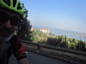
Looking down at the road to the col (which is out of frame to the right)military base past Comps-sur-Artuby was quite reminiscent of the climb to Pink Lake in Gatineau Park, at least until it added a minor 2% section to finish things off. Beyond the base the pavement changed for the better allowing us to thoroughly enjoy a 10km downhill run past Montferrat before climbing again to Chateaudouble, which itself yielded the next pleasant descent leading to the final climb towards Ampus and the subsequent freefall into Draguignan. Along the way we even hit an unexpected col (or so the sign claimed. It wasn't much and we didn't really climb it - we encountered it on our descent - so the normal photo protocol didn't apply).
Speaking of which, I seem to have hit a limit on my chromebook app that is keeping me from being able to upload all the photos I would like for today, so there will be more posted once I return home to my PC. Meanwhile, tomorrow looks like it could be a challenge: not only will there be plenty of urban wayfinding, but it looks like our weather luck may finally be running out - the current forecast calls for 80% chance of showers and thunderstorms. Yay.
Advertisement
Tot: 0.115s; Tpl: 0.012s; cc: 5; qc: 45; dbt: 0.0534s; 1; m:domysql w:travelblog (10.17.0.13); sld: 1;
; mem: 1.1mb


