Advertisement

 Enchanted Forest
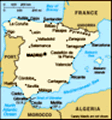
Camino Portugués, Etapa 3My time in Galicia/Spain is nearing an end. I’ve lived in Galicia around 15 months in total, so I figured it was time to do some of the Camino de Santiago. If you haven’t heard of it, it’s an increasingly popular pilgrimage route that leads to the city of Santiago de Compostela in Galicia.
People have been traversing it since the Middle Ages for religious purposes (they say St. James the Apostle’s remains are in the cathedral), but these days, people choose to travel it for other reasons too. Around 200,000 pilgrims made it to Santiago after covering a minimum number of kilometers (100 if you walk) each year for the last 5 years (these are people who registered with the church and received a special certificate, but not everyone registers). The technical end of the path isn’t the cathedral, though—it’s Finisterrae, or ‘Land’s End’, on the western coast. That’s why a well-known symbol of the trail is the scallop shell.
Because historically people started from all over the place, there are different ‘routes’ that all lead to Santiago. There’s, for example, the French route (by far the most popular), the English route, and the
Portuguese route, among others. I decided to do a section of the Portuguese route (stage or ‘etapa’ 3) because it was in a part of Galicia I haven’t spent much time in. The end points (Redondela and Pontevedra) also had train stations, which made transportation much easier.
I was wary that most of it would be along the road and that there would be too many tourists (alternatively that it would be desolate which is worrying as a solo hiker), but the part I did was mostly countryside paths, and I came across around 15 pilgrims. I only started hiking around 12:30pm, though, and usually pilgrims start in the morning, around 7 or 8am. So it’s probable that I walked at a less busy time of day.
Because I was alone, I did a decent amount of research and had the map and detailed route info saved on my phone. I also carried my keychain with a self-defense tool outside the towns, although unsurprisingly I never came close to feeling like I needed it. Most of the time I think I was within shouting distance of someone else, but a whistle might be a
good idea.
It surprised me how well-marked the trail was. It only took me a kilometer or so to get used to searching for bright yellow spray-painted arrows or other symbols on the road, walls, or telephone poles. I did consult my phone in places, but it also helped that I could often see some pilgrims ahead of me, so I followed them, checking for trail markers at the same time.
It seems like every time recently I’ve decided to go to the countryside (alone), I’ve been really happy with my decision. All of the worries ahead of time or ruminating about spending money or even the laziness were useless . . . the trips have been worth it x10. I felt really comfortable on this trip, not only from being in the countryside, but also because the villages were a familiar style to the Ourense and Lugo countryside that I spent a lot of time in last year.
The day reminded me of the things I loved about Galicia last year—hearing Galician, seeing traditional festivals, passing ancient, moss-covered stone walls, and hórreos: the small huts used to store harvests. And
. . . being near fields, walking along streams, and through forests. Although where I walked was about 100 km from where I lived last year, the feeling was similar. And it’s crazy that I just never get that feeling here in La Coruña. La Coruña feels like a Spanish city on the ocean, but with no extra feeling of Galicia, and not a strong sense of history.
I happened to go on May 1, which is a public holiday. In lots of towns and cities in Galicia, there are festivals called ‘Os Maios’ (The Mays) around this time. Usually it’s a competition of sculptures made of organic material, like flowers, seeds, and leaves.
I didn’t expect it, but in Redondela they were celebrating! As I walked into town from the train station (the wrong direction for the route, but I wanted to see the town while I was there), I heard off-key singing on loudspeakers. A group was presenting their entry on stage, and the kids, dressed in traditional Galician costumes, were dancing and singing songs in Galician. A huge crowd was gathered, mostly of locals.
A few pilgrims looked
pleased to have happened upon it, but confused (oh, that happens often as a foreigner!). What I love about Os Maios, beyond that it’s artsy/creative/connected to the earth, is that it’s a tradition that they carry on not for tourists, but because they like it.
After some time in fields, I arrived in the village of Arcade, along an estuary (‘ría’ in Galician/Spanish) where they apparently harvest a lot of oysters. There’s a picturesque old stone bridge, and the town on the other side of the bridge was kind of the epitome of ‘Galician village along the Camino’—stone buildings closely packed, hórreos, cute Camino trail markers.
Walking such a popular route with dedicated travelers leads to a feeling of community. I felt like a bit of an imposter when the ‘true’ pilgrims told me ‘Buen camiño’ or ‘Buen camino’ (the trail greeting meaning the equivalent of ‘Happy trails’). But, it was quickly apparent after I greeted people with a more typical ‘Hola’ or ‘Buenas’ that most were non-Spanish speakers. I was surprised that maybe two-thirds were women, and almost everyone I saw traveled in pairs.
For me, although around 80% of
stage 3 was scenic (meaning not industrial or along roads), there were a few rural sections that were really pretty. The first was soon after Arcade. The trail led into tall pines, then across fields and next to a stream. Soon after, the path became much harder to walk on—they’d laid bigger stones down unevenly, and it was more uphill. This is a section that you wouldn’t be able to bike.
The next area was (I think) just before Capilla Santa Marta. It was a wider, flat path that bordered fields and forests, and because of the season, was covered in (covered in!) wildflowers. Super-beautiful! At that point you’re pretty close to Pontevedra, so you’re a bit motivated.
The final nice-nice section is a kind of alternative to walking alongside the road in the last few kilometers near Pontevedra. It’s a detour that follows a small path along the winding Tomeza River (more of a stream than a river). There were Camino trail markers, so I don’t know if they’ve changed the official itinerary, or that they know that lots of people go that way so they try to help. You’ll see an information
board for the riverside trail on the left, pretty soon after you turn left onto the road after Capilla Santa Marta. Because of the winding, it does add a bit of distance, though.
It was just such a green, quiet place. The path was narrow and mucky in places, but traversable. There’s a cute stone bridge about halfway along it that makes a good resting spot. The trail markings along this alternative path aren’t as good, but they do exist. Anyway, it’s easy to just follow the river.
That area, along with other rural places that day, reminded me of Western PA. I never thought of Pennsylvania as especially green, but it’s certainly on par with Galicia and Asturias, known as the ‘greenest’ areas of Spain (of course that’s because most of Spain is a dry meseta).
A revelation I had while walking was how much my eyes were working all day. There was so much to see, so much visual input! It’s crazy how nowadays you can spend most of a day reading or watching a computer screen. The vision you use is totally different for those tasks than for
being outdoors.
Finally, I made it to Pontevedra! Success! It was the third time I was in Pontevedra for less than 2 hours, so I made the most of it by walking around areas I hadn’t seen before. It’s got a nicer old center than I thought, and it’s charming. I wish I had budgeted more time there.
The part of the path I walked that day was probably around 19 kilometers, plus I walked a few kilometers to and from my train station in Coruña. Then, let’s consider that I also wandered around Redondela and explored Pontevedra for another 4-5 kilometers. All in all, I estimate I walked somewhere around 28-30 km that day.
I felt it the next few days for sure. I, unlike real pilgrims, only carried a backpack with some food and water, a small camera, and an extra layer. It was a pretty easy section, with just a bit of uphills and downhills, but all the walking still took a toll. It’s admirable that people do it for days or weeks at a time.
If I were going to do the Camino for
real, I would avoid the French route, which is the most popular one. I think the Portuguese route had the right number of people, and any more would feel crowded. It’s annoying to pass or be passed by people as if you’re driving on a highway. I would also avoid doing it in the summer. Even the day I hiked, around 65-70 degrees F, was on the warm side. Wearing a heavier backpack adds a lot of heat as well.
I might also consider, if at all possible, shortening the stages so that I was doing around 12-15 km a day, instead of 18-24. That would all depend on accommodation, though.
Actually, after doing that part, I’m thinking about going another weekend to do another section. But not the whole thing. For sure . . . ;-)
Advertisement
Tot: 0.137s; Tpl: 0.015s; cc: 16; qc: 64; dbt: 0.0686s; 1; m:domysql w:travelblog (10.17.0.13); sld: 1;
; mem: 1.3mb


Home and Away
Bob Carlsen
Having walked the Camino last September and October...
as I walked through Galicia I thought of you and was hoping that you would walk at least a portion before you left Galicia. One day is just a taste. I hope that your next walk will include at least one night in an albergue where you can talk with other pilgrims. That may be enough to inspire you to walk at least the last 100 km on one of the ways. I walked the last 100 km from Lugo, having started in Pamplona and then switching from the Camino Frances in Ponferada, where I took a bus to Lugo. The most amazing experience of my life. This July I am walking the St. Olavsleden in Norway.