Advertisement

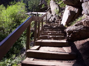
 Steps
Steps
Looking up--on the way down! What a great decision I made on Tuesday!! This morning I awoke to pristine blue skies and ready to go for my boat trip down the Black Canyon of the Gunnison which is run by the National Park Service. I had registered for the first trip of the day at 10 a.m. but was told to be at the trail-head by 9 a.m. as there are 232 steps and then a half-mile walk along an old narrow gage railway line to the boat dock. (I can’t imagine how they got those steps installed into the face of the canyon.) There were 27 of us including several kids in the party. We were greeted by Ranger Kirk and Captain Tom, who were a very outgoing and knowledgeable couple of guys who obviously loved their job. We set off heading west at precisely 10 a.m. Ranger Kirk was the narrator during the trip and kept the commentary informative as well as entertaining.
Captain John Gunnison had decided that the canyon was too imposing to try to bring the Pacific Railroad line through it but the Denver and Rio Grande Railroad Company thought that they could install a narrow gage line and

 Half way down
Looking into the sunthey hired Italian and Irish laborers to do the job for $1/day. They completed the job in one year and one week and the line operated from 1882 until 1949; it was called the “Scenic Line of the World,” the Denver & Rio Grande logo bears the silhouette of the Curecanti Needle.
The Gunnison River springs to life along the western slopes of the Continental Divide, and because the area is semiarid three dams were constructed to provide irrigation and hydroelectric power. Blue Mesa is actually the main storage reservoir, Morrow Point Dam generates most of the power, and Crystal Dam maintains an even flow through the Black Canyon. The river drops about 43’ per mile, at only 12’ deep at the boat dock it is 250’ deep by the time it reaches Curecanti Bay which is the turn-around point. I tried to take a picture of the obvious fall of the river but don’t know whether I captured the impression. One of the stories that Ranger Kirk told us was of an Englishman named Robert Nelson, who came down the river, decided that he didn’t want to live in a town or a city and loved what he
saw at Curecanti Bay so he built a cabin and lived there from 1904-1944, getting a 30 mile ride into Gunnison on the train every so often. Today the point where his cabin was is called “Hermits Rest.”
The land just 50 miles west of here is very arid, receiving only about 3.5 inches of rain each year, so the farmers of the area were digging canals and draining the Umcompahgre River to irrigate their crops, demand soon overwhelmed the supply and they began looking at the Gunnison as a water supply. So in 1902 they started the project to cut a 6 mile long tunnel through the hard rock of the Black Canyon and in 1909 the water from the Gunnison River was watering crops in and around the Montrose area, the river water flow today runs at 900 cubic feet/second. The tunnel is recognized as a National Civil Engineering Landmark.
Needless to say I was much impressed, my camera’s internal memory was full and I had to start deleting duplicate pictures half way through the trip. I could go on and on. We got back to the boat dock at about 11:45 a.m. and then started

 Curecanti Needle
Stands 800' out of the waterthe climb back up those 232 steps -- seemed like more! However, puffing and blowing I made it with just a couple of breaks.
Now to prepare for departure for Utah.
Advertisement
Tot: 0.047s; Tpl: 0.011s; cc: 7; qc: 23; dbt: 0.028s; 1; m:domysql w:travelblog (10.17.0.13); sld: 1;
; mem: 1.1mb

 Steps
Steps
 Half way down
 Narrow Gage Railway
 Curecanti Needle


Jacob, Ellie & Ben
non-member comment
We miss you!
Be careful Nanny, we are so proud of you. We love you and miss you.