Advertisement

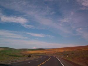
 Central Oregon Hillside
That's Mt. Hood in the background.From the Cove we headed north on US 197 through mostly rolling farm country. We crossed the Deschutes River in the tiny town of Maupin, where we got caught up in a crosscountry bicycle race. We spent the next 10 miles trying to pass cyclists struggling up the curvy road out of the Deschutes River canyon.
We reached the Columbia River at The Dalles. This is where Lewis and Clark made camp in 1806, and is the terminus of the historic Oregon Trail. Here the pioneers loaded their wagons on rafts and floated down the Columbia to what is now Portland, then south up the Willamette River to Oregon City.
The 100 mile trip from The Dalles to Portland takes you through the Columbia River Gorge, on either Interstate 84 or US 30 (the "old road"), both of which are sandwiched between the river and the 3,000 foot canyon walls. It is an unforgettable ride, especially on the old road, with many waterfalls and roadside observation points with breathtaking views.
We overnighted in Ainsworth State Park, near the foot of Multnomah Falls, the second highest in the US at 620 ft. (Nobody seemed to know which was the highest.)

 The Dalles
Neat Little Town.We passed on the 1.2 mile hike to the top of the falls and stopped about 1/4 mile up at a wonderful observation bridge where we had a very close-up view of the falls.
On Saturday, April 30, we set out on our last leg of the trip to the coast. We passed through Portland, one of the most beautiful large cities we have seen, and reached the Pacific at Cannon Beach, where we stopped at a roadside overlook to gape at the picturesque rocky coastline. From here we could see the Tillamook lighthouse, built on a 100 foot high rock about a mile offshore. Because of the constant harsh weather conditions, the construction of the light (in the late 1800's) was an engineering marvel, and operation of the light was a costly and rigorous undertaking. The light was frequently lashed with severe winds, often damaging the structure and making resupply dangerous. In 1957 "Terrible Tilly", as it became known, was decommissioned and replaced by an automated floating signal nearby. Today it is the privately-owned "Eternity at Sea Columbarium", a unique resting place for ashes of the deceased. Sounds like California, doesn't it?
The trip down the coast

 Columbia River Gorge
From the Rowena Overlook -- looking upriver toward the Dalles.to Nehalem Bay was only about 25 miles. From an observation area on a cliff several miles from the park we were treated to a bird's-eye view of the park and the little seaside village of Manzanita, which is right next to the park. It was a truly beautiful sight, and we are looking forward spending the next month in this area.
Advertisement
Tot: 0.204s; Tpl: 0.011s; cc: 21; qc: 88; dbt: 0.0885s; 1; m:domysql w:travelblog (10.17.0.13); sld: 1;
; mem: 1.2mb

 Central Oregon Hillside
 The Dalles
 Columbia River Gorge


