Advertisement
Published: July 20th 2010

 Fish Lake
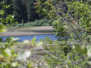
Water is going down, but still had many geese there.July 18, 2010
The beautiful McKenzie Pass Highway (Highway 242) in the Central Cascades mountains of Oregon is only open a few months a year. It closes in October/November when the snow becomes an issue and doesn't reopen until the snow melts in May/June/July. This is an old and very winding road and while they allow some trailers, I would not want to pull anything on this road or be in a very large vehicle. This year, it opened late because the road department repaved the entire length of the road - and did a magnificent job, I might add!
We used the little known detour around the town of Sisters - as the highway becomes much like a parking lot on Sundays in the summer - and drove up Highway 126/20/22 - through the Santiam Pass. When the road divides, you stay on the Highway 126 branch along the McKenzie River, then take Highway 242.
We made a rest stop at the pull out at Fish Lake - just beyond the Fish Lake Guard Station. When the wagon roads were first built over the Santiam Pass, this was the site of a hotel, barns and a toll
gate. They have done some reconstruction to show the area and built a path to walk from the wayside to the Guard Station. We walked the path and were delighted by the diversity of the wildflowers. The Lake is quite shallow and often dries up in the summer, but still had some water.
The McKenzie Pass veers off of Highway 126. This narrow and winding road was an 1860's wagon route. You can still see areas where the wagon road was, especially where they built it through the lava fields.
This road is not only narrow and winding, but very steep. You will gain about 3,000 feet in a very short distance. There are not a lot of pullouts, but, oh so many places you'd like to stop and look at! We had a very late arrival of summer this year, so we were astonished at the number and variety of wildflowers that were in bloom!! We stopped at every opportunity to just enjoy the beauty!
Up from the lush Willamette National Forest, you arrive at the summit at 5,325 feet. You find yourself in the middle of a vast black lava field with the Cascade mountains
rising above. There is a sizable parking area with the Dee Wright Observatory above. This was constructed by the CCC in 1935. It is an easy access (the western access is easiest) to the top. This lava building has windows which isolate and identify each of the mountains when you look through them - Mt Washington, Mt Jefferson, North Sister, Middle Sister, Black Crater, Belknap. It is amazing to see trees growing in lava fields. Once you get to the top of the Observatory, be prepared for wind!!!
One of the unusual aspects of this trip was the number of motorcycles! The BMW riders had had a big convention here the week before and they were out enjoying a glorious day on this beautiful road.
We had two disappointments. We had planned to have our lunch at a small lake near the lava fields, but the mosquitoes were out in force!!! The other was that the path through the lava fields was closed. It looked like it was being reconstructed. I'm always disappointed when the educational aspects of a site are closed down. We've been going there for years and while we don't need the signage, I felt
disappointed for the others and I missed taking the walk out into the lava fields.
Advertisement
Tot: 0.073s; Tpl: 0.012s; cc: 9; qc: 51; dbt: 0.0417s; 1; m:domysql w:travelblog (10.17.0.13); sld: 1;
; mem: 1.1mb

 Fish Lake
