Advertisement
Published: January 15th 2021

 Kebler Pass Road
my camp
time for wineI drove West from Monarch Pass on US Hwy 50 and saw a warning sign (on Colorado Interstate and US Highways) warning people of the statewide fire hazards and not to burn. Getting near Gunnison, Colorado I saw a neat old church. In Gunnison I got gasoline, food, other supplies that I needed for camping in the back-country. I turned North on State Hwy 135 for Crested Butte. (At Crested Butte all supplies are fairly expensive.) There are still no signs for county road 12 (left turn) until you leave the City of Crested Butte, and it is hard to find. Gunnison County Road 12 quickly enters the Gunnison National Forest. This road is now paved (unfortunately) up through Kebler Pass at about 10,000 feet elevation. The dirt trail there on the ridge at the pass is a legal camping in the thin alpine air. Also at the pass is the Ruby Camp Cemetery, long abandoned.
I drove West of the pass on the now paved road. When I got to the dirt road there was unlimited free back-country camping in the Aspen trees. Also there were neat extinct volcanic mountains. This is the last open land in Colorado, that
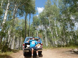
I know about, with unlimited back-country free camping. (They now call it "dispersed camping".) There were many campers there, but also plenty of open camps. I found a spot I liked and made my camp in the wonderful Aspen forest. (Camping in the Aspen trees is a spiritual experience for me.) Since my driving was done for the night it was time to drink some wine. I slept very good that night.
The next morning I had my long coffee break before hitting the road. I drove West and turned left on Forest Service road 706 to the Lost Lake pay campground. On the way up to the campground I spent some time at my very first camp in the Gunnison N Forest back in 1985. (Pics are from 2020.) I made it up to Lost Lake and stopped at the only free parking space that was provided for fishermen. (I was fishing for a photo shoot.) I walked over a KM (round trip) for the pics of Lost Lake and the Beckwith Mountains reflected in the lake.
Then I returned Westbound on the Kebler Pass road. About four miles West of Marcellina Mountain going downhill I left

 old church
West of Monarch Passthe Gunnison N Forest for private land, still on Gunnison County road 12.
completed
Advertisement
Tot: 0.084s; Tpl: 0.014s; cc: 11; qc: 28; dbt: 0.0477s; 1; m:domysql w:travelblog (10.17.0.13); sld: 1;
; mem: 1mb

 Kebler Pass Road
 old church


