Advertisement
Published: March 4th 2008

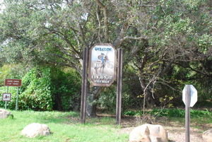
 Entrance to El Capitan State Beach
Located just north of Santa Barbara.We left San Diego for El Capitan State Beach, just north of Santa Barbara, on Friday (29 Feb - Leap Year). Jon was apprehensive about dragging our home on Interstate 5 through the tangle of freeways that is Los Angeles. Actually, it went smoothly, except at the point when the storage compartment holding our sewer dump hose opened and resulted in dragging 25 feet of hose down the freeway. Fortunately, we were able to pull over onto a shoulder and retrieve our equipment, Within a minute of that, a CA highway patrol cruiser was there to help us and be sure we were not “trying to dump” on the freeway. He explained that people in this part of the country did strange things. We proceeded north to El Capitan State Beach.
El Capitan State Beach is located in a quiet, scenic section of the Santa Barbara Bay area. It is connected by a bike/hiking path to a companion state beach called Refugio, located 2.5 miles to the north. The coast in this area consists of high sea cliffs, mostly, rough cobbly beaches, and lots of surf. At El Capitan, the campgrounds are located high on the cliffs and overlook the

 Looking North From El Capitan State Beach
Actually due to the curvature of the Santa Barbara Bay, the view is to the northwest.Santa Barbara Bay. The three channel islands of San Miguel, Santa Rosa, and Santa Cruz are located about 15 miles offshore. Several oil and gas drilling rigs are visible from the shoreline. Running next to the state beach property is an AmTrac rail line carrying mostly passenger trains between San Francisco and San Diego and the coastal highway (route 1-101). Just interior to the highway in this part of California are the Santa Ynez mountains.
Many sea birds can be seen from the cliffs overlooking the Pacific, including all three species of the sea ducks known as scoters. Large groups of western and Clark’s grebes feed in the waters as far out as one can see with a spotting scope. Gulls, terns, and loons abound. Along the beach we saw many long-billed curlews, willets, whimbrels, semipalmated plovers, sanderlings, and more. Anna’s hummingbirds, bush tits, California towhees, and white-crowned sparrows are everywhere. Territorial black phoebes and spotted towhees are singing, convinced that spring is here. Jon is happy!
Unlike a standard RV park, which provides at each site, water, 30 amp electric, and a sewer connection, many regional/state facilities provide just a place to park, requiring what is called
“dry camping”. This necessitates a different approach to managing the energy requirements and fluids (!) on board the trailer. Our tankage usually allows us to transfer the 40 gallons of fresh water we carry into the gray (sink, shower) or black (toilet) water tanks in about 3-4 days. Usually at that point we need more fresh water and also need to empty our wastewater tanks. We typically also carry 60 lbs of propane that is used for refrigeration, heat, and hot water. We were delighted to find that with all of the sunlight available here in California, our two 85 watt solar panels could easily keep up with our electrical needs.
After three days here we will venture further north to a state park at Morro Bay, CA, where we hope to do much more kayaking both in the bay and, if weather permits, on the ocean.
We are now on the way north from Santa Barbara and El Capitan State Park. For many miles, from the Los Angeles area north, we have had the ocean to our left and the coastal range to our right. The farther north we have gotten, the greener everything is. We have

 Family Reunion
We receive a visit from Lynn's cousin John and his daughter who live in Santa Barbara. now moved more inland and things are greener than ever. There are lots of sizable trees now, some of which are not yet leafed out. After passing through miles of cattle grazing on the hills, we are now in vineyard country. There are immense acres of grape vines in the Los Alamos area. The ground under the vines is green but the vines haven’t sprouted for the year. Lucas and Lewellyn is the name on the largest vineyard. Is Lucas related to the winery at home? Jon just observed a yellow-billed magpie, the first of the trip.
We are looking for California condors too. So far, we’ve seen lots of turkey vultures. The road signs say “Historic Camino Real”, marking the route of a historic Spanish trail from San Diego to Sonoma. We are now in the Santa Maria area and there are housing developments (presumably for migrant farm workers) on the left and large agricultural fields of strawberries, broccoli, etc on the right. As we approach Morro Bay, we are moving back toward the coast and getting lower again.
Advertisement
Tot: 0.084s; Tpl: 0.012s; cc: 13; qc: 49; dbt: 0.0468s; 1; m:domysql w:travelblog (10.17.0.13); sld: 1;
; mem: 1.1mb


nick
non-member comment
vinca minor
if you tried to buy periwinkle in berkeley you might get kicked out of the nursery. (it's a plant i've studied in my plants class). nick