Advertisement
Published: September 30th 2017

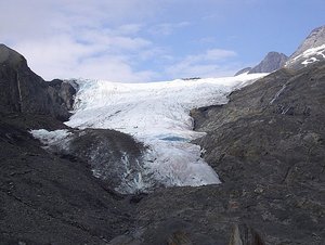
 Worthington Glacier
Taken from along the trail climbing the gravel side of the glacial valley.Geo: 61.1308, -146.348
Friday, 7/30/2010 –Drove to Valdez (pronounced VALDEEZE) by retracing the drive along the Tok cutoff and then took the Richardson Highway south of Glennallen. Stopped at the main Wrangell-St. Elias Visitor Center near Copper Center and hiked a short trail there while waiting for it to open at 9:00. Saw the park movie and talked a bit with a very nice and informative ranger there, then drove on to Copper Center where we purchased a couple of wraps at a place called “The Fisherman's Widow” for lunch later that day . Anne got a small one with veggie stuff (humus, veggies, etc.) and I got a Bacon Ranch Chicken wrap. Both were huge and delicious. I had gotten a large one and could only eat half for lunch. (Unfortunately, I left the other half in the refrigerator at the Downtown B&B where we spent the night in Valdez.)
Drove on to the Worthington Glacier State Recreation Site. Viewed the glacier from below, then hiked up the loose slate surface along the side of the glacier to a spot high above the glacier where we ate our wraps. To return to the parking area, we scrambled over the loose slate scree to a trail along the knife edge cliff above the glacier and back down through some bushy areas. Nicest hike so far since arriving.
Drove on toward Valdez through amazingly picturesque scenery with huge rugged mountains of the coastal Chugach range. Stopped at Keystone Canyon and hiked portions of the Goat Trail and the Pack Trail to a stream crossing, then backtracked to the trailhead at the Bridal Veil Falls parking area. The Alyeska Oil Pipeline parallels the highway for most of the way to Valdez and we could catch a glimpse of it from time to time. Arriving in Valdez, we checked into the Downtown B&B Inn. More a run-down motel than a B&B or inn. We were on the first floor in a borderline clean room with a window that had a torn screen so that leaving it open invited unwanted insects in. Had to leave it open a bit though due to the musty smell of the place. As in most places in Alaska, there was no air conditioning. Normally it is not needed. This place did have WiFi that did not work initially. After complaining about it, the desk clerk said he

 Lunch above the glacier.
Can't see the glacier in this picture, it's just over the edge of the ridge Anne is sitting on. Nice view of the surrounding mountains though.would check on it and later it did start working, though with a very weak signal. We had been warned that this place was not particularly nice - but we thought we could stand anything for one night. We could and did - but wish we hadn't. We walked around the waterfront a bit, had dinner, and went to bed fairly early in preparation for an early morning departure on the ferry.
Advertisement
Tot: 0.094s; Tpl: 0.011s; cc: 12; qc: 28; dbt: 0.0319s; 1; m:domysql w:travelblog (10.17.0.13); sld: 1;
; mem: 1mb

 Worthington Glacier
 Lunch above the glacier.


