Advertisement
Published: June 20th 2009

 Taylor Highway
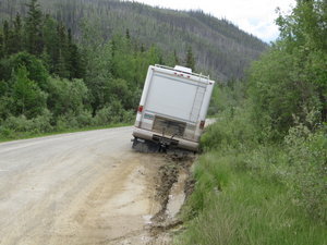
Don't try too hard to avoid the potholes.My next must see location before I go home is Dawson City, Yukon Territory, but I decided to spend the night in Tok, Alaska and see if I could find a new set of tires. One of the things that I pondered long and hard before I left was the tires on the Burban. (BTW, in my many long miles alone in the car and listening to my Jack London audiobooks, I've started to call her "Buck," after the St. Bernard Shepherd mix sled dog hero of "Call of the Wild." I know I've always thought of cars in the female, like ships, but I think she is as good as old Buck was. Maybe I'm going a bit stir or scenery crazy)
The tires had about 55,000 miles on them before I left, but still had a lot of tread on them, so I figured that if I could make the trip with them, I'd buy a new set when I got back. And I figured that if I had tire problems, I'd just buy a new set on the road. Well, in most of Alaska you don't get to go shopping for tires. In Tok there are 2
possible auto repair places to get tires. I tried Chevron first, but they didn't have the tires for my truck. But, in typical helpful Alaska fashion, they called their competitor for me and he had one set that would fit her. And amazingly enough, the price wasn't too bad. So now Buck has a new set of paws and I'm feeling real good about my 4,000 plus miles left on this trip.
If you look at a map of the Alaska Highway, you'll see there is a highway that splits off at Whitehorse and goes up to Dawson City. Well I wanted to drive the full length of the Alaska highway on my way out and planned to go to Dawson City on the return trip. So when I left Tok the next morning, I headed north on the Taylor Highway(which Google Maps above doesn't even show) toward Chicken (a local told me they couldn't spell ptarmigan, the Alaska state bird, so they named it Chicken.) After a few miles, The Taylor Highway turns into a dirt and gravel road and it was pretty rough shape from a lot of trucks tearing it up going to a fire and
flood in Eagle. And it's narrow, winding through the mountains. I was sure glad I had the new tires.
I stopped in Chicken. It's an old gold mine camp and a good break from the Taylor Highway.
I then continued up the Taylor Highway to the border with Canada. This is where the Top of the World Highway begins and it is what they call a sealed chip road, waaaay better than the Taylor Highway. I stopped right after customs and I was at 4,223'. I checked my latitude and this was the northernmost point of my journey: 64 degrees 05.130N. The longitude is 140 degrees 59.939W for Google Earth geeks.
I wanted to go to Dawson because it's a famous, fun old gold rush town and also where Jack London's cabin is. I found a hotel room at 10:30 PM and could not fall asleep. It's just too bright and I still haven't gotten used to it so I caught the midnight show at Diamond Tooth Gerties across the street.
The next day I went to the Jack London Centre to see the rebuilt cabin he lived in. He grew up in poverty in Oakland,
CA and was self taught by reading in the local library. Hoping to strike it rich, he came up for the gold rush at 20 years old in 1898 and was only in the Klondike for 1 year, but made it through the 8 month winter. He came down with scurvy from lack of vitamin c and had to go home the following summer when the river opened up. But in one year, he got enough memories for several great books and short stories. I've always found the gold rush and amazing toughness of the people who came into this far north world so interesting.
Everyone told me you have to see Dawson from the Midnight Dome, so I went up there on my way out of town. It gives you a great view of Dawson and the Yukon River, the super highway of the gold rush. When I came down from the dome, I decided it was time to head for home in earnest. It was 1:40 PM, Thursday, June 18th when I started toward the Alaska Highway connection in Whitehorse. I now have over 6,300 miles on the trip.
Advertisement
Tot: 0.075s; Tpl: 0.012s; cc: 7; qc: 31; dbt: 0.0531s; 1; m:domysql w:travelblog (10.17.0.13); sld: 1;
; mem: 1.1mb


Jan
non-member comment
Sounds so sexy!!
Of course I'm talking about "Diamond Tooth Gerties" Can we expect pictures from that entertaining evening? Or are you leaving that night up to our imaginations?