Advertisement
Published: October 19th 2011
SEE TEXT IN ENGLISH BELOW
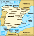
28-29 mayo 2011 Este fin de semana fui con montañeros al Bierzo, una zona que desconozco casi por completo. El sábado hicimos una ruta por la sierra de Gistredo, al norte de la comarca, y el domingo por los Ancares, ya el límite con Galicia, la esquina noroeste de toda la región de Castilla y León.
A la
Sierra de Gistredo ni la había oído mentar nunca antes de venir. Ya en plena cordillera cantábrica, zona húmeda y nubosa, y con las cumbres más altas de la comarca, de más de 2.100 metros de altura.
Nada más entrar en el Bierzo por el puerto de Manzanal, se levanta la sierra de Gistredo al norte, con poco bosque y mucho matorral.
Junto al río Boeza se encuentra el pueblo de Colinas del Campo de Martín Moro Toledano, uno de los pueblo con uno de los nombres más largos de toda España. Allí nos dejó el autobús y comenzamos la ruta. El cielo estaba azul y el sol comenzaba a brillar ya con fuerza. Mucha gente se dió crema.
Colinas del Campo es un pueblo típico del Bierzo, con todas sus casas de piedra oscura
y tejados de pizarra.
Comenzamos a remontar el río Boeza, y al poco un afluente, el Susano, hasta que llegamos a unos prados con vacas. Entonces las cuestas se hicieron algo más duras y se acabó el bosque. No volvimos a ver un árbol hasta el final de la ruta, ya en la otra vertiente de la sierra.
El cielo se fue nublando, pero nunca nos llovió, y según ascendíamos, se iba haciendo mayor la grandeza de Gistredo y las demás sierras cantábricas a la vista. No hay cortafuegos, no grandes pistas que corten el paisaje, así que tuve la sensación de estar en lugar algo remoto.
Llegamos al Catoute, la cima más alta de la sierra, y de aquí bajamos al pueblo de Salentinos, otro bonito pueblo berciano. En la tasca una cerveza, y carretera hasta el albergue.
El albergue estaba en el pueblo de Ocero, y desde Salentinos hay que recorrer un buen pedazo del Bierzo para llegar. El terreno que pasamos es muy accidentado con mucho más monte bajo que bosque. Cerca de Fabero, uno de los municipios más grandes de la comarca, pasamos delante de una mina de carbón enorme a cielo abierto que ocupaba
más terreno que el mismo Fabero.
El albergue tenía piscina con agua templada (tenían paneles solares), la cena y desayuno estuvieron correctos y los colchones no eran muy blandos. Además el pueblo tiene bares, y en uno cabíamos todos los del grupo. El orujo es buenísimo. Es de éste que lo hueles y te desentapona las narices, pero luego al beberlo pasa con facilidad. Eso sí, calienta bastante el gaznate. Tenían orujo blanco y de otras clases. El de arándanos estaba también riquísimo aunque era algo más suave. No es de extrañar que Pasásemos muy buen rato.
El día siguiente fuimos a por la otra ruta, justo en la dirección opuesta a la sierra de Gistredo y el Catoute. Fuimos al confín con Galicia y Asturias: a los
Ancares. En el corazón de la comarca se elevan sus montañas más imponentes que rallan los 2.000 metros, rodeadas de profundos valles. A una de estas montañas fue a la que subimos: el
Miravalles.
Desde el albergue en Ocero el autobús nos llevó, remontando el valle del Ancares hasta el puerto, límite del Bierzo con la vertiente gallega. No eran muchos kilómetros, pero la carretera es a veces estrecha y tortuosa,
así que tardamos al menos una hora.
Desde el puerto tomamos dirección noroeste, haciendo parte del cordal de la sierra hasta el pico Miravalles. Tuvimos suerte, pues muchas veces a estas sierras se les agarra la niebla. Hoy, las nieblas estaban pegadas en los valles bajos de Galicia y en la parte Berciana y en las montañas el día estaba despejado por completo. Al sur está el monte Cuiña, un poco más alto que el Miravalles. Justo debajo de su cumbre hay una laguna glaciar y se veía aún algún nevero.
Desde el Miravalles, que domina buena parte de los Ancares, con sus valles cubiertos sobre todo de monte bajo, descendimos a Balouta. Balouta es un pueblo que pertenece al Bierzo, pero está situado de pleno en la vertiente gallega. Hay muchas pallozas, la construcción típica de la zona. Son construcciones circulares con un diametro entre 10 y 20 metros y tejados cónicos de paja de centeno.
Había una palloza abierta, amueblada según la tradición.
Comimos en Balouta, justo cuando comenzó a llover, y después volvimos para casa.
Un paisano me preguntó con su acento gallego después de saludarnos: -y ¿de dónde sois? - De Burgos- le respondí.
-Qué bonito
-Y usted ¿es de aquí del pueblo?
-Sí, aquí he vivido siempre
-¡Qué bonito que es su pueblo y sus montañas!
-Sí, muy bonito, pero para un día, no para toda la vida.
TEXT IN ENGLISH
2011 may 28-29th This weekend I went with the mountaneers club to El Bierzo, a shire that I hardly now. Saturday we did a trekk in the Gistredo range, at the north, and sunday the trekk was in Ancares, the northwestern coin of the shire, boundary with Galicia and Asturias.
I had never heared anything about the
Gistredo range before. It is right in the Cantabrian mountains, cloudy and wet place, and with the highest peaks in the shire, higher than 2.100 meters over sea level.
Once you enter in El Bierzo after having passed the Manzanal pass (motorway), the Gistredo range can be seen at the north, with little forest and much schrubland.
Next to Boeza river is set the little village of Colinas del Campo de Martín Moro Toledano, with one of the longest names in Spain, if not the longest. It is a typical village in El Bierzo, with dark stone houses covered
with slate roofs. There the bus left us to start our trekk. The skies were blue and the sun was shining, so many used sunscreen.
We went up Boeza river valley, and soon after a side one, river Susano, up until a meadow with cows. Then we left the valley and took the mountain slopes. The forests had ended, so we didn´t found a tree until we arrived to the valley on the other side. The sky became cloudier, but it didn´t rain. Gradually, as we were going up, the grandeur of Gistredo and the other Cantabrian mountains on view increased. There were no firebreaks or tracks cutting the landscape, and I had the feeling of being in a remote place.
From the Catoute summit we went down to other valley and ended the trekk in Salentinos, another typical nice village in the area. In the tavern we had some beers and refreshments and the hit the road to the lodge. It was in the village of Ocero, and to get there we crossed a good part of the shire, thorugh a very hilly landscape covered with shrubs more than trees. Very close to Fabero, one of the biggest towns
in El Bierzo we saw a huge open pit mine, bigger than the town itself.
Our logde had a swimming pool with warm water (they had solar panels), the dinner and breakfast were right and the matresses not soft. Besides, the village had some bars and one of them has space enough for all our group. The pomace brandy was excellent. It is one of those that when smelling it, you get your nose unblocked, but when drinking it, goes down like water, even if it heats the gullet. Not only there was plain brandy, but also of other kinds. The one of cranberries was softer but very nice also. We had a good time.
Next day we went for the other trekk, right in the opposite direction of Catoute and Gistredo range. We went to the border with Galicia and Asturias: to Ancares. At the heart of this shire, its most imposive mountains rise, almost getting the 2.000 meters and surrounded by deep valleys. We climbed one of the highest mountains:
Miravalles. From the lodge in Ocero the bus took us, going up the Ancares valley, up to its pass, the border between El Bierzo and Galicia. The
distance was not great, but the road is sometimes narrow and winding, so it took us aroung one hour.
From the pass we walked to the northeast, doing the ringe up to the Miravalles (=lookingvalleys) peak. We were lucky, for many days the mists grab this mountains. Today, instead, the mists were at the bottom of the valleys on the Galician side, and in El Bierzo and the mountains were completely clear.
South it´s the mountain Cuiña, a little bit higher than Miravalles. Just below its summit there is hidden a glaciar lagoon, and still there was still some snow.
From Miravalles, where you can get a view over a great part of Ancares with its mountains and hill covered with shrubs, we walked down to the village of Balouta. It belongs to El Bierzo, but it is set on the Galician slope of the range. There are many pallozas in the village, the typical houses of the area. They are circular with a diameter between 10 and 20 meters and conical roofs in rye straws.
There was an open palloza with the typical tradicional furniture. It was interesting to peep inside.
We had lunch in Balouta just right when
it started to rain, then we went home.
A villager, with his Galician accent, asked me after the greetings:
-and, where are you from? - From Burgos- I answered.
-Nice place.
-And you, are from this village?
-Yes I am. I´ve been here always.
-It is a real nice place, Balouta and the mountains!
-Yes, very nice, but for a day, not for a whole life.
Advertisement
Tot: 0.111s; Tpl: 0.014s; cc: 14; qc: 30; dbt: 0.0576s; 1; m:domysql w:travelblog (10.17.0.13); sld: 1;
; mem: 1.1mb