Advertisement
Published: October 8th 2012
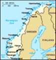
Greetings from
Norway and Sweden! We flew to Oslo and first stayed in Geilo (Norway) for 5 days, then traveled by train to Karlstad (Sweden) for 6 days, and last but not least visited Oslo for 3 days.
First stop - Hiking in Geilo / Norway Geilo in Norway is a smaller town surrounded by hills which makes it a very good spot for hiking. Other towns (like Finse), which are more backcountry, can be easily reached by train (or even bike). I recommend taking a DNT turkart and a compass since the trails are marked but sometimes the small red "T"s are not visible at a first glance.
On our first day in Geilo we decided to have breakfast in the common cabin breakfast room. While sitting and eating we were asked by a guy where we are from because he noticed we spoke German. He turned out to be a guy from Germany who immigrated to Norway several years ago. We asked him where we could go for a hiking tour and he suggested Finse, which is only 45 min away from Geilo (by train). Furthermore, he gave us a
"turkart" (DNT hiking map) for free.
Thanks! But since it was already quite late that day (11 am) we decided to hike the mountains southwest of Geilo first (
close to the Ustetind). Here we followed the marked path and finally lost the orientation (no compass, oh), because the markers ended suddenly. So we ended up in a wet marsh area. Mmh, what to do? Going back was not the prior option because the path was kind of slippery and steep. So we decided to follow a little river uphill. Not the worst decision, finally we found another hiking trail. But since it was quite late (5 pm) and we were not eager to spend the night outside, we decided to follow the official trail. Not always easy, it is marked with
a red T but still hard to find. Maybe because it was the off-peak season. But I can recommend hiking in the area because the landscape is so different from what I have seen so far, no trees but a lot of greenish ferns and lichens (I hope that's the right word).
On the second day we went to
Finse by train and wanted to see the
Blaisen glacier (sorry, my keyboard doesn't have
the right "a" character). After we started at the train station in Finse the weather was still ok, cold but ok. After some time it started raining but we decided to proceed anyway. Finally, we lost the trail again and went on the trail to the
Appelsinhytte instead of our intended one. Since the rain did not stop, it was the best decision to return to the train station. Unfortunately, it was windy too. Not so surprisingly the wind caught my umbrella, so I only had the handle left in my hand. Fortunately, I was able to collect the rest of it on a snowfield. That was the point where I decided to buy a rain cape and hard shell pants as soon as I come home. Back in the train station, both of us were totally wetted through. So we used the heatings and the tables to spread our stuff and hoped that it will dry soon. We met a Belgian couple that did a trekking tour, but canceled it because of the rain and because all of their stuff was wet too. She had already a cold, and he started to get one. They made their soup with
 How to fight the boredom at the airport
(We had to wait four 4 hours until our train left the airport)the water from the water tap, which is very hot if your turn the lever to the very "red" position. We only had some bread and cookies with Nutella and yam.
On the last day in Geilo we hiked the northeast, more specifically we walked to the
Budasvatnet. As always, we had rain. Then it suddenly stopped and we decided to walk further into the next valley. A stunning view. But what was that? Was it seriously snowing? Really? Yes. Since my travel mate had no gloves the both of us shared one pair of gloves. But very soon they were wet and did not keep the hand warm anymore. Since the trail stopped anyway we went back to Geilo and bought some postcards.
Second stop - Bicycling and kayaking in Karlstad / Sweden So a nice, but rainy time in Geilo ended. The train took us from Geilo to Oslo to Karlstad (Sweden). A look through the window revealed that the landscape changed from hilly/mountainous to totally flat with lots of lakes. Our destination was the biggest lake in Europe, or better: the EU (at least someone told us it is), the Vänern.
Unfortunately, the
First day in Geilo
Hiking in the South-West first day started like the others, it rained and it was windy. Fortunately, it changed to sunshine in the afternoon. Right now, right here I would like to mention that we stayed in the Karlstad Vandrarhem (HI Hostel), which is an EXCELLENT place to spend your time in Karlstad. Nearly every day
we were picking mushrooms, which grow right next to the pathways. But only some of them did not have any of those small maggots inside. The locals did not pick them but rather buy them on the market instead, so our chances for a homemade dinner rose. We went biking on
Hammarön, to the Eastern and the very Southern part, the
Sydspetsen. The archipelago there is a nature reserve. By bike we also rode the
"Klarälvsbanan", a paved former railroad track from Karlstad to Sysslebäck. Altogether, a trip in one direction would sum up to 90 km. Our trip took a little longer than 33 km oneway, we went a little further than Deje. Along the way you mainly see the Swedish forest, but also some dark-blue colored lakes (e.g. the
Alstern), and ocherous fields. A lot of houses are made of wood and are very colorful.
Walking on stones
(Hiking in the South-West) And then there was another day, another "adventure": a
kayaking trip on the Vänern. We intended to visit the island Jäverön. The one way trip was supposed to be around 8 km from our starting point. Unable to read the map 😉, and not used to navigate on the water, we took the wrong turn and
ended up riding 14 km (roundtrip) more than we expected. We got skeptical as we reached Östra Sön, a nature reserve where the Vänern starts to become more or less "open water". No good luck, since we had to stay on the water, and therefore couldn't open the storage chambers, where our food was stored. So we were hungry and out of our powers but still had to return to the Kayaking Shop. Another unfortunate circumstance was that in the afternoon, the waves on a lake point to the middle of the open water, not to the shore. So we had to deal with that, too. In the end, after six hours of kayaking with no calorie consumption, we reached the Kayaking shop at 5.58 pm, exactly two minutes before it closed. Lucky us!
Third stop - Oslo, our final stage Finally,
I love this landscape
(Hiking in the South-West) we went by train to
Oslo. Our final stage. On the first evening we explored the city, driven by the thought that we need to buy a cooking pot since our hostel did not have ANY cutlery (and was moreover quite dirty and uncomfortable altogether). On the other days, we did the typical sightseeing, the inner part of the city, the embassy district, Bygdöy (e.g. paradise beach), and back to the city by boat. Furthermore, we took the train up from the Toyen station to Kjälsas station, and walked down the river Akerselva. The route included a lot of old industrial buildings and ended in the district of Grünalökka - very green as the name suggests and home to a lot of small restaurants.
Some things for Norway/Sweden: - English is the best way to communicate. One roommate also told us, that some people are even a little upset if you dare to ask them "Can you speak English?", because nearly all of them can.
- That might be a result of the TV shows and movies, which are not synchronized and only have subtitles.
- If you want to use the train (/public transport), you
Mini-Mushroom :)
(Hiking in the South-West) can save money by booking your tickets in advance. If you did not, you can buy them on the train. But be CAREFUL. Enter the train in the car that states "conductor", otherwise you might be fined.
- It might be wise to at least have a cup, a pot, and a knife/spoon with you when traveling around, and staying in hostels.
- As always, be prepared for any kind of weather. Although it was not too cold for September (10-15°C), it felt colder because of the wind chill and rain.
- If you want to save some money, take your own linens with you (if you are staying in hostels).
- And, just some advice from our experience: don't take a travel bag. I think you know, but it is very heavy if you want to carry it for km's. Next time I am going to take my backpack, but I guess I have been too frivolous to take a travel bag for carrying 16 kg 😉
Advertisement
Tot: 0.085s; Tpl: 0.014s; cc: 8; qc: 24; dbt: 0.0319s; 1; m:domysql w:travelblog (10.17.0.13); sld: 1;
; mem: 1.1mb