Advertisement
Published: July 26th 2006

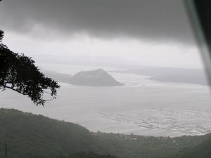
 Not Mount Taal
This is Mount Balantoc, which is on the same island as Mount Taal, but is not Mount Taal. Confused? So was I, but it became clear later when I got to the island and we did not walk up this crater.Arranged a tour out to TAAL Volcano. This was a fairly soft day overall, but I did get to walk up another volcano, and admire the view. Typical arranged tour, with standard stops at fruit stalls, etc of the driver's choice. As the only pax for this trip for this company, was given the VIP treatment - I think that meant that I could ask anything, and then just had to take the response with a grain of salt.
Trip across the lake to the island was by a motorised outrigger canoe. Basically a fibreglass hull with bamboo trunk outriggers on both sides. Was raining, but not badly, and it stopped by the time we reached the island.
As we walked up to the track to the volcano, there was a yard full of horses and jockeys waiting to provide transport up to the top. They were disappointed, and kept pestering me to use a horse. Even when we had cleared this area, every time a horse came down without a paying pax, they would try to get me to ride. Eventually one became so annoying that I asked my guide to get rid of him. Did not have

 The Lake Taal Ferry Service
This was one of dozens of similar boats ferrying people across to the island. If they were a traditional shape, nothing much else was. They were moulded fibreglass and powered by a small petrol engine. The only traditional materials were the bamboo outriggers.a problem after that.
View from the top was magnificent, given the cloud, etc, and will put up photos in due course.
The walk was pretty soft, but I was pleased to have done it.
Advertisement
Tot: 0.594s; Tpl: 0.011s; cc: 10; qc: 52; dbt: 0.1958s; 1; m:domysql w:travelblog (10.17.0.13); sld: 1;
; mem: 1.1mb

 Not Mount Taal
 The Lake Taal Ferry Service


Phil. trip
non-member comment
mike
planning trip to the islands in sept. avidly reading blogs. waiting for more info/blogs from you. and pics too. tx!