Advertisement
Published: January 10th 2013

 The approach
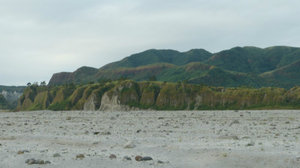
I was about to blather on about ingnious extrusions, but this is simply Lahar FlowsThe trip started with 4x4 drive to a base station. Not Mazda Tribute drive to Wheatsheaf, but a bone jarring, butter churning experience that nearly caused an eruption of my own which would not have been pleasant for anyone complete with sulphurous gases, albeit hydrogen sulphide not sulphur dioxide as one might expect wth a volcanic eruption. I did get a sense though of what 4x4 enthusiasts get out of the 'sport' - by the return trip though - I was completely over it.
The first thing that struck me was the terrain - almost lunar if you ignore the luh tropical growth at the top. The amount of lahar that reamins after the lasst eruption (1991 I think) is truly amazing. Having said that - I was told that it's a common misconception that a lot of people are killed by the pyroclastic flows of an eruptong volcano. Whilst not an insignificant number, this number is usually overshadowed by those who erpish in the landslides created in subsequent typhoons that follow. The locals believe that the 1991 eruption was triggered by the Yanks drilling for geothermal energy. I asked if Pinatubo was active or extinct and was
told it is extinct, witht he rider that everyone thought it was prior to 1991. Let's hope no-one's drilling anywhere close by then.
Another thing that really struck me was range of colours in the rocks. Not sure why but I sort of expected everything to resemble the blue of basalt, grey of pumice or ash and perhaps a little rust from the iron content. I suspect Jimmy could shed a little light as to why, but the range of colours was more like Raglan St Daylesford in Autumn than just two or three earthy shades.
The climb to the crater top is approx 7km with most of it being a relatively slight incline but very unsteady underfoot as we followed a creek bed most of the way and the sandy ash has been washed away leaving lots of small 'wobbly' rocks. As you near the top, the foliage becomes more and more lush and prolific and the last 1km becomes really steep until you reach the rim of the caldera or crater and the view.
To be completely honest - as nice as it was it was probably a lttle
anti-climactic. Certainly no Mt Mayon ( you may recall my love affair with Mayon from my previous blog).
All in all, would I recommmend it??? I'd have to say that if I'd travlled a long way out of my way to get there I probably would ahve been a little disappointed, but given it was more or less on our way it was worthwhile. There's also an option to fly over, but given our cast of thousands we didn't choose that option.
Advertisement
Tot: 0.138s; Tpl: 0.013s; cc: 12; qc: 65; dbt: 0.0764s; 1; m:domysql w:travelblog (10.17.0.13); sld: 1;
; mem: 1.2mb

 The approach


Jim McDaid
non-member comment
The Crater
That would be rust (iron oxide). These are beautiful pictures John. The white material is volcanic ash and it can flow very fast due to the amount of gas and steam that it contains immediately after eruption. Volcanic ash flows (also called pyroclastic flows) can move at speeds ranging from a few km per hour to more than 1000 km per hour as was reported from Mt St Helens. Nature and her laws are wonderful things to behold.