Advertisement
Published: September 6th 2007
For some reason while we were relaxing in Jinja we got chatting to Brian and decided it would be a good idea to climb mount Elgon. I don't know why, it's a bloody big mountain, the second largest caldera in the world after the Ngorogoro crater in Tanzania and rather high. In other words it's a bloody big mountain.
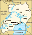
First of all we needed to head North up the Eastern side of Uganda. This side of Uganda is very flat but quite green, with some swampy bits. Mt Elgon is an isolated but huge extinct volcano which straddles the Kenya / Uganda border.
Mbale is the base for Mt Elgon climbs. We were relieved to get out of the matatu (minibus taxi) after the 4 hour journey, which was one of the less comfortable / more overcrowded ones we have been on.
At Mbale we went along to the Ugandan Wildlife Association office to make arrangements. There are several routes up and down - we planned to take the Sasa route up and then come back down the Sipi trail, mainly because it ends at Sipi which looked like a great place to chill and recover afterwards. The
UWA guys told us to go along to their office near Budadiri (the trailhead for the Sasa route) to sort out Guide and porters for the trip.
We did some shopping for supplies, and left the kit we wouldn’t need at the hotel (so that we were only carrying what we needed on the trek). We then spent the afternoon lounging by the pool of Mbale’s only posh hotel, psyching ourselves up for what lay ahead. In fact we nearly decided to stay by the pool for 4 days instead. Later we headed for Budadiri which is just a tiny village on the lower slopes of the mountain.
Mt Elgon is a hike you organize yourself - none of this “package hike with lots of porters and luxury tents and hot dinners thrown in” lark. You provide your own stuff, you need your own tent, cooking equipment and food, and you hire a guide and any porters you need from the National Park office. When the National Park man asked how many porters we needed, "one" was our sensible first answer because we just needed somebody to carry our food. We would carry our own packs thank you
very much. The UWA man at the office recommended two maybe even three, it's quite difficult if you're not used to the altitude etc. Quick discussion outside "of course he's going to try to get us to take more porters, they just want our cash" and the decision to take two porters was made. One to carry the food and the other to carry either Brian’s or Adam’s pack if either needed a break. Marianne would carry the small bag (with the VERY HEAVY camera and accessories in). Sorted.
We stayed the night at 'Roses last chance' guesthouse in Budadiri, and wandered into the town to get some fresh veg and a few last bits and bobs. Like Mossie coils. Roses has a wee mossie problem. Brians room which we dubbed the cave, seemed to be the place from which all mosquitos are spawned. I thought the dive we stayed in in Mombasa on the way to Lamu was bad, but his room had a bit of a bug issue. The whole time we were wandering around the town we were escorted by the local loony who fancied himself as a bit of a Charlie Chaplin character, twirling his
cane around and constantly running around getting us random stuff from each of the stalls. He couldn't actually speak any English so everything was done in mime which was a little bit strange but it did provide the locals with much amusement.
Rose provided us with a good feed the night before we went and some pretty good banana pancakes and coffee the morning we set off, which we really really needed later on that day. Let’s just say we might have underestimated things a tiny bit…
To cut a long story short (and to give the hard hitting statistics first for maximum impact) the first day we walked only 19km. But we climbed more than 2,300m in altitude! It was a nightmare. Why didn’t we take that extra porter…?!
The morning was a 2km distance 500m climb up through a few of the villages and banana plantations close to Budadiri to the boundary of the park itself, with Marianne collecting the usual groups of kids that were all to eager to come out and say hello. It seemed word spreads fast and every village turned out to see more Mzungus climb the big mountain for no
really good reason.
Very early on Adam was beginning to regret the decision to only get two porters, but even giving the pack to the 'spare' porter was out of the question because he had rocketed off up the mountain only to be seen again at lunchtime. (On the way up we were overtaken by a group of cheating Czechs who had opted to get a Matatu through the villages saving themselves 2 hours and a shed load of sweat, but we'll come to them later on). It was a real slog of never-ending steep muddy uphill.
As if that wasn’t enough, after a bit longer we arrived at the 'Cliffs of Death' which, according to the guidebook, are surmounted using 'ladders'. It fortunately turned out that the 'rickety' ladders had been replaced by some rickety stairs. Adam was seriously apprehensive about trying to climb up ladders with full pack, dehydration, quite a serious case of 'Disco Knee' and badly in need of something sugary. (different variations of what the cliffs would be called after our visit kept going through our heads). It turns out they weren't too bad and at the top you enter into the rainforest
proper. It was here the unpredictable Mt Elgon weather started to predictably rain. And of course you carry on MORE uphill.
We've done walking in quite a few places around the world but never carrying enough equipment for a few days on a mountain somewhere. Also, generally the paths we've walked on tend to be zigzaggy, with the general effect of lessening the gradient but making the distance a little longer. The African way of planning a route from A to B is to hack a path through whatever is between A and B regardless of how steep, muddy, wet, rocky, overgrown A to B is. That combined with boots that tend to slip badly on the mud and a heavy (for Adam, Marianne allows that hers was a BIT lighter) pack, makes for a very tough constant uphill slog that just doesn't stop.
The stretch from Budadiri to Sasa camp (the morning of day 1; Sasa camp is the lunch stop) covers a distance of about 8km and ascends 1700m. You reach Sasa camp for lunch at about 2 in the afternoon (after setting off at 7:30). After lunch you set off on the second shorter (but
 Coffee!
The stuff we've drunk so far has been like muddy water unfortunatelyno less steep) stint which covers another 5km and ascends another 600m to the first night’s camp, Mude Camp at 3500m. This is through montane forest and then bamboo forest, until you come out on more exposed mountainside shortly before the camp. It’s all quite atmospheric with mist and weird shaped trees dripping on you etc.
We finally arrived at Mude (the first night’s camp) at around 6pm. We were exhausted, wet and cold. We staggered up to find all the best camping spots nicked by the Cheating Czechs. They were dry and warm and happily eating their dinner and greeted us with a cheery "hello how are you?". We'd be feeling chipper too if we'd skipped the first bloody 2 hour slog and had the porters carry our packs the whole flipping way… Cheating gets.
We pitched the tent in the dark and spent a couple of hours in the porters’ hut drying ourselves and our gear, warming up and cooking ourselves some food. The first of three nights’ gourmet dinners of Heinz 2 Minute Noodles with tinned tuna. The porters make a massive fire which was sorely needed as it was a really clear night and
very cold. Then hit the sack at about 8:00 ready for the morning.
Day 2 was summit day and a relatively easy day apart from the altitude. We set off early (about 6am) to get the top before the unpredictable weather closed in and obscured the view from the summit. Uganda is flat, very flat. So the view from the top of a 4000m+ mountain promised to be worth the early start.
Of course the Cheating Czechs had started off even earlier than us which was slightly odd because you really don't need that long to get to the top. The Cheating Czechs took “all the gear no idea” to a whole new level - they had so much kit! Although like us they would be returning to the same camp after the summit (it’s an out-and-back day) they carried three big packs between four of them, just containing all their layers of waterproof-breathable-wicking Northface gear, and their multitude of Nordic walking sticks etc. And they were SLOW.
The climb takes about 4 hours, it's 9km with a climb of about another 820m. By this time you have climbed above the rainforest and the high montane forest
and have started to enter sort of a high altitude moorland dotted with some weird prehistoric looking trees and plants like the groundsel and giant Lobelia. Very desolate but beautiful.
Marianne had to have a bit of a pause about 1km away from the summit because of altitude sickness but made it in the end (Marianne comment: it was NOT altitude sickness it was exhaustion brought on by trying to keep up with macho Adam and Brian zooming up the hill. When I stopped pushing so hard and took it at my own speed I was fine AND I was still faster than the Cheating Czechs).
The view from Wagagai summit made the slog the day before and the early start worth the effort. The weather was really clear and the views fantastic. In fact the view does not take in the plains of Uganda. Mt Elgon is way too big a volcano for that, you can’t see down to the base. What you get instead is a magnificent view of the massive caldera (all 40km2 of it!) and crater lakes on one side (also views into Kenya) and high heathland and rocky peaks on the other (Ugandan
side).
At this point we were still wondering why the Cheating Czechs had taken a huge rucksack up to the summit with them while everyone else just had day packs (we still thought that it was because they were headed for another camp that night). When we realized that they had just taken an enormous amount of hardcore mountaineering gear with them which just slowed them down enormously, we felt ever so slightly smug.
Same routine that night: back to the camp, dry the gear, eat, then get some sleep for the 5 o'clock wake up on Big Day 3.
Day 3 covers 37km, up and down across the peaks and valleys and heathland on the top. Almost all well above 3000m altitude. I (adam) don't think we have ever walked that far in a week, never mind a day. With a pack. I don't want to labour the point but after walking with it on for a few hours it feels like your arms are going to drop off at the shoulders and each slip on the mud is a potential Cruciate popper. 18km to the first camp for lunch, then another 19km to the second
View from the edge of the park towards Budadiri
Yes we were that high already and it was only the beginning... camp. I (Marianne) found it ok, cos it was up and down, sometimes steep and sometimes rolling, through beautiful scenery. I was quite happy plodding on and looking around. It was not unlike one of the longer walks we have done in the Alps. Oh and I was carrying a smaller bag.
On the third night we camped - in a cave! with bats! Pitching a tent in a cave may seem largely pointless until you see the various creepy crawlies living in it and the few hundred fruit bats in residence. All of us were seriously running on fumes by the time we got there and treating ourselves to Heinz baked beans with noodles and Tuna was totally gourmet after two and a half days of just noodles. A short while by the fire and we were all ready to call it a night.
We all got a lie in the next morning and were woken at 7 by Moses our guide ready for the descent of day 4 to Sipi where there are some spectacular waterfalls, and where we intended to spend some well deserved days relaxing after our 4 day mountain extravaganza. The last day
is another 18 km and all of us were really in need of getting down and stopping. Unfortunately, although it’s largely downhill, it had been raining and the path was a mire which made the going difficult. Better still, we had to hurry to beat the coming (more) rain as the path would have become an even more difficult to negotiate muddy stream. As we came back out above the small villages and banana plantations above Sipi, the views down and across the plains were spectacular.
We finally arrived at Sipi and plumped for Lacam lodge which is built on the ridge right next to the third waterfall, expensive but with full board and the rumour of good food it was enough to keep us interested. We had a well deserved beer with the guides and porters then....showered. Oh. My. God. It's amazing how much you take things like food and showers for granted.
Advertisement
Tot: 0.118s; Tpl: 0.016s; cc: 9; qc: 21; dbt: 0.0903s; 1; m:domysql w:travelblog (10.17.0.13); sld: 1;
; mem: 1.1mb