Advertisement
Published: January 13th 2016
Sunday January 10th, 2016. Las Palmas, Gran Canaria
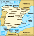
Las Palmas is the capital of the island of Grand Canaria, and Spain's 7th largest city. The island is in the Atlantic Ocean about 100 miles off the coast of north-west Africa. As such it is the largest city in the European Union lying outside the European Continent. Founded in 1478 by Juan Rejon, the city's original name was 'Real de Las Palmas'. Rejon was head of the invading Castillian army, before engaging in war with the locals. In 1492, Christopher Columbus anchored in the Port of Las Palmas and spent time on the island on his first trip to the Americas and on hs way back to Spain. The Casa de Colon Museum in the city is named after him. Francis Drake tried but failed to plunder the island in 1595. The raid and partial destruction of Las Palmas by the Dutch under Vice Admiral Pieter van der Does in 1599 is considered a major event in the city's history. In 1927, Las Palmas was designated the premier capital of the Canary Island by decree of 30th November 1833.
We had a posh breakfast and then
met Pam and Stewart as arranged at bottom of the gangway as soon as the announcement came that we had been cleared by the Spanish Authorities. We walked along the quay and headed straight for Santa Catalina Square. It looked completely different from the last time we were here a few weeks ago as a huge stage and seating area was being erected in time for the Carnival season. This annual festival brings together flamboyantly costumed performers, music and dancing. We couldn't see anything yet as they were still in the process of installing all the speakers, seats, lighting etc. We continued round to the same car hire place that we had used before. Raul remembered us from a few weeks ago and we didn't even need to complete all the paperwork as he simply retrieved the last lot from a huge box file. While we waited for the car M took Stewart and Pam to see the Playa de las Canteras (Singers Bearch). This is considered to be one of the best urban beaches in the world. It is the symbol of the city and its citizens, perfect for a stroll or quick dip. When it arrived we found
we had a different car - same model but a bit more battered.
We didn't get lost in the suburbs this time either! We drove straight on to the motorway and headed for Ageate. D wanted to show Pam and Stewart the little port of Las Nieves, the high sea cliffs (7th highest in the world) and the 'El dedo de Dios' (The Finger of God) rock formation. We wandered around and read some of the blurb which was dotted around the port on various information boards. This time a Fred Olsen ferry had arrived from one of the other islands (not sure which one). We hadn't realised but Puerto de las Nieves was formerly the principal port on the island - more important than Las Palmas even - and the ferries still land here from the other islands. This also explains why the motorway stretches from Las Palmas and stops at Ageate. We had another look at the cliffs and then walked back to the church. The chapel has been in existence for nearly 5 centuries but the building as it is today is the result of constant renovation and the extension over the years. It
was built beside the fortified tower which the Spanish captain Alonso Fernandez de Lugo ereted in 1481 to facilitate the conquest of the island. It was the captain himself who dedicated the chapel to the Virgin of Las Nieves. Following the conquest in 1483, the Spanish monarchy gave Fernandez de Lugo plots of land in El Valle where he cultivated sugar cane and built a refinery. In 1494 he sold the plantation to the Genoese merchant Francisco de Palomares and went off to conquer the islands of Tenerife and La Palma. Palormares left the administration of the refinery in the hands of his brother Anton Cerezo. In a sworn statement drawn up in 1532 Cerezo together with his wife Sancha Diaaz de Zorita, promised to set up monastery and a chapel dedicated to our Lady of Las Nieves. Although the monastery was never built, the chapel came into being under the patronage of his heirs and successors. We looked at the empty plot where the sugar refinery used to be and took some photos of the church before returning to the car.
Pam and Stewart were anxious that we didn't repeat any more of our trip a
few weeks ago because, as they said, it was all new and exciting to them. So we decided to drive along the GC200 down the west coast of the island to Aldea. This was an absolutely stunning coastal drive. We stopped at a mirador looking back to Puerto Las Nieves and took some photos. We continued on and stopped at Guayedra where there are some restored remains of aboriginal dwellings. Guayedera is set amidst rugged terrain where towering cliffs and sheer rock faces rise upp towards Tamadaba Natural Park. Part of the aboriginal population settled here and archaeological remains of their stone houses, cave dwellings and tombs abound. Roque Guayedra is rich in such remains. When the island came under Spainish rule in 1483, the Crown bequeathed the area to Fernando Guanarteme, last aboriginal govenor of the island. At the end of the esplanade which separates two gorges, La Palma and Guayedra, there are two stone houses which date back over one thousand years. M and Stewart went to take a look. In addition, a group of caves is found on the vertical rock face. These were used for burial and habitation but we couldn't see them as we were
standing on the cliffs above. On the summit, stone graves known as cists are found. Access to the caves and cists is extremely dangeoros due to continual rock falls so we couldn't go and look. The group of stone houses on Roque Guayedra was one of the first sites in Gran Canaria to be scientifically studied. A series of excavations were carried out between 1975 and 1981 supervised by Dr Celso Martin de Guzman. Part of the material obtained is exhibited in the Canary Museum which we visited on or last trip to the island. The houses that we could see at Guayedra would have been built with double stone walls, fitting in to an area where rock would have been previously excavated. Seen from the outside the houses are round or oval and inside they are cruciform. Originally the dwellings were higher and had a flat roof made from wood, stones and mud. Inside there was a large central room with smaller rooms off to both sides. The outside and roof would have been adapted for daily use. Today Guayedra is a protected site.
We continued along the stunning (and at times hairy) coast road and
stopped at a couple of places to take photographs of Puerto Las Nieves which was by then a long way distant. As we drove we took in the magnificent views of the coast and mountains and also across to Tenerife where we had good views of Mount Teide. We missed the Mirador Anden Verde but did stop at Mirador El Balcon. This was a lovely viewpoint with steps down to a rock "balcony" that jutted out over the cliff face. There were fantastic views north from where we had just come and also of the coast to the south and across to Tenerife.
We drove into Aldea where we took advantage of one of the two gas stations before turning off on the GC210. This looked like a good, if minor, road that went into the Parque Natural de Tamadaba, back towards the north where we could turn off to the Teror Valley. This turned out to be one of the most exciting, narrow and steep roads, with 180 degree switchbacks that we had ever driven - often with sheer drops to one side. We continued on to a Mirador with a tower overlooking the Parradillo dam
and took a few photos of the amazing scenery. Next we came to Acusa where there were a number of dwellings that were either built into the rock-face - some even incorporating natural caves as part of the dwelling. We continued upwards reaching Brezos where the highest point was 1,335 metres (approx 4,350 feet - almost the height of Ben Nevis the highest mountain in the UK). There is no way to describe how hairy this drive was. If anything was coming the other way it was a case of finding a place wide enough for two cars to pass. This was going on in both directions so sometimes the oncoming traffic waited for us and other times we waited for them. It was amazing that at no point on the hour plus long journey did anyone have to reverse in either direction - quite incredible (or lucky) really. We dropped down into Artenara which was quite a bustling place with a monument and plenty of activity. Despite cruising up and down a few times we couldn't find anywhere to park so gave up and continued until we picked up the signs for Las Palmas.
The road
took us up into the clouds to 1663 metres (5,450 feet). We couldn't see a thing - it was like driving in thick fog. Then to top it all it started to drizzle. It was also feeling much colder. There were several viewpoints on this road but we didn't stop as there was no way we could have seen anything. As we had gained some time by not stopping in Artenara or at any of the viewpoints we decided to return to Firgas a second time. Pam and Stewart had not seen it and it was pretty much on the way back. We parked in the municipal car park and walked to the Paseo de Gran Canaria. This is a lovely steep street down which flows the water that feeds the mill. It is presented as a terraced fountain. Down the side of the fountain there are stunning tiled seats with a tiled crest above. There is one seat for each of the main towns on Gran Canaria. We walked up the Paseo de Gran Canaria to the top of this fountain. To the right was the church. The street continued on up into the village. Here there were more
tiled terraced steps - one for each of the 7 major islands in the Canarys group. Each step contained tiles depicting each island, its crest and a tiled relief of the shape of each island. M took a picture of each one - something she couldn't do last time because there were too many tourists. Due to the inclement weather we were the only ones there today. We were amazed to see that the U3A here had their own building ont the Paseo de Gran Canaria - the Club de Tercera Edad. Wish we had our own pad in Costa Brava. The four of us went into a bar that was full of locals on this Sunday afternoon and took some refreshement and used the servicios. We returned to the car through the municipal gardens with the statue of the bull that we had seen last time we were here.
We drove the car straight to the rental place in Las Palmas and called Raul to tell him we were back. The surf was breaking over the reef in spectacular manner on Playa Las Canteras so we went to take a few photographs. We returned via Santa
Catalina Park/Square.
We made use of the Mc D free Wi-Fi (and grabbed a quick burger) posted the blogs, checked emails etc. The show tonight was the Marco Polo Pantomime: Cinderella. This was by far the best cruise show we had seen for a long time. Really really funny. After the show we went to Scott's Bar for the Excelsior Trio and Kings and Queens Themed Disco We didn't stay terribly late as we were both a bit tired. A good day again on GC.
Advertisement
Tot: 0.073s; Tpl: 0.014s; cc: 7; qc: 26; dbt: 0.0504s; 1; m:domysql w:travelblog (10.17.0.13); sld: 1;
; mem: 1.1mb


Julie
non-member comment
....
Hs his Dangeorus Ont refreshement Reading your blog makes me desperate for some booze!