Advertisement
Published: December 4th 2014
Travel Notebook Learning Adventure
Photography: capture the essence of people and place
Writing: transform experience into story
(and have fun too)
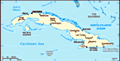
Over the Mountains: Santiago de Cuba to Baracoa
One treacherous road winds through the Sierra Maestra, a mountain complex comprised of a number of ranges. It is over this road that James and I and our companions will travel. We’re lucky; until the 1960s there was no road joining Santiago de Cuba and Baracoa.
The Sierra Maestra emerges out of the Caribbean Sea at Cuba’s eastern edge, the oriente. The island’s highest peak, Pico Turquino, rises above all others at 1,973 metres. The root of its name is obscured with time, but it might be a corruption of turquoise, a hue it often wears. It is in these rugged, isolated mountains where revolutions smoldered until the sparks caught, beginning with the Tainos, an indigenous people of the area, through to resistance against Batista in the 1950s that ended on January 1 1959 with Cuba’s current government taking power. A litany of conflicts stains memory and history books. It was this vast mountain range that slipped across
starboard as our sailboat, Magic Badger, made her way to the port-of-entry, Santiago de Cuba, on the island’s southeastern shore. Now we sit in an old blue Ford jeep as the city fades behind us and the mountains rise ahead.
We pass through the semi-arid plains around the Cuban city of Guantánamo. During the Spanish Civil War, the United States won a battle in the Bay of Guantánamo, and in 1903 the first lease was signed between the U.S. and Cuba. A treaty was signed in 1934 that gave the U.S. a “perpetual lease” on 45 square kilometers. While Cuba disputes the legality of the lease, the Americans and their military remain entrenched. We drive on Cuban territory, and along the way we stop at many Cuban checkpoints. Somewhere on the other side of the 27 kilometer-long fence, American soldiers undoubtedly go about their business of soldiering.
We are stopped at the final Cuban checkpoint. Young Pochuto, who we’d met at the marina, Porta Gorda, where we left the boat tied to the government dock, and who had introduced us to Santiago, was now being escorted to a building across the road. Military personnel begin to
 Overland transportation
(Photo by Kathryn MacDonald©)peer into our open jeep. Young servicemen look into the bags of those travelling with us, but they do not look into ours, nor do they speak to us or acknowledge our presence in any way. I feel invisible, a mere witness to the action that unfolds. Curious, I wanted to ask about the delay. Practical, I think better of it and sit quietly waiting. Eventually, I see smiles and handshakes and our driver and truant hop into the jeep and we speed off. Pochuto sits chastened; he has flaws in his documents and was told to address them in Baracoa before returning. We are a noisy group as Guantánamo disappears behind us. For a few minutes we thought we might be turned back to Santiago.
From Guantánamo, we head southeast toward the sea, crossing the Sierra de Mariana range, then through the Sierra del Purial where the road runs along the coast. This stretch inspires awe, as I gaze across a landscape that seems uninhabited. Occasionally, I glimpse the Caribbean Sea between trees. When we are able, we pull over to stretch our legs and attempt to capture the magnificence of the panorama in photos. At Cajobabo, we
turn north, crossing the high and twisting La Farola Montañas/The Lantern Mountains to Baracoa and the Atlantic Ocean. This final stretch feels the most dangerous as the road drops off into bottomless gorges and twice half the roadway itself has fallen away.
Along La Farola, the road shares the mountain range’s name, we drive through many small villages. At road’s edge, hand-lettered placards bear the names of resistance fighters, an eerie reminder of the price of revolution. Clearly, families here paid a great price to remove Batista from power. I find it disquieting that after fifty-some years, the loss remains so poignantly and personally remembered.
We slip down through the rainforest into a jumble of buildings weathered by winds off the Atlantic Ocean. They crowd together on streets that slope down to the malecón, the seawall that usually protects the city from surges off the ocean. On August 25 2012, almost two years before my arrival, Tropical Storm Isaac crashed over the seawall, depositing ankle-deep water through the streets of Baracoa, creating havoc. Images of the ocean buffeting coastal buildings flash across my mind. It was this past August 2, that saw Magic Badger,
our Beneteau Oceanis 381, tied down at a dock at Casa de Campo, Dominican Republic, while I lay in the forward cabin listening to the wind howl and thunder crash as Tropical Storm Bertha blew over. But today, the sun shines and we are all hot and thirsty, looking for water of a drinkable kind.
This leg of our journey completed, we find a casa particulare, a bed and breakfast Cuba-style, and drop our bags. The refrigerator in our room is stocked with bottles of water and James adds cans of coke to pour over splashes of rum. I, on the other hand, rush to the shower to wash the day’s sweat and grime from my body and let thoughts of mountain views seep into my mind and heart.
Please check out our website at
www.travelnotebook.ca for information about the 10-day workshops in 2015. Thanks.
Advertisement
Tot: 0.118s; Tpl: 0.011s; cc: 12; qc: 56; dbt: 0.0613s; 1; m:domysql w:travelblog (10.17.0.13); sld: 1;
; mem: 1.2mb


Judith Versavel
non-member comment
New views
Hi Kathryn, These are sights we didn't see when in Cuba several years ago. Sounds like quite an adventure. Loved the photos and history included. Hugs, Jude