Advertisement
Published: October 19th 2010
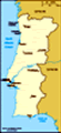
Caminho Portugés
Introduction After the Camino Francés (French Way) the Caminho Portugés (Portugés Way) is the most popular of all the ways to St James. Most pilgrims start at Tui as it’s a short route into a see Jimmy and obtain a Composetela.
This time as it is winter we will be starting in Santiago and heading south to Lisboa, trying to keep ahead of the rain. Well that is the theory, but the rain has followed us from Spain so far!
The Caminho Portugés is one of richest cultural and architectural heritages of the existing Caminos. In Portugal there is a long history of devotion to St James and St Roch, the patron Saint of Pilgrimage. Representations of both Saints are to be found everywhere along the pilgrim road, some can be in prominent positions - literally on the way. But others are well kept secrets, hidden away in locked churches, high up in the sculptures or stained glass of great Catedrals or simply insignificant ruins.
The Caminho Portugés gently winds northwards, along ancient tracks and paths that traverse woodlands, farmlands, villages, towns and historic cities. The route is enriched by the presence of chapels, churches, convents, petos de animas (stone altars usually found at crossroads) and cruceiros (wayside crosses), where the comforting image of Santiago the Pilgrim is ever-present, to accompany and hearten the pilgrim on his journey.
For us its bridge / history nuts it paths over medieval bridges, many of that maintain some trace elements of Roman design, that we look
forward to.
Many of the paths along this way were built upon the major Roman roads that formed the backbone of Roman Gallaecia - such as Via XIX, that was used for trade and travel for many centuries. Via XIX was built in the 1st century AD under the Emperor Augustus. Referencea to this road in classical texts are proof of the vitality of the route from antiquity. Since the Middle Ages the Caminho Portugés has maintained a tradition of exchange between neighbours, began during the days of the Roman Empire. There are sections on the way that have Roman markers indicating you are on an old Roman road, or pointing you to Roman points of interest. Okay, yes we are road nuts as well - well given our interest in walking on ancient paths it kinda makes sense.
The hospitality offered to pilgrims goes back to the Middle Ages by the monks and clergymen serving the hospitals founded by the monarchs and nobility. This tradition is kept alive today by the inhabitants of the towns scattered along the way and by the inn keepers at pilgrims' hostels. And sometimes even strangers who take pity on lost pilgrims
 Mystery Marker
The way to Padronand offer them a place to stay and cheese...
Despite its rich historical background, the Caminho Portugés has not escaped the processes of modernisation. At times, the pilgrims must leave the dirt paths and stone-paved ways to walk along the verge of the N-550 road between Vigo and A Coruña. This main road follows the Caminho Portugés to Santiago, something of a drawback for those seeking to recapture the essence of the original pilgrims' way, and can mean you are often walking on the hard shoulder of the road which can be tough on your feet and dangerous to say the least.
The Oporto-Barcelos-Valença road has a particular importance, as here the roads come together, reinforcing this road as the backbone of the Caminho Portugés to Santiago. Features of the Oporto to Lisboa route include:
- A number of very nice towns, including liked Vila Franca, Golegã, Tomar and Oliveira de Azemeis.
- Terrific Roman ruins around Rabaçal and Conímbriga.
- The beautiful medieval university city of Coimbra.
- And of course the port caves in Oporto
Though this caminho goes through rural Portugal, it is most usually through rural developments in Portugal. There are
Which way?
Follow the blue to Fátima very few sections that qualify as away from civilization, or out in nature, except perhaps for the eucalyptus forests (bloody Australian weeds). But there are also a lot of flax and New Zealand cabbage trees on the way, well enough to remind us of home from time to time... oddly too just about every garden has a persimmon tree in the front yard, they look about 10/15 years old so this is obviously the latest addition to the Portuguese diet.
For us (Fran & Hel), our reverse trip down the Portuguese way will start in Santiago de Compostela and move south through Galicia to Pontevedra and Tui before crossing into Portugal. Our walk will include cross the iron bridge into Oporto and continuing down through central Portugal via Coimbra and Tomar (where it coincides with the famous Caminho de Fatima and mainly follows the Tejo river valley) before finally reaching Lisboa.
While the Galician granite waymarks with a blue tile stop in Tui, the trusty yellow arrow is used throughout the route. In Portugal the way is often marked by both yellow arrows showing the direction to take and crosses showing the way not to go. However all
this may be wasted on us as we will be heading back the other way and won’t see signage such as his one on the telephone pole as it will be facing away from us. That said we would really like to thank those who maintain the marking on this route, especially the guy who sticks the arrows on the road and the crosses on the "not this way" bits. very helpful!
What about the blue arrows?
The Centro Nacional de Cultura is developing pilgrimage routes to Fátima, marked with blue arrows one from Lisbon largely along the river Tejo, and one from Oporto.
The routes run with the Caminho Português between Lisbon and Santarém and between Ansião and Oporto . As the route is marked by blue arrows so on leaving Oporto our way will be easier to follow as we can follow the blue arrows as far as Ansião. For the rest of the way, well good map reading skills will be called for. As most guide books write on the assumption that you are going to Santiago (i.e South to North).
Hel has done her head in unscrambling the travel advice and reworking it backwards - did I
mention she is dislexesick which doesn’t help (also explains the spellin in this blog).
It is not just a simple matter of following the arrows backwards , as you may not even see arrows when they face away from you. If you are brave enough to follow us then try to keep up with the instructions that follow - or get the excellent John Brierley maps, or CJS guides.
And don't get tooo confused with this entry as we are updating it ... may take a while, you can tell the bits that are done as they are dated and include the extra kms we did from the times we got lost... the rest is an explanation of what we intended tto do...
Santiago to Teo 17 kms including getting lost
13 November 2010
Today we were heading for Padrón, but after a 42 km stint into Santiago we decided to go a bit light on the walking today. that and the rain and getting lost and all....
This is a moderate day with a climb up over and out of Santiago and includes several crossings of major roads.
Leaving from the catedral we
go down the Rúa do Vilar from the pilgrim office wand join up with the raditional Portuguese entrance to the city the Porta Faxeira at a set of traffic lights. Then its on down the Av de Xoan Clarlos I (AC404) and across through the Cabelleria de Santa Susana to exit on the Av Rosalia Castro cross the round about and continue down the Rúa da Choupana veer towards the Complejo Hositalario. So far so good, but we end up slightly off tract and have to search around for the crossing of the (AC543). Less then 3kms from catedral we've made it to the Ponte Rio Sar and already got lost. We stop at a bar to check out the way and have polpo empandada. Hel gets rewarded by a smooch by an old boxer in the bar (a dog not a pugilist) this sets of a ramble about how she misses her usually walking buddy.
We descend as planned to cross the river, then up Monte Agro. Around here we get lost by weird arrows going to and fromthe look out and then later on lost again and end up under a motorway bridge, we figure out this
is the Ctra Coruna-Tui (N550) crossing the Autopista AP9 and the railway line we use this to figure out where we are, go back and rejoin the route... This is not a good sign of things to come...
Getting lost proves to be the theme for the day, and we spend much of our time walking in the rain going backwards and forwards trying to find the markers and the camino. This is not due just to our poor navigation skills, but is compounded by the fact that new roads / motorways have been put through the area and cut across the route. The worst is outside A Grela where the camino has been replaced by a motorway and all the routes lead back to Santiago.
Despite asking for advice we end up in the middle of nowhere with no markers or signposts in sight. We cut across unmarked country got horrible lost and had to ask for help from a farmacy in international mime language.... As itt's pouring and getting dark so we end up getting a taxi from the farmacia to take us to a road junction with the camino and from there make our way
to the modern Albergue at Teo by the roman bridge over the Rio Tinto and Castro Lupario.
While it's a very pleasant, well equipped albergue it is out in the whops (10kms south of Padrón) and we don't have much in the way of food on us, but we still managed to resect a meal from pilgrim left overs, lucky for us as this is the last albergue for pilgrams going the other way they tend to ditch the rice and pasta before heading off to Santiago.
The albergue is packed, mainly by a group of pizza eating poles who have come up from Tui, one of them falls from the top bunk in the middle of the night and makes the earth shake, at least it made for a break in the heavy snoring.
Teo, Padrón to Caldas de Reis 24 kms
13 November 2010
When we finally made it to Padrón we stopped into to see the bolard in Jimmys river shrine and then padded through the market that was in full swing on the river bank of the Rio Sar (an off shoot of the Rio Ulla), picking up hot sweet fatty churros
as we went.. tastey.
Padrón is the old Roman town of Iria Flavia, it is here that Jimmy apparently first preached during his stay in Hispania (vee-vaa Hispania - okay enough singing). How fisherman James, son of Zebedee and Salome, ended up as a missionary in Hispania, before returning to Jerusalem to have his head chopped off by Herod Agrippa’s sword - escaped Hel, they must have covered that after she got thrown out of Sunday School. Clearly Jimmy got around a bit before settling down in Santiago de Compostela. As well as being St James the Pilgrim, in Spain he is Santiago Matamoros (the Moor-slayer) and pictured wielding a sword, so he obvioiusly got over that beheading thing.
After his beheading his body (and head) where brought back to Iria in a rudderless, unattended stone. The boat was moored to a pedrón (Spanish for big stone), and gave the place its new name, before transferring Jimmy to Compostela. The pedrón can be seen today at the parish church of Santiago de Padrón, this is on the way by the river (obviously) and has a great sello. They also cleverly get you to bend low in front of
the alter to see the stone underneath, all very devout, especially if you haven't taken your pack off.... here endeth the lesson
Interestingly you can get a certificate from Padrón if you have walked from Santiago to Padrón, they have even laid out fancy brass markers into the foodpaths to promote it, not that it helped us in the rural areas yesterday when we got lost! We don't get out certificates as the albergue is closed and we can't be bothered waiting around in the rain for it to open.
From Padrón it was on for an amble in the showers / rain to Caldas de Reis, a small town famous for its thermal waters and many older people go there to take the waters. There is a hot spring for public use outside the Hotel Dávila, we strip off our feet and soak these in the warm water - bliss - nut not hot enough for Hel.
Caldas de Reis also boasts the Church of St Thomas à Becket, the only Church in Galicia dedicated to the English Martyr, it was closed when we where there. There is also the Capilla San Roque at the end
of the town, also closed. Inside there is a free standing wooden polychrome statue of San Roque peregrino. Outside there is a stone figure of San Roque with a dog.
Caldas is a small town, accommodation are all within a few minutes walking distance. Albergue de peregrinos de Caldas is listed as being at Calle Iglesia 18. NO IT IS NOT! It is by the bridge, we went backwards and forards in the rain but could not find it, we checked into a hotel and only saw it the following day when we left through the market which seams to be following us.
So if you are looking for the albergue, then stand on the old roman bridge and turn around till you see a willow tree - the albergue is behind this tree across a small park.
Caldas de Reis to Pontevedra 29 kms including getting lost
15 November 2010
Leaving Caldas de Reis past the public fuente with thermal waters we rejoin the camino and are due to walk parallel to the road - the N550 - and railway line most of the way.
This is the first day of our trip
that it has not rained! Given we started from Ferrol on the 9th, thats over a week of waling in the rain! The forecast is for more rain.
We do pretty well on the navigation front too, until we end up on another main road with no signs of arrows, we head up to a little Capella on a hill to see if we can get our bearings from there. After consulting the oracle we figure out that we have to march 5kms down the busy truck laden road to get to Pontevedra. It proves hair-raising but we get there in.
Pontevedra is a town of some 80,000 inhabitants and has all transport links, restaurants, banks etc. It has a very well preserved medieval town centre along with many small and popular squares. Attractions include the large multi building museum and the weekly market on the alameda (town square), ahead is the Pazo do Concello, town hall and council offices.. Local churches and museum contain many depictions of St James, St Roche and Our Lady the Pilgrim at the Sanctuario de la Peregrina. The Tourist Office is on the Calle Xeneral Gutierrez Mellado 3.
There is supposed
to be a temporary albergue in San Amaro on the way and an albergue in Pontevedra, Rúa Ramon Otero Pedrayo by the estacion de ferrocarril 1.5 km out of town. There is also a parador in Pontevedra and range of hotels.
We stayed in the excellent albergue in Pontevedra, a great building at the edge of town, but a dragon of a hospitlair who spent most of her time making sure the pilgrims (the few bedrgagled wet souls that we were) were kept in their place. The pilgrim numbers are dropping and the albergue is nearly empty, on a handful heading north.
Ponteverda to Cabaleiros / Mos 30 kms
16 November 2010
Today we are to look out for a lost dog who followed the dutch girl yesterday, if we find it we are to take it back over the hill... well spanish dogs have pretty good sense of direction and if one follows you its likely to find its own way home. In any case there is no sign of a lost dog looking for a pilgrim to follow.
Leaving Pontevedra on the Rúa de la Pergina, we go back over the railway line and
head south to Capela Sta Marta (2km).
As you leave Pontevedra’s alameda you cross a busy junction with the city’s old town directly in front of you and the ruin of San Domingos church to your right.
Continuing cross country the route comes out by the Rio de Vigo cross the Roman bridge, Ponte Nova and Ponte Sampaio on outskirts of Arcade. Heading carefully down the N550 before detouring over the Alto de Lomba, past ruins and rejoin / cross the N550 down the hill. We continue on side road into Redondela cross N55O by the Capilla Virgen, cross rail line to Iglesia de Santiago. The church features Santiago Apostól over the main altar, Santiago Matamoros over main door, rose window with scallop shells and Santiago swords... in case you forgot you are on the way of St James.
Somewhere along the way we clocked up our 200kms for the trip... only 600 odd to go...
The Redondela albergue is on the route nearby 56 beds, showers and toilets, living room, library, small kitchen, open 5pm closes at 9.30pm. Restaurants, banks in the town. Leave Redondela along the N550 and up the Monte Cornedo on a parallel
road, the alto (6km) has a recreation and Roman Milario.
Continuing down to Cabaleiros / Albergue de Mos (3km) and the very good new albergue on the route which we stayed in. Ask for the key at Flora's opposite. They are also developing a bar / cafe to better service pilgrims in the old large stone town hall.
It’s another 5kms to O Porriño , mainly on roads close to the railway line and N550. Hopefully we do better navigation wise, as today we managed to loose the railway - how can you misplace a railway - but we managed to stay mainly on route.
Cabaleiros to Tui 20 kms
17 November 2010
We start off on a fairly straight forward flat stretch to O Porriño and pass the sign to their albergue on the way into town.
O Porriño is a small town and has a good range of shops, farmacias and banks. There are also a number of hostals, hotels and restaurants. Approximately 1.5 kms south of Porriño is the Church of the Virgin of the Way. There is a statue of San Roque Peregrino on the wall on the left inside wearing
a hat, scallop shell, stick with a dog. There is the traditional depiction of a wound on the Saint’s left leg, and the dog doesn't have a fat lip it's bread for San Roque.
San Roque is our guy, he's a patron of pilgrims and he's helped by a dog, the day commemorating his death is very close to Fran's birthday. He is linked to the Bubonic plague and other infectious diseases, according to legend he was the son of the Governor of Montpellier. When his parents died he distributed all his worldly goods among the poor and set out as a pilgrim, arriving in during the plague, he helped tend the sick and is said to have effected miraculous cures, including the pope's brother... apparently he also cured cattle. However he fell ill with the plague and was expelled from the town, where he made a hut in the woods and was saved from starvation by a local dog who brought him bread every day. He recovered and returned home where he was locked up as a spy and died in prison.
Pretty grim this lot, but it makes for interesting reading on wet days.
Anyway
we waved to San Roque and pushed on to Tui in the rain. The area around O Porriño is pretty grim and industrial but the council is housed in a mock medieval tower, which has a very good stained window of Jimmy, and a very boring stello. After leaving O Porriño we reach the Rio Loura and then to Orbenlle, crossing the river near the Santa Comba and the Puente das Fenres outside Cruceiro San Telmo where legend has it that the Saint fell sick and died of a fever on returning from a pilgrimage to Santiago in the 13th century.
Okay I should also point out that no, we are not catholic, we are pagans and yes you can walk the various caminos without being religious and be welcomed into albergues etc.
We had the good fortune to be sheltering in the rain consulting the guide book when the hospitaliar for the Tui albergue when past (complete with umbrella and gumboots) and showed us the rest of the way, note good beds, great view, no kitchen. After which we went for a flash lunch to celebrate our travels through Spain (nearly 250kms so far). Hel entertains Fran
(and the waitress) with her attempts to clean out all of the flesh from the langoustine.
Tui is better known in New Zealand as a native bird, and a brand of beer. But in Spain, Tui is a town of over 15,000 people. Tui started off as Roman settlement called Tude and has the typical turbulent history of many of Galicia’s towns, and wars with Portugal and the Normans as well as being a part of the Visigoth empire. The oldest parts of Tui's walls were built during the reign of King Ferdinand and date back to the 12th century. Over subsequent stages of the town’s development, and as a result of the city’s expansion, large sections of these walls have been demolished, but one of the original gates the Pia remains.
Tui’s compact historic quarter has a number of monuments, the most significant being its castle catedral that unlike the basilicas of Pontevedra, Ferrol and Vigo, is exactly that - a real cathedral consecrated in 1225 AD, but building work started over a century earlier. The Catedral’s position, on top of a hill at the summit of the town, makes it the emblem of the city. The
Adam & Eve
Pontevedra building is a castle and the walls are adorned with battlements and fortifications, dating back to the year 1120 AD.
We check out the view from the catdral and make good use of the panorama feature on the camera, weirdly a small gun ship travels up and down the river blasting brass band tape recordings. despite this we have a sound nights sleep and sharing the albergue with only two newbies off to Santiago.
Tuito Ponte Lima 42 kms
18 November 2010
Today we will be crossing out of Spain and into Portugal. The border is runs between two towns Tui and Valença and it is good to remember there is a time difference between the two countries with Portugal being an hour behind Spain.
The border is the River Mihno that is crossed by a pedestrian walkway with the Spanish Consulate and Parador nearby. Scallop shells lead down from the Tui Catedral (and albergue) to the border. When we crossed in the early morning the mist was so strong we couldn't see a meter ahead and it was a leap of faith to step off onto the bridge and not see anything!
Valença do
Minho is the first Portuguese town on the route we will reach, it has a population of under 15,000 people. Valença is a walled town of Roman origins . One of the four gates into the town is the Porta de Santiago. Within the fortress Roman milestone marks the XLII mile of the road connecting Braga to Tui.
Valença do Minho is surrounded by defensive walls in the top of a hill, showing its ancient defensive facet. The most interesting things to visit are mainly inside the fortress, the main entrance is the Porta do Sol. From the fortress you can look down on the Ponte de Arcos de Valdevez that connects Portugal with Spain.
Valença do Minho was of extreme significance during the Middle Age, up the hill with a privileged view over the border line, looking over its neighbour Spain. Valença’s stone-paved narrow streets show history on every corner with traditional small shops with hand made products such as gold, linen, basketry, ceramics and pottery. The village is dominated by the impressive double walled Fortaleza / fortress , built in 17th / 18th centuries, designed by French engineer and architect Vauban. The fortress is now a
luxury hotel Pousada São Teotónio.
We follow scallop shells out of Tui down Rúa Seixas and detoured up the road so we could stop at a cafe. Once across the mist laden bridge we stormed the fort - Fortaleza - and spend some time looking for the Portas do Sol, we fond the gate mothers gate and a rainbow instead. After visiting the Bom Jesus (okay Fran liked the name) we mailed our first Portuguese postcards and headed down the hill to the Largo da Trapichara and south on road parallel to N13 to Casa Diego.
Keep on the road and pass the Quinta da Bocuca 2kms and shortly after cross the Ponte Romano over the Rio Pedreira. From the river it is a steady climb up 270m (a dip and the up again into São Pedro de Rubiães. For comparison Mt Eden at home is just under 200m climb. Continue up the path 3km to Fontoura Fuente and another 3kms to São Bento da Porta Aberta to cross the N201. It’s another 4km to the Ponte Romano over the Rio Coura. The Albergue de Rubiães is less the 1km on.
We considered staying in São Pedro
de Rubiães with its 12th century Romanesque church, by the medieval way Caminho de Santiago. The nave of the church was added in the 16th century and the chancel moved further east. The tower dates from the 17th century. The interior features 17th century mural paintings.
Leaving São Pedro de Rubiães past the church. The bulk of the day is on natural pathways for a change.
Cross the road shortly past São Roque 2km, and over a Ponte Romano, climbing another 200m to the Alto da Portela Grande 4k. A steep 300m decent down to the Rio Fonte 3km. The route wriggles around a number of roads and following the Rio Labruja, cross the river via Ponte Arco and then the motorway A3 (5km).
Continue to following the Rio Labruja and cross the river again via the Ponte Arco da Gaia. Once down on the flat the route crosses the A 27 (3km) and past a number of old manor houses / Quinta to enter Ponte de Lima (2km) by the Roman/Medieval bridge and the new albergue.
Ponte de Lima to Barcelos 34 kms
Ponte de Lima has all facilities, is well located on
the banks of the River Lima and has had a huge market twice per month since 1125. Named after its Roman/Medieval bridge Ponte de Lima is a picturesque town and was a favourite stop for pilgrims on their way to Santiago. It remains so today. Construction of the medieval bridge started in 1368, it is 277 meters in length and 4 meters in width, with 16 large arches and 14 smaller ones (yes, we are bridge nuts).
On the opposite side of the river is the Roman bridge between Braga and Astorga. Churches to visit are the Igreja de S. Francisco and Santo Antonio dos Capuchos. There is also the Terceiros Museum featuring ecclesiastical, archaeological and folk treasures.
There are two albergues in Ponte de Lima, The best place to stay is the new albergue that is in the way on beside the bridge and well marked even we managed to find it! The other option is the youth hostel Pousada da Juventude, Rúa Agostino José Taveira 50 dorm beds. Prices change with the season. There is a 10% discount for Pilgrims with a Credencial.
The Hotel Império do Minho is on the route but can be
busy and it is best to phone ahead to reserve a room. Discounts are available for pilgrims. There are single and double rooms as well as family rooms for pilgrims wishing to share. A cheaper option is Pensão Residencial São João, Largo de S. João.
Leave Ponte de Lima on the Passeio 25 de Abril and Av D Luis Filipe. The path runs along the N204 for most of the day. Continue on path with steady incline up to Portela 160m 10 km. Descend to cross the Rio Neiva 7m before going up to the Alto de Portela 170m 3km. And then down the hill and across the flat to enter Barcelos on Rúa Manuel Paais 15km.
Barcelos to Vilarinho 28 kms
Barcelos is a town with banks, farmacias, shops, restaurants and accommodation. There is a huge open air market on Thursdays. Barcelos is the home of the legend of the Miracle of the Cockerel that led to the cockerel becoming the national symbol of Portugal. This is a very similar legend to that of Santo Domingo de la Calzada on the caminho Francés. The legend is that at a banquet given by a rich landowner
silverware was stolen. A pilgrim was accused of the theft and was condemned to death by the judge. The pilgrim declared his innocence and claimed that if he was hanged a dead cock would come alive as proof of his innocence. The judge at dinner was astonished when the roasted cock on the plate before him suddenly jumped up alive. The judge rushed to the gallows to find the pilgrim alive through the assistance of St James. The legend is also commemorated by the granite 14th Century Cruceiro de Galo with Santiago holding up the hanging pilgrim.
At the Church of Our Lady of the Bridge you can still see the footbaths used by pilgrims resting on the way. In the Templo do Bom Jesus there is a statue of Nuestra Señora de la Peregrina dressed in cape, satchel with scallop shell, hat with three scallop shells, gold stick with gourd, carrying the child Jesus.
The albergue in Barcelos is in the Fire Station. Alternative accommodation is available at Residencial Arantes, Av. DLiberdade 35, note this is on the route and behind the Templo do Bom Jesus.
The way to Vilarinho Exit Barcelos via the
medieval bridge over the Rio Cavado and the road to Caravalhal and onto São Pedro de Rates , Arcos and Vilarinho.
There is an alternative costal route to consider taking over the next two days. The more direct way is Barcelos to Vilarinho ( 27kms) and then Vilarinho to Oporto (26kms). The costal route is Barcelos to Vila do Conde (29kms) and then Vila do Conde to Oporto (30kms) see following page for alternative route details.
Alternative Vila do Conde Costal Route If you wish to take this then follow the route south of Barcelos, then divert at Arcos (Quinta San Miguel) approx 4kms south of São Pedro de Rates. Take the road down to Vila do Conde, no albergue but several hotels .
In the morning follow a costal track 22kms down to Matosinhos harbour. Note this route is not waymarked in either direction. To get back to the caminho take the metro to Custio or Forum Maia in the outskirts of the city (approx 8km) or to São Bento by the Catedral in Oporto.
Road walking from the port is not recommended.
Vilarinho to Oporto 25 kms
Confusingly there
are lots of Vilarinho’s as it translates as little village, from what I can make out the highlights of this are a tower.
The caminho here is on an extremely dangerous road, where for several kms south of Vilarinho the caminho is on the main road with pavement beside the road, and no shoulders, despite being a national road and walls on either side. The town has a restaurant (that may not be open) and a bar that serves tosta mista (toasted ham / cheese sandwich).
The refuge in Vilarinho is in the sports centre, Refúgio Provisório Polidesportivo. If you wish to sleep in the small 4 bedded albergue with showers turn right at the cross roads and KSO until you reach the Farmacia with sello and keys to the albergue that is a short distance away. If the Farmacia is closed go back to the Bomba GasolinRepsol for keys.
As the albergue is one small room with two bunk beds some guides recommend going across to Vila do Conde (1.5€ on the bus) for better hostal accommodation.
The way to Oporto The route into Oporto is almost entirely on the road, at times
these roads are busy and considerable care needs to be taken. Some pilgrims choose to take the Metro from to Vila do Conde into the city. Heading into the city if you walk you will travel along the secondary but busy road to Vilar Do Pinheiro and Vilarinho to the junction at Araújo and another 9km into the city.
The general opinion on the forum is that this route is absolutely horrible/dangerous but everyone I met who took the bus/metro got incredibly lost!
But they also warn that If you do take the metro or coastal route then take a VERY good map with you as there are no waymarkings and it's quite hard to find the way back to the main route even with John Brierleys directions and randomly accosting locals!
Oporto to São João da Madeira 35 kms
Oporto (Porto in English) is Portugal's second city and the regional capital. The city is located in the estuary of the Douro River. The city, that had an estimated population of about 240,000 (2008), lies at the centre of the Greater Metropolitan Area of Oporto, with a population of 2.0 million people. In 1996 the
historic centre of was declared a UNESCO World Heritage site.
The Catedral Sé do Oporto, located in the historical centre is one of the oldest Romanesque monuments in Portugal. Construction of the catedral began around 1110 and was completed in the 13th century, but there is evidence that the city has been the seat of a Bishop since the 5th-6th centuries. You can play spot Jimmy on the 2nd floor (polychrome wood statue); in the Last Supper scenes in a painting in the Sacristy; in a abas relief in the Capela São Vicent; in the Sacristy a wearing robes depicted with staff and gourd, hat slung over his shoulders with scallop shell; and in the Treasurey engravings.
While the catedral may well be impressive, we however will be looking forward to Eiffel’s cast iron bridge over the Douro River. The Luís I Bridge (Ponte Luís I) is a metal arch bridge that spans the between the cities of Porto and Vila Nova de Gaia. At the time of construction its span of 172 m was the longest of its type in the world. It’s not strictly Eiffel’s bridge, the Government held a competition for it’s construction, Téophile Seyrig
had already engineered a project nearby, whilst working as a partner of Eiffel, he now took sole responsibility for the work. Construction began in 1881 and the bridge opened on 31 October 1886. Today it has the Metro on the top deck and selected traffic, on the lower deck, including a pedestrian walkway that forms part of the caminho. The arrows will want to take you down to the Rio Douro, where the port wine lodges are in Vila Nova de Gaia. Depending on your plans that may be what you want to do.
The high crossing takes you to the upper town very near the catedral. On the high side of the bridge you are very close to the Jardim do Mouro, a garden in Gaia with a fabulous view overlooking the Oporto riverfront, and the Gaia port wine lodges below.
It is approx 380 kms from Oporto to Lisboa, about 2 weeks walking (averaging 25kms per day). There is a lot of road walking on this leg of the caminho, as much as 85% on asphalt. Most of that is either through industrial parks, on quiet rural roads, or on residential streets. Overall not much is
on busy roads, though there are a few stretches on national highways and other major thoroughfares. The shoulder on those busy parts is usually quite wide. Extensive walking on hard surfaces puts a lot of pressure on your muscular and skeletal systems. But the good news is that it is pretty much flat.
The albergue is Pousada de Juventude do Oporto, Pousada da Juventude (Youth Hostel), But there are also a number of cheap student residential some of that may offer a discount is offered to Pilgrims with Credencial. We will be heading to the student Café Dour that is next to the Carmelite church Igreja do Carmo on the route. It has cheap rooms next door and is right on the route.
Of course there is always the Bombeiros Voluntários Oporto, RúRodrigues Sampio no 145 has 2 beds that may be available for pilgrims with Credencial late in the day.
The way to São João da Madeira With your back to the West door of the Catedral look for the blue arrow to Fatima and follow it. We will leave Oporto via the port town Vila Nova de Gaia and the Luís I Bridge
that crosses the Rio Douro. Due to the network of motorways out of Oporto most of the route is on roads, with only short wooded sections around Grijó. It’s also mostly uphill. This is a long day of road walking, it is recommended to leave Oporto early.
The route passes a CalzadRomana (Roman road) about 9kms out of Oporto, and several more around Malaposta later in the day. Upon entering Grijó, the high walls holding lots of greenery behind them. The entrance to the Monastery is in those walls and obvious. There’s a long shaded driveway with lots of benches.
The Junta da Freguesia across from the Monastery has a carimbo. Clean bathrooms. Not much to see in the monastery, but the cloister with its 13th century tomb is likely to be open for a quick peek, and the well shaded benches are a nice rest spot.
Note the Calzad Romana on the way out of Lourosa, the Rúa da EstradRomana. Some of it in remarkable condition.
São João da Madeira to Albergaria 29 kms
São João da Madeira is not very attractive. Their main square has a huge round modern projectile shooting up
into the sky, not exactly clear what it is.
The Municipal Forum is a very large modern building, carimbo available. Internet available until midnight at the Casa de Cultura (very nice old renovated blue building about a block off the main square towards the little church up the hill) and also in the basement of the library next door to the Casa de Cultura (till 7 p.m.) About three blocks off the way you will come to a totally renovated large old hat making factory, now a museum. According to an inscription on a nice statue/fountain out back, this was a dirty job.
The albergue is in the fire station in São João da Madeira, along the way you can also stay in the station in Lourosa. Residencial Solar São João is right in the main square, the PraçLuis Ribeiro.
The way to Albergaria A Velha The first section to Oliveira de Azemeis (9 km) is almost totally through development. Go through the town via the historic center, past the main municipal building (carimbo available), past the church (little park in front of it to see the authentic Caminho de Santiago mojón sent to Oliveira
by the government of Galicia).
About 2kms south of Oliveira cross a medieval bridge 2 kms out of Travanca.
The way doesn’t pass through Bemposta’s centro historico but it’s worth a diversion (doesn’t add any distance) if you want to see it, a few nice old buildings, a beautiful fountain/trough, and an interesting pillory with both the templar cross and an armillary sphere on it.
Continue down the road through small hamlets with limited services. 4 kms before reaching Albergaria A Velha you going through hamlet of Albergaria a Nova (not to be confused).
Albergaria to Águeda 17 kms
In Albergaria a Velha, there are several options for accommodation. The Pensão Casa da Alameda is on the camino, on the street leading into the main square. The Casa Parochial of the Igreja Matriz also offers space to pilgrims. It is down the road on the left after the church. The priest’s house is on the corner across from the café has the key. There are a few mattresses and blankets in a basement room with cold water facilities.
Also, the Bombeiros offer hot showers and no beds. Pensão Restaurante Parentes is near the
Bombeiros - walking past the Bombeiros (with the building on your right side), turn right and the pensão is at the next left by the fountain (Rúa Doutor Brito Guimarães.
If don’t make it to Albergaria you can also stay in the station of Oliveira de Azeméison the way.
The way to Águeda Apparently this is a nice day though peaceful pine and eucalyptus woods, a leg of the caminho that follows the original ViRomana XVI, with a beautiful stone bridge crossing over Rio Marnel... if I’ve got the right direction, otherwise we will see this tomorrow.
Águeda to Mealhada 26 kms
The good folk of Mealhada and Águeda sound interesting sorts, Mealhada has its statue of Bacchus and suckling pig, not to be outdone Águeda house of ill repute (residencial immediately in a little plaza on the right across the bridge). Also next to the bridge is the Tourist Office.
Agueda is a town with many shops and restaurants. In addition to the Ribeirinho, the Pensão Celeste (tel. 234-602-871) is also highly recommended, but it’s at least 1 km off the way up a fairly steep hill.
If you have time
to explore, the Parque da Alta Villa is a huge estate donated by the owner to the city for a park. Very shady and cool, lots of painted pig statues there for some reason.
Assuming we don’t stay at the brothel, the albergue is in the fire station in Águeda. Alternatively we could try to find the Pensão Ribeirinho along river to the right is the Restaurant Ribeirinho (tel. 234 623 825), behind a large parking lot and the Residencial is attached. Cheap, clean and comfortable.
The way to Mealhada A reasonable level days working along paths in the Certima river valley. Most of it is on asphalt.
Cross the bridge out of Agueda via a long 7km slog out of through industrial suburbs. About 4kms on is São João da Azenha and more rural areas. Follow road back to cross the N1 again and over to around Anadia 7km. Follow the route around the roundabout outside Anadia and down to the outskirts of Sernadelo. From Sernadelo it’s a 2km walk by the motorway N1 into Mealhada.
Mealhada to Coimbra 23 kms
Despite being a vegetarian Mealhada sounds like Hel’s kind of town,
at entrance there’s a roundabout with a statue of Bacchus. Mealhada is famous for its roast suckling pig (Leitão). It has many restaurants serving this local specialty. Reasonable prices, if Fran gets out her € out she can give a report.
The albergue is in the fire station in Mealhada. Residencial Oasis on far edge of town is on the caminho, decent simple food is served in the restaurant here.
The way to Coimbra Leave Mealhada along a route close to the rail line. At the Bacchus roundabout, take the route across the river and then veer down a path that leads back to the river and onto Lendiosa (4km).
Go up hill (slightly) to SantLauzia 6km and gentle decent (crossing the motorway A14) to Cioga do Monte 4km. Sharp decent to the plain leading into Coimbra.
The way into the city is by a rural road alongside the river left, rail line further left. Join the road into Coimbra at a roundabout 2kms to the centre.
Note there day is a mix of sections of old Roman road and very busy modern roads. Conimbriga is the largest and most extensively excavated Roman site
in Portugal, lies on the Roman road between Lisboa (Olisipo) and Braga (Bracara Augusta). There is evidence of Roman habitation as early as the 2nd century BC, but it was under Augustus, from about 25 BC, that Conimbriga became a substantial town baths, a forum and the aqueduct have been uncovered from this era.
Coimbra to Rabaçal 29 kms
Coimbra is worth a leisurely visit. An old university town with, narrow streets a cathedral, lots of churches (13th century church of Santiago), lively atmosphere.
Just out of town Queen Isabel is buried at the Santa Clara Convent, but her tomb is not open for visitors. The convent has pleasant views of the city below. Walk down, cross the Ponte de Santa Clara (over the Mondego River) to the center of Coimbra. Tourist office on square, with carimbo.
Caminho continues ahead into Coimbra, past the Church of Santiago (pictured), and takes narrow streets to the in-town train station (called Coimbra-A to distinguish it from the newer station slightly out of town that accommodates high speed trains). Coimbra (1.5 km from convent).
The albergue is Pousada de Juventude de Coimbra. Numerous hotels, pensiones including Pensão Residencial
Domus, Rúa Adelino Vega, located on Camino. Tel. 239 828 584
The way to Rabaçal Leave Coimbra via the Ponte de Santa Clara, and around the round about heading south. Past the Acueducto and onto Cruz de Mourocos. Negotiate the maze of roads around the N1 to Cernache and Combriga (13 kms approx).
Conímbriga is one of the most important Roman site in Portugal, its museum and ruins have a cafeteria and are definitely worth a visit. Opened at 9 am, it is only partially excavated, but interesting. Lots of mosaics, pools, baths. Note you can divert to Condeixa a Nova from Conímbriga (off the caminho).
Leaving Conímbriga past the museum, take a 3 km path / Roman road to the hamlet of Casas do Poço, continue on a path alongside an old riverbed to Fonte Coberta (2 km).
Between Fonte Coberta and Zambujal (2km) there are also newly painted GR red and white striped markings going in the opposite direction of yellow arrow. Between Rabaçal to Alvaiázere 32 kms
In Rabaçal you can stay at Casa de Turismo (next door to museum). Two restaurants in town, decent food. Try the well known Rabaçal
cheese.
Roman Villa in Rabaçal The Roman Villa in Rabaçal definitely worth a visit (1.5€, that includes entrance to the museum and a ride out to visit the ruins). Open till 6 p.m. Highlight of the ruins are the baths, quite large, original walls remain intact, particularly around the sauna alcove. The small museum has its own carimbo, it houses artifacts found at the site including marbles and petrified food garbage that showed that these wealthy Romans had seafood brought to them from the coast. The site itself was a large single family villa, and the walls have all been marked out to show the size. It has spectacular mosaics, but all are kept under sand since they can’t afford to put a roof on to protect them, as they have done at Conímbriga. The guide will brush off the sand to show you some of the best, including feminine representations of the four seasons. There is also a bar across the street from the museum .
The way to Alvaiázere Leave Rabaçal through a twisted rural road, or walk down the main road to Ribera de Alcalamouque. Passing through Alcalamouque look for a small
round tower a lookout tower for the 13th century Castelo de Germanelo you can see off in the distance on the top of a hill. Note while the main road goes direct from Rabaçal, the caminho takes you on an unpaved road, sections of an old Roman road 4kms to Alcalamouque.
The cross country route around the hills, crosses the main road in 5km enters Alvorge, a village (mini-market /bars). From Ansião follow a mix of road and paths to Casais Maduros (4km), Venta Negra (4km) and Vendas (uphill). Descend the last 3km into Alvaiázere. 4 kms on veers off by a petrol station onto a dirt track that goes over the hill and down the road Ansião crossing the motorway just before entering the town 7km.
Alvaiázere to Tomar 31 kms
Alvaiázere is a small town with grocery store, restaurants and bars, pharmacy. Free Internet in library (close to O Bras, open till 6 pm). The albergue is in the fire station in Alvaiázere. Or try the Restaurant/Residencial O Bras, Rúa J. Augusto Martins Rangel (on the way).
The way to Tomar Leave via path to the Casa Torre 6km. Continue down
hill through small villages and eucalyptus forests via poorly marked tracks and road sections. Through olive groves over the Ponte de Peniche 3kms into Tomar.
Tomar to Golegã 29 kms
Entre Tomar on the main road Rúa Serpa Pinto crossing the old bridge. Tourist office by bridge, carimbo available. Tomar is a pleasant town on the River Nabão. Lots of commerce and accommodation. Tomar’s Convento de Cristo sits a bit above the town and is worth the walk up the hill for a visit. It is both a castle and monastery, built by the Knights Templar in the 12th century, with additions from later centuries. The Reconquest in Portugal was complete a lot earlier than in Spain. By the mid 13th century the Moors were gone. When Spain and France began to try to diminish the Templars’ power, many took refuge in Portugal, where King Dom Dinis welcomed them and renamed them the Order of Christ, they were very influential during Portugal’s sea expansion. The Convento has what is commonly agreed to be the best Manueline (flamboyant Portuguese gothic) window in Portugal.
Also worth visiting is Tomar’s 15th century synagogue, said to be the oldest in
Portugal. It was built to honor the Jewish community’s support of Portuguese expansion and discovery in the New World. It has been turned into a small museum with interesting artifacts and two very old burial stones. The interior is well preserved and has beautiful horseshoe arches.
The albergue is in the fire station in Tomar. Other places to spend the night in Tomar on or next to the caminho.
The way to Golegã Leaving Golegã, from the Praça Alves Redol down the Torres Pinheiro, with the Rio Nabão on the left. Stay on this road (N110) to São Lourenço (2km) chapel and a monument to the martyred saint. At the junction shortly after turn right and cross the rail line.
Go over the bridge and negotiate the crossing over the motorway (IC3). Continue on the N100 into Guerreria. The route rises steadily to the top of the hill to Grou before dipping down a path to another past another manor house / Quinta and up another hill. Approx 10kms from Guerreria, you need to cross the A23. Follow a mix of paths and minor roads into Atalaia (3km). In another 2km look for signs that indicate
the route as it veers around Vila Nova Barquina, and a path to Quinta Cardiga (4km).
The abandoned palace at Quinta Cardiga is a very large former royal palace, estate, and castle. Dating from the 13th century, it is now totally abandoned. Lots of shade, on the river, a nice rest spot. There are rumors and hopes that a pousada (historic hotel similar to the parador) will be built on the site.
Continue down the road, in another 3kms take a path to your right for 3kms into Golegã. In the square is a bullfighter statue, Largo da Imaculada Conceição is in the square with the manueline church greja Matriz da Golegã from the 14th century. It has beautiful blue and white tiled walls inside.
Golegã to Santarém 30 kms
In Golegã, there are plenty of shops, cafes and restaurants. Shady gardens outside the very pretty late 19th century home good for a rest, turned museum, of Carlos Revas. It’s next to the Junta da Freguesia, where you can get a carimbo. Golegã is the center of Portugal’s horse breeding area and there are many horse shows here throughout the year. Their statue also explains
the horse motif on many street signs and stores.
Accommodation is limited in Golegã. The albergue is in the fire station in Golegã. There are also two fancy hotels, a cheaper alternative is the campground that has rooms/apts available.
The way to Santarém It’s a flat day with a climb at the end into Santarém, mostly along country lanes running parallel to the Rio Tejo. There is little shade and few places to stock up so take plenty of water and food for the day (this will be a theme heading into Lisboa).
Leave Golegã (campgrounds over to the left). Walk down the road for 2km to a road crossing KSO for other 4kms to the cross the bridge over the AlmondRiver, near the Quinta da Broa. Just over 1km into Azinhagaa small town with bars, restaurants, stores, a pharmacy, and rural tourism Casa da Azinhaga (tel. 249 957 162). Rúa de Misercordia takes you past the old hospital and pilgrim’s albergue (XVI-XVII century), the town church. Azinhaga is the birthplace of Jose Saramago, Nobel prizewinner. Leave Azinhaga via local roads leading to a path / road along the river. 4kms on take care around Bosque
and avoid the roads leading into Reguengo. It’s another 5kms to another bridge and 3kms to Vale de Figueira. Follow the road out of town 3km to Quinta Legua veer off left on a path. In 2kms cross the road and KSO the path.
Rejoin the road in 3kms and cross the Ponte Alcorce and railway line on the outskirts of Ribeira de Santarém. The road leads to a dirt path that goes around the castle walls to the Porta de Santiago. The Porta do Sol, that are inside the castle ramparts left and the gardens - Miradouro. Follow the Av 5 de Outubro into Santarém, past the church of São João de Alparão now a museum. Crosses the old town to leave by the Lg Cãndido dos Reis.
The Tourist office is not on the caminho itself but is within the old walls in the main square Praca Sã da Bandeira in the pedestrian shopping street Rúa Capelo e Ivens.
Santarém to Azambuja 32 kms
Santarém has a bustling population of 65,000 and serves the Portuguese bull fighting hinterland. It is located on a fortified hilltop, out of reach of the flood waters of
the River Tejo. The remains of the Moorish castle form the perimeter of a pretty municipal park and garden, that is called the Porta do Sol. Before the Moors, Santarém was the Roman administrative centre for Lusitania. Carimbo in church office next door to the Igreja Matriz .
There are three albergues in Santarém (including the fire station). Alternative lodging in the city ranges from a big 4-star to several smaller residenciales, and Casa da Alcacova a quite fancy manor house located very near the Santiago Gate. There is also reported to be very cheap accommodation directly across from the train station, located in Ribeira de Santarém, down below by the river.
The way to Azambuja Note the blue arrows for the route to Fatima veer off in Santarém so we will use our handy backward way marks that we will have followed from Oporto. Shade is limited and there are only a few isolated cafes on the route so a packed lunch is recommended.
Decend downhill to Omnias and past the Aerodromo (4 kms). Shortly after the route crosses the A13 by the Puente Salgueiro Maia. The route leads to the route across flood planes
and past market gardens with the Rio Tejo on the left. Basically flat all day. It’s 10 kms to the manor house, Quinta das Varandas and then 2kms to Porto de Muge and a railway crossing.
The way continues down the road another 4ms to Valada, and then another 2kms to Reguengo. A fountain in Reguengo is good for ensuring you have enough water (assuming it’s not raining). At the Aerodromo (another 5 kms) the route leaves the road and crosses the country side to another bridge. Follow the road for the next 2kms, cross the railway line and enter Azambuja.
Azambuja to Vila Franca de Xira 30 kms
Azambuja is a major town with lots of commerce. Carimbo is available at the Residencial and at the Junta da Freguesia. Free Internet in the Espaço Internet, run by the municipality on the second floor of the small centro comercial in the center of town.
The albergue is in the fire station in Azambuja with the Bombeiros Voluntarios (Volunteer Firefighters) and pilgrims can stay at these in many towns along the way. All sleep in one big room, no beds, no mattresses, but they do let
you take a shower. No charge, but they ask for a donativo.
The way to Vila Franca de Xira The route between Azambuja to Vila Franca de Xira runs for most of the way along the N3. It’s 5kms to Vila Nova dRainha, where signs of Roman occupation can still be found such as this Miliário used a stair support. And then another 4kms to and then Vale do Carregado (crossing the A10) before the way veers away from the rail line to Lidi 3kms,
Shortly after the route crosses the motorway (A1) and then to the river in Vila Franca de Xira.
Vila Franca de Xira to Lisboa 40 kms
Note it’s between 37 to 43 kms to Lisboa (guides differ as many give distance to the Parque das Nações and not the Catedral), so it is do-able to walk from Franca de Xira to Lisboa. One of the reason’s for this is it can be hard to find a place to stay. Franca de Xira has a range of accommodation and lots of restaurants, shops, cafes. You can get a carimbo at the main municipal building, located on the main square across
from the tourist office.
The albergue is in the fire station in Vila Franca de Xira. Alternative accommodations is also the available.
You can split this day in two by a short detour Verdelha de Baixo (Alverca do Ribatejo), close by the Museu do Ar (abut 4kms before Santa Iria de Azoia), you can stay in the fire station or local pensions Residencial A Faia or Dormidas and walk the last 29 kms to Lisboa the next day.
The way to Lisboa The way into Lisboa is along the Tejo River. Leaving Vila Franca de Xira you take the pedestrian bridge over the train tracks right before the bullring. You will see the yellow arrows at the bullring. Follow them to go into the center and then out again to the municipal gardens along the river. A paved well used river path runs between Vila Franca de Xira and Alhandra (4kms).
The route between Alhandra and Alverca (5 km) is on the side of the national highway there is a wide shoulder and we may be able to pick up a few arrows. At the crossing with the railway line in the industrial area of
Povoa de Santa Iria you can detour to break the journey (approx 20kms out of Lisboa)
Detour to Verdelha de Baixo To take the detour to spend the night in Verdelha de Baixo, follow these directions
After crossing the railway line into Povoa de Santa Iria, take the bridge back over to the west side of the railway line again and enter Verdelha de Baixo.
Turn left at the first roundabout, go down the busy road and cross over at the next roundabout onto the street named Estrada de Alfarrobeira.Note that you should not go all the way into Alverca.
Variety of accommodation / café serving workers from the nearby industrial estate. Try Alojamentos, Particulares, Estrada do Alfarrobeira 10. To return to the camino the next morning, retrace your steps over to the east side of the railway line and you will again be on the camino paralleling the railroad that goes into Alverca.
Alverca to Lisboa Alverca to Alpiarte (3 km) runs along the rail line and river/canal with a number of road crossings, the caminho continues (another 8km) into Sacavém. From Sacavém its 3kms to the Parque das Nações along a
river pathway, going past the Vasco da Gama Tower on the Tejo. From the Parque das Nações it’s 8kms to Lisboa. The park is also the site of the youth hostel that acts as the city’s refuge, Pousada de Juventude Parque das Nações.
It is recommended to stop at the Tile Museum (Museu Azulejo 3kms to go) housed in the monastic buildings of the Madre de Deus Convent. The highlight of the museum is a composition of 1300 blue and white tiles (23m in length) of Lisboa made in 1738, prior to the Great Earthquake, reputedly the country's longest tile piece.
From the park, follow the arrows (back wards) to the Lisboa Sé Catedral, or use the map. The catedral is Lisboa’s oldest building, s built in 1150 by Portugal's first king over an old mosque for the city's first bishop, the English crusader Gilbert of Hasting. We will probably end our coast to coast walk by making the trip down to the Comercio Square, and Tourist Office.
Hel has to dredge her memory for the handy little place (off Rúa Madelana), we stayed in that was walking distance to the catedral and the pastelaria. Other sites
we’ll aim for include:
* Casa dos Bicos, House of Spikes 16th century architectural curiosity, faced with 1125 diamond-shaped stones on Rúa dos Bacalhoeiros (the road to the station for trains to Madrid).
* Santa Justa Elevator, Eiffel landmark... yes, we are iron nuts too…
* Rossio Station neo-manueline train station (local)... and train nuts...
* Saint George's Castle, oldest parts date from the 6th century, fortified by the Romans, Visigoths, and eventually the Moors as a royal residence.
* São Roque Church, behind the plainest façade in Lisbon is the world's most expensive chapel (showpiece is the fourth one on the left) designed in Rome, in 1747, using the most costly materials e.g. ivory, agate, porphyry, lapis lazuli, gold and silver. The chapel's paintings are extraordinarily detailed mosaics, and the ceiling painted with scenes of the Apocalypse.
Santa Engracia Church / the National Pantheon, stands on the site of an earlier church that was torn down after being desecrated by a robbery in 1630. A Jew was blamed and executed, but was later exonerated. Legend has it that before dying he cursed the rebuilding of the church, the church was only completed in 1966.
Then home… where is is warm and sunny… hopefully the raspberries will be ripe and corn ready in Hel’s garden!
Advertisement
Tot: 0.413s; Tpl: 0.039s; cc: 8; qc: 43; dbt: 0.053s; 1; m:domysql w:travelblog (10.17.0.13); sld: 1;
; mem: 1.4mb


Agnes Demcsik
non-member comment
wonderable way
Yes this blog amazing, thanks for it, i am going to go to this way portugese camino next year. I am gathering informations from this way. Your blog make for me very attractiv that and i am looking foward to take it. Good luck and nice day , all of my respect yours, Ágnes, from Hungary my caminos were 3 this time.