Advertisement
Published: February 10th 2007

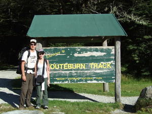
 Routeburn Trek
The beginning....Our first hostel in Auckland was aptly described by Megan as a "hellhole". Our double room was located in the basement at the end of a dark, long and narrow hallway. It was all tiled and our window got about two centimeters of light despite the fact that it was as bright as could be outside. The finishing touch was a few rows of barbwire outside the windows to keep the undesirables away.
After getting accustomed to our lodging, we spent a wonderful two days walking around Auckland. We found an oasis nearby our hostal in the heart of that city that was Albert Park. We spent our evenings there relaxing, and planning our next day's activities. We also took a trip to the Auckland museum and spent some time taking in the atmostphere along Queen Street.
For some reason, I didn't know that Auckland is built around volcanoes. It is quite a hilly city and we spent quite a bit huffing and puffing up and down the hills.
After three nights, we travelled south to Queenstown, otherwise known as the Adventure Capital of the World. It is the southern hemisphere's premier skiing destination in the winter time.

 Volcano
Auckland will perish... it's just a matter of timeThe village had a similar upscale atmosphere to Whistler. You can do any adrenaline sport that you can imagine and it is home to the world's first commercial bungy bridge (A.J. Hackett). New Zealanders are also the inventors of the jetboat. We went white water rafting one day and had a blast. Some of the rapids were rated 3+. I only wish there were more rapids and less calm water.
The weather on the southern island is temperamental at best. It changes at the drop of a dime and it has been surprisingly cool and cloudy, due to the nearby mountain ranges. The west coast gets over 7500mm of rain per year. Having possibly not done enough research, we came ready to do the three day, two night, 33km Routeburn hike without proper hikers, only a rain shell, and one pair of long pants and a sweatshirt each.
Luckily for us, we hit the weather just right and saw three solid days of sunshine. The trek was much more difficult than we anticipated as it was only rated as moderate. Apparently, the kiwis idea of fitness and North America's are quite different. The scenery was stunning, as it

 Oasis in Auckland
A beautiful park in the heart of the city. Our escape from the hellholeshould since it reminded me quite a bit of British Columbia. The second day was truly the toughest with 8 solid hours of climbing and than the descending was equally as tough. I have a feeling that Megan never wishes to repeat day 2 of the hike ever again. We made it though.
After the trek, we were dropped off in Te Anau, where we booked a tour to Milford Sound (an inlet carved out by glaciers). It was cloudy and windy as was to be expected. It was still impressive and a must see sight despite it being a tad pricey.
Advertisement
Tot: 0.035s; Tpl: 0.01s; cc: 9; qc: 23; dbt: 0.0164s; 1; m:domysql w:travelblog (10.17.0.13); sld: 1;
; mem: 1mb

 Routeburn Trek
 Volcano
 Oasis in Auckland


Zammit
non-member comment
The first to make an entry!!
Hey there.. you dont know me John but i'm Meg's mate - Hi Megan. Love the updates.. keep em coming. Its the only way i can tame the travel bug in me! Am soooo jealous. By the way - megan - Nice photo haha u look like a little kid :-) Chow