Advertisement
Published: January 7th 2008

 1
1
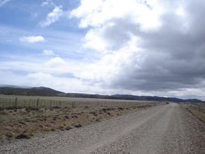
Just across the border crossing from Coyhaique Alto in Chile, heading east to Rio Mayo. This is the main "highway".We had originally planned to drive from Bariloche to El Calafate via the Carretera Austral and Ruta 40 but everywhere we went, when we told people of our plans, everyone looked at us like we were crazy. The rental car people. The border control people. The hosteria people. Finally, we decided to follow everyone's advice and travel from Coyhaique to El Calafate via Rio Mayo and Sarmiento, and along the coastal road Ruta 3 through Comodoro Rivadavia, Caleta Olivia, Tres Cerros, Puerto San Julian, and Rio Gallegos.
When I was originally planning this trip, it seems I was unaware of some pretty important info. Like how super-HUGE Argentina really is. And how all the maps I saw in the guidebooks and that I bought in the U.S. seemed to make it seem that all the roads were really nice when they were, in fact, little more than dirt trails that stretched for hundreds of kilometers through completely empty country. No houses, no phones, no gas stations, no people. No nothing except for a few sheep and the odd guanaco here and there. I was also to find out, after buying a map that was actually produced in Argentina, that there

 2
2
Patagonia: The Big Emptyis only ONE paved road in southern Argentina that runs north to south and only a couple of paved roads that run east to west. I had had no idea...
So, we ended up driving hundreds of kilometers out of the way but actually ended up saving loads of time. The only unanswered question I was left with was that with all that wide open empty space, straight highways and sparse traffic, why was it that I only came upon a slow-moving truck that I wanted to pass only when there was a curve, a hill, and traffic coming from the other direction?
Advertisement
Tot: 0.136s; Tpl: 0.01s; cc: 13; qc: 63; dbt: 0.0621s; 1; m:domysql w:travelblog (10.17.0.13); sld: 1;
; mem: 1.1mb

 1
1
 2
2


