Advertisement
Published: March 22nd 2015

 Camping at Cockle Creek
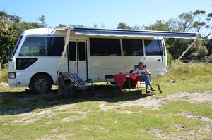
Coaster (with awning extended) and Georgi relaxing reading at Cockle CreekThe most southern location in Tasmania (where you can drive) is Cockle Creek. It's a very pretty location that was visited by the French explorer Bruni D'Entrecasteaux in the 1790's. Since then, whaling and timber have been industries that have developed and declined. Nowadays, Cockle Creek is best known as the end point of the South Coast Track, a long coastal walk of approx 80 km that commences at Melaleuca.
We planned to walk to South Cape Bay (which is approx 16 km round trip) to test our abilities to walk longer distances when we travelled up north. We chose to walk on Saturday which was forecast to be 35 degrees C to see how we would cope.
It's an interesting walk, taking you along Cockle Creek and then up into lightly forested bush before coming out on to the "savannah". These marshlands can become very swampy when it rains (regularly but not today) and so there is quite a lot of duck-boarding. Closer to the beach you walk through forested sand dunes (with shade) and then on to the cliffs that overlook South Cape. It's a bit of a climb down to the beach and to the rock

 Lenny at end of road sign Cockle Creek
Lenny at end of road sign Cockle Creekpools (using a staircase).
We ran out of water as we crossed the middle "desert" and were very pleased to get back to Cockle Creek. We had started to slow just a little towards the end of the walk and a group of young guys (all carrying large packs and surfboards) caught and passed us. They were very keen to walk all that way for a surf, but it is a spectacular place and well worth a visit.
After a steak and an early night, we recovered sufficiently to walk to Fisher's Point the next day. This is a relatively easy walk (approximately one hour each way) mostly along the beach but also through an enchanted forest to the remains of the pilot station and the navigation light at the point. It's an insight into how things were for the early settlers. Fishers Point was established in 1836, but after whaling died down, so did Fishers Point. The only brick building, the original pilot station, became a pub in its later days before it was abandoned to the bush.
At the height of its existence, Cockle Creek was a small town with over 2,000 people. Little remains

 South Cape Bay track
Georgi on South Cape Bay tracktoday but there's a lot to like about Cockle Creek.
Advertisement
Tot: 0.114s; Tpl: 0.013s; cc: 14; qc: 69; dbt: 0.0684s; 1; m:domysql w:travelblog (10.17.0.13); sld: 1;
; mem: 1.1mb

 Camping at Cockle Creek
 Lenny at end of road sign Cockle Creek
 South Cape Bay track