Advertisement
Published: October 25th 2018

 Drive Inn Movie
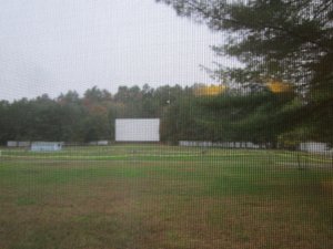
The screen for the drive inn as seen through the picture window in our motel room. Poor quality since it was taken through the window screen.We spent Friday and Saturday nights in a pretty unique motel in Fairlee, VT, called the Fairlee Motel and Drive-In Movie. It is an old roadside motel with only 12 rooms, but they had been refurbished and were clean and very nicely furnished. The drive-in movie screen is right behind the motel and, when movies are shown, the guests can sit in their room and watch the movie through the picture window overlooking the parking area and the movie screen. Unfortunately for us, movies are not shown after the area schools start, so we didn’t get to see one while there. True to form, it rained pretty much all of Saturday morning when we had planned to hike to Smart’s Mt. near the Dartmouth Skiway outside of Lyme, New Hampshire. Instead, we unfurled umbrellas and hiked from the same trailhead in the southbound direction for a couple of miles to the Skiway before returning to the car. A couple we met at the trailhead had told us of another hike a bit further on the southbound AT to an area called Holt’s Ledges that they recommended. We drove back down to the Skiway area where we parked and ate a bite

 Southbound
Mileage marker on the AT in New Hampshire looking south. 1,730 miles to Springer Mt, GA.of lunch while we waited to see if the weather would clear up enough for anther hike. After lunch, the weather app on the phone looked pretty clear so we hit the trail to Holt’s Ledges. This was a 4.2 mile RT hike on the AT with a significant elevation gain of around 1,100 feet that led to a steep cliff with really nice views to the east. The trail passes a shelter called the Trapper John Shelter which is named for the MASH character who supposedly graduated from Dartmouth. The cliff edge is fenced off, not only to keep hikers from getting too close but also to protect the peregrine falcons who nest on the cliff. Just beyond the cliff edge a path leads to the top of one of the Dartmouth ski areas with more easterly views. After returning to the car, we headed back to the motel.
Sunday, our travel day for going to the area for our planned hike in Vermont, the weather was clear, cool, and sunny, nice weather for a hike. Since East Dorset, VT, our next stop on this trip, was only a couple of hours away we decided to

 Northbound
Only 412 miles to the north is Mt Katahdin in Mainedo the Smarts Mt hike before driving on. This was an 8 mile RT hike with an elevation gain of around 2,500 feet. We hiked up the AT along a ridge called Lambert Ridge to the summit which had a fire tower where the 360 degree views were spectacular. We returned via an older trail used in the past by rangers to access the fire tower. Both trails were very steep and rocky in places as are so many of the AT trails in New England. After returning to the car, we drove on to the Aerie Inn in East Dorset, VT.
Advertisement
Tot: 0.162s; Tpl: 0.017s; cc: 12; qc: 51; dbt: 0.1048s; 1; m:domysql w:travelblog (10.17.0.13); sld: 1;
; mem: 1.1mb

 Drive Inn Movie
 Southbound
 Northbound


