Auburn SRA & Bridges of the American River Canyon


Advertisement
United States' flag
North America » United States » California » Auburn
July 5th 2005
Published: July 6th 2005
Edit Blog Post

American River ConfluenceAmerican River ConfluenceAmerican River Confluence

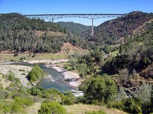
Where the North and Middle forks of the American River meet at the Auburn SRA, Foresthill Bridge in the background.
Just minutes from our home in Cool, in the heart of the gold country, the Auburn State Recreation Area (Auburn SRA) covers over 35,000 acres along 40-miles of the North and Middle Forks of the American River. Once teeming with thousands of gold miners, the area is now a natural area offering a wide variety of recreation opportunities to over 500,000 visitors a year.

Major recreational uses include hiking, swimming, boating, fishing, camping, mountain biking, gold panning, equestrian riding trails and off-highway motorcycle riding. Whitewater recreation is also very popular on both forks of the river.

Auburn SRA is made up of the lands set aside for the Auburn Dam. California State Parks administers the area under a contract with the US Bureau of Reclamation.


Additional photos below
Photos: 13, Displayed: 13


Advertisement

Foresthill BridgeForesthill Bridge
Foresthill Bridge

California's Highest at 730 feet to the riverbed below.
Foresthill Bridge, top viewForesthill Bridge, top view
Foresthill Bridge, top view

Looking East towards Foresthill.
The Mountain Quarry Cement BridgeThe Mountain Quarry Cement Bridge
The Mountain Quarry Cement Bridge

Just downstream from the Foresthill Bridge. The Mountain Quarry Cement Bridge, later known as "No Hands Bridge," was completed on March 23, 1912
No Hands BridgeNo Hands Bridge
No Hands Bridge

Today, primarily used by horsemen, runners and hikers. The name "no hands" came from veteran rider, Ina Robinson, who would drop her reins to ride across the then guardrail-less bridge.
No Hands Bridge, another viewNo Hands Bridge, another view
No Hands Bridge, another view

View taken from atop the Foresthill Bridge.
CALSTAR Med EvacCALSTAR Med Evac
CALSTAR Med Evac

In action, during an actual rescue medical evacuation. The American River Canyon is rugged and steep, the river waters are cold and the current strong. Many times injury and even death can result to those who are careless.
Foresthill BridgeForesthill Bridge
Foresthill Bridge

Spanning the North Fork of the American River.
Salmon Falls BridgeSalmon Falls Bridge
Salmon Falls Bridge

Steel Truss Type, South Fork of the American River.
Salmon Falls BridgeSalmon Falls Bridge
Salmon Falls Bridge

Salmon Falls Road at Skunk Hollow.


Tot: 0.061s; Tpl: 0.012s; cc: 14; qc: 29; dbt: 0.0244s; 1; m:domysql w:travelblog (10.17.0.13); sld: 1; ; mem: 1mb