Advertisement
Published: April 12th 2011
The Izta ascent - you could also say "Orizaba - the second” to it. And that is because it just took us the same time or start-ups for the final peak ascent as at volcano Orizaba.
Friday, 26th March
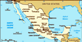
After a seven (!) hour drive for a maximum of 100 kilometers we arrived at the starting point "La Joyita" (4,000 m) in the National Park Izta-Popa. It needed seven hours because we wanted to avoid toll highways, and we had to handle lots of questioning and small detours on rural roads. The last 20 - 25 miles from San Nicolas de los Ranchos were then unpaved – the road was covered with volcanic dust, bumps and potholes often occurred.
At the same day we hiked for an altitude of about 300 meters and had a fantastic night view of the Popo, the Popocatepetl, who greeted us with a high sulfur vapor cloud. The active volcano Popo may not be climbed. Scientists with protective clothing have access to measurements.
We stayed overnight at parking area “La Joyita” (about 4000 m high). Next day we had to do akklimation work and hiked therefore tot Esperanza (4,800 m altitude). From there
you have a look at the refuge and the steep climb up to the knee of Izta (Las Rodillos). It was Saturday and many had the same idea to do the hike. Some of them used the day to go up to Refugio (more a large bivouac box) and to do the more strenuous part of the climb on the following day. Back at the parking lot we had a cordial meeting with Vicente, hg guide for mexico, which we had already met on Orizaba. How nice it would be if we met him the next day for our ascent! But it should not happen.
Sunday 28 March.
We got up around 2:30 clock in the night. After a short coffee and finishing preparations, we start at 3:30 on the first ascent of Izta. The mood was already a little bit down in the morning and after the first 400 m of altitude Hans asked me whether we should go on at all. I had some aspiration problems but went on at first. Then after another 50 meters we decided to go back. We were too tired to have an enjoying climb up. Instead we took advantage of
the day and visited Miguel in the accommodation of the national park near the television station. Miguel is a volunteer for the National Park and manages the accommodation (25 pesos per night, only toilets, no water supply). The distance to the parking lot of La Joyita is about 2.5 kilometers but Miguel is ahle to give you a lift there.d. He shows us his photos and panoramas of Izta and Popo.
We meet Vicente again coming back late at 18:30 after 16 exhausting hours guiding his five hikers. A final goodbye hug - maybe we will see us in Germany again!
Now we are alone again in the parking lot - too bad. We intend to start the next climb attempt the following day a little later to enjoy the mountains in full morning light.
Monday, 29th March
It's 5:00 clock in the morning and we’re not sure whether to go or not. Hans regrets “that it has not snowed over night” So we decide to have a start and just take a pleasure trip! is the motto. We leave at 5:30. At six o’ clock we can switch off our headlights and it's much more fun to
see where to go. We notice that we’re not bad in time and that gives hope. After two hours we reached the saddle above the refugio and saw four hikers on top of Las Rodillas! That motivates! Without long breaks we went on to climb the steep rock wall. “Always look for the iron cross in the wall”, we were told yesterday. After the cross, we found the way now marked with yellow dots quite well through the rock maze. At this altitude 4800-5000 meters, we were slow - it was too steep uphill. Given time was 2 hours from Refugio - we were half an hour faster.
Then we had to follow mountain ridges to the first pre-peak and we had a first glance of La Pencha - the main summit. Walking was a little bit easier now, the trail went only slightly uphill. No comparison to Orizaba, where we had a tough time to reach the peak. After we had the second pre-peak behind us, we looked down at the snow and ice field of the glacier. Snow and ice triangles stood upright on the glacier. That was very bizarre. The glacier was very much plain. But we
took our crampons to be faster. We left a backpack at the other end of the glacier and went with the lighter field pack. Just before the last level we missed the right way and climbed on all “four feets” more on the left side of the mountain. Then we met the four Mexicans we have seen before and they told us showed us that we have reached the peak (5230 m). We were happy but done!
time for ascent: 5.5 hours
Descent: 4
Advertisement
Tot: 0.072s; Tpl: 0.02s; cc: 11; qc: 31; dbt: 0.0353s; 1; m:domysql w:travelblog (10.17.0.13); sld: 1;
; mem: 1.1mb