Advertisement

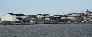
 View from the ferry
White vinyl has replaced much of the old weathered siding. Shortly after leaving St. Barbe we saw Anchor Pointe.We drove north 120 miles to St. Barbe, had a quick lunch and proceeded to the ferry for our 90 minute crossing of the Strait of Belle Isle. It was a cold windy day so while the hardier souls, Harold, the Peters 2 and guide Mark headed to the outside decks, Marilyn and I chose the warm lounge with it's big pictures windows across the entire front of the ferry. I ventured outside when Mark rushed in to announce a whale sighting, and I made it out just in time to experience the thrill of watching the huge tail of a humpback slip into the water.
The ferry actually unloads in Quebec at Blanc Sablon, but after a 10-minute ride east, we entered southern Labrador and began our coastal drive. It was still very cloudy and rainy as we headed north on highway 530. Here the trees appeared more stunted than those we’d seen in NL and plenty of rock outcroppings produced a barren landscape.
Our first stop was L’Anse-Amour Burial Mound, considered the oldest burial mound of its kind in North America. It holds the remains of a
young boy from the time period called Maritime Archaic First Nations about 7,500 years ago. The body was wrapped in a shroud of bark or hide and placed face down in the grave with the head to the west. The construction of a large mound of rocks over the grave completed the burial.
The rain increased as we approached Point Amour Lighthouse, a provincial historic site, Atlantic Canada’s tallest lighthouse at 109 feet and an area famous for whale watching and wildflowers.
Point Amour is one of four lighthouses built in Canada during the 1850s as steamship travel between Europe and the New World increased in popularity. The lighthouse is built of locally quarried limestone with the walls 6-feet thick at the base. Construction was a major 3-year enterprise. Building supplies and equipment had to be landed from schooners at L'Anse au Loup, four miles from the chosen site. Stone quarries were opened nearby and roads had to be built. Because the site had no suitable forest, all the timber had to be shipped from Quebec as well as the shingle, cut stones and brick.
In the beginning the light was fixed, not blinking, and during a
season 200 gallons of whale oil were burned to keep it operating. Although beacons and equipment have changed over the years, the original Fresnel lens is still used. Point Amour is identified by its pattern of 16 seconds of blinking, followed by 4 seconds of darkness. The light was automated in 1995.
On August 08, 1922, the wreck of the 12,000 ton British warship, known as the HMS Raleigh, became the most famous marine disaster in the history of the Strait of Belle Isle. Launched just three years before, this 605 foot, 700 crew vessel was on its way from Port Saunders, Newfoundland, toward Forteau Bay.
In heavy fog, the Raleigh approached its destination, barely missing a massive iceberg that was in its path. While avoiding this collision, the ship went into shallow waters, and the rocks of Forteau Bay ripped a 360 foot gash through the belly of the Raleigh. The speed and size of the ship grounded it near Point Amour Lighthouse, just 200 yards from shore. Eleven lives were lost as a result of this wreck. The remaining officers and crewmen, some 680 plus individuals, spent that night scattered about the buildings of the
Point Amour Light-station.
I walked the path above the water in order to see the wildflowers, even though it was really raining, and Harold made his way down to the beach to watch for whales. Several humpbacks were spotted - a long way off shore, but with binoculars’ the blow, a bit of the back and sometimes the tail were visible. Harold made good use of his new long lens and took many shots.
Finally we all piled into the van and headed south a few miles to L’Anse au Clair and the Northern Lights Inn. As we drove, the clouds parted and the sun came out just as we pulled into the small village, population 241, located on the water.
Advertisement
Tot: 0.097s; Tpl: 0.013s; cc: 11; qc: 50; dbt: 0.0555s; 1; m:domysql w:travelblog (10.17.0.13); sld: 1;
; mem: 1.1mb

 View from the ferry
 Mosses and Lichens


