Advertisement
Published: June 20th 2008
Where In The World Did We Get To??
Contrary to popular belief the Buckley family haven't been whisked away by a band of renegade leprechauns. We arrived safely in Ireland but poor/expensive internet access made blogging difficult...better late than never so they say.
We had a very smooth and quiet crossing on the Stena Line ferry between Stranraer and Belfast, just under 2 hours sailing time. Only just made the check-in time as the road we took down the West Coast of Southern Scotland between Kilmarnock and Stranraer was narrow and winding with no opportunity to overtake.
The ferry was full of young guys (looked like a football team) heading home after a big game over the long weekend or perhaps just a footy trip for the end of season. Anyway, they obviously weren't too hungover or anticipating a rough journey and seasickness as they all lined up at the cafe and tucked into fish and chips with mushy peas and vinegar.
Map of Ireland in hand this time we headed north out of Belfast and spent our first night in Carrickfergus (Carraig Fhearghais) about 15 km away. Carrickfergus Castle (yes, another one) was right next
 Stormont
Parliament Buildings in Belfastdoor to our hotel overlooking the harbour where William of Orange landed on the 14th June 1690 on his way to the Battle of the Boyne. The castle's construction was commenced about 1177 and the outer walls completed in around 1242.
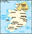
The next day saw us head into Belfast and on a bus tour of the city sights. Tour highlights included Stormont (Parliament Buildings) and Falls and Shankill Roads known for their colourful murals that depict the history of the "Troubles" and the political passions of the moment. We crossed the "Peace Line" a 6m high wall that divided the Protestant and Catholic communities of West Belfast for 30 years.
From Belfast we headed north once again and hugged the Antrim Coast for a very scenic drive. We stopped at the Giant's Causeway the site of spectacular rock formations and a Unesco World heritage site.
Legend has it that the Irish giant, Finn MacCool, built the causeway so that he could cross the sea to fight the Scottish giant Benadonner.
Our second night was spent in Londonderry or Derry as it is also known, we arrived quite late in the evening but we did manage to walk
around the walls that surround the city. They are about 8m high and 9m thick and encircle the old city for about 1.5km.
The next day we continued our journey west into the Republic of Ireland and came upon an ancient stone fort, Grianan of Ailigh, perched high on a hilltop and believed to have been built as a pagan temple around the 5th century BC. St Patrick is said to have baptized a founder of the O'Neill dynasty here in AD 450.
Our route took us through Letterkenny, Dunfanaghy, Cloghaneely and then around the Bloody Foreland, a very scenic area which got it name due to the colour of the rocks at sunset. We seemed to travel for ages this day but in actual fact only covered minimal kilometres, the roads were particularly narrow, winding and rough in places. This night was spent in Killybegs, a small town but a major fishing port in Ireland.
On the road early and off to Slieve League just a few kilometres from Killybegs but again slow going because of the narrow roads and confusing road signage (see photo). The people of north-western Ireland are known for speaking Gaelic and
for having all their roads signs written in it too!! The Bunglass Cliffs were spectacular, their tops covered in mist and their base pounded by the North Atlantic Ocean. We all loved the ruggedness of this place, the sheer cliffs, steep drops and the daredevil sheep who graze close to the edges.
From Slieve League we made our way back through Killybegs and pretty Donegal then headed south on the N15/17 through Ballyshannon, Sligo, Claremorris and Tuam to Galway. Our B&B host in Galway was a chap from Sydney named Peter who had come to Ireland for a holiday and ended up staying for 7 years. Galway is a very pretty place and we would have loved to have stayed longer but sadly one night was all we could spare. It is known for many things, one being the Claddagh ring, traditional wedding rings depicting a heart held by two hands and topped with a crown and representing friendship, love and loyalty. If the heart points toward the hand it means the wearer is "taken" or married, if it points toward the fingertips then the wearer is looking for a partner.
If you ever go across the sea to Ireland
Then maybe at the closing of your day
You will sit and watch the moon rise over Claddagh
And see the sun go down on Galway Bay
Arthur Cohalan 'Galway Bay'
Our journey continued down the
coast of County Clare through an area known as the Burren, a vast limestone plateau on to the Cliffs of Moher. We had fantastic weather to see the cliffs and were able to see the Aran Islands in the distance. I must admit that we did venture beyond the warning sign (see photo) as many people did to appreciate the cliffs from a different perspective. The narrow path followed the cliff edge in front of a fenced field, we have since been told that a number of people have lost their lives here, deliberately or otherwise.
The town of Tralee was our next stop-over on the way to the Dingle Peninsula. We drove up over the Conner Pass, the highest in Ireland at 456m. We held our breath on the way to the summit as the road becomes single lane only and heaven help you if you meet a vehicle coming the other way as there is a wall of rock on the left and a steep drop on the right. The town of Dingle is quintessentially Irish with brightly coloured houses and pubs and fishing boats moored in the harbour. We drove around the peninsula taking in the
Giant's Causeway
Hexagonal patterns formed millions of years ago as lava cooled and hardened. scenery which just got better and better with each bend in the road. The boys became a little tired of stopping every 5 mins for photos. The weather was perfect, the sky clear and temperature warm. Small white cottages surrounded by miles of dry-stone walls dotted the landscape and the Blasket islands could be seen off the coast.
Cahersiveen was our next place of rest, chosen because it was close to the departure point for the boats to the Skellig Islands. We woke the morning of our trip to thick fog and we thought our much anticipated trip would be cancelled. A call to our boat's captain Eoin Walsh, assured us that the weather would clear and we would get to see the islands after all. Our small boat took about 1 1/2 hrs to reach Small Skellig Island, the second largest gannet rookery in the world (the largest is in Scotland) with 20,000 breeding pairs. We circled the island and were amazed at the sight of thousands upon thousands of birds nesting and flying overhead. We noticed a bright green colour on the rocks and were told that this is discarded fishing net and other debris that the
birds build their nests with.
Tourism on Skellig Michael, the larger of the two islands, is strictly monitored and only a few boat operators are allowed to take tourists and then only a maximum of 12 passengers in each vessel. I must say that this was a highlight of the trip, the island itself is isolated and rugged, situated in the unforgiving Atlantic ocean and the thought that monks built a monastery and inhabited the island from as early as the 6th century is mind boggling. The monks survived several Viking invasions between 795 and 839 A.D. only to leave the island in the 12th or 13th century possibly due to increasingly bad weather, I think I might have hitched a lift with Olaf!!
There are several routes to the top of Skellig Michael and the monastery, all of them involving 600-700 steep stone steps. The day, as promised, cleared and we were blessed with blue skies to enjoy the scenery. As our boat was one of the last to arrive on the island, it was also the last to leave, so as we ate lunch on top of the island (714 feet), it was just us and
Antrim Coast
Castle Ruins a few curious birds .....magic.
From the Ring of Kerry we drove through Killarney to Cork and Blarney where we stayed at the best B&B of the trip. Our room had a view of Blarney Castle and of course we all now have the gift of eloquence as granted by kissing the Blarney Stone. The Castle and gardens are beautiful and we spent a couple of pleasant hours wandering around. We paid a visit to Cobh or Cove formerly Queenstown, it is about 25kms outside of Cork and is where thousands of Irish emigrants (the Buckley ancestors included) left for Australia, the United States and Canada among other destinations. It is was also the last port of call for the ill-fated Titanic.
After 2 nights in Blarney we headed north to Dublin via Cashel. This trip took the best part of the day as we were held up in traffic several times, the most memorable was 1 1/2 hours on the ring road around Dublin a trip of just a few kilometers.
Our trip around Ireland had sadly come to an end and we were about to fly out to New York. Ireland was more rugged and
Grianan of Ailigh
Ancient stone fort, walls 4m thick and 23m in diameter. mountainous than I had imagined but still green and steeped in history and tradition that I am pleased to say the Irish have no intention of surrendering.
The Buckleys
P.S. Make sure that you click on the "next" icon as there are loads of photos attached.
Advertisement
Tot: 0.069s; Tpl: 0.014s; cc: 6; qc: 46; dbt: 0.0285s; 1; m:domysql w:travelblog (10.17.0.13); sld: 1;
; mem: 1.2mb