Advertisement
Published: August 28th 2019
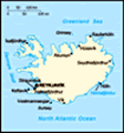
We're moving around the island in a counterclockwise direction, so we are at the south part of the island. The storms hit from the south and the wind picks up alot of moisture. As the air rises over the mountains it drop the precipitation as snow which is why the largest glaciers are on the south side of the island. Then volcanoes erupt and push through the glaciers which causes massive floods. We drove by massive lava fields; some had moss all over them and some looked like they happened yesterday. We also went by areas that massive glacier floods had brought tons of debris, boulders, and ice. The shoreline was actually pushed out by debris from glacier outflow.
From GuidetoIceland website:
"The vast Eldhraun lava field (“Fire Lava“), in the south of the Icelandic highlands, was created in one of the greatest eruptions in recorded history and is of the largest of its kind in the world. The Lakagigar craters were also created during this eruption. This eruption lasted from 1783 to 1784 and is known as the Skaftáreldar (The Skaftá River Fires). This was a cataclysmic event for Iceland and beyond. In Iceland, it lead to disease,
crop failure and disasters.
The eruption affected Europe as well. In Great Britain, that summer is known as the Sand-Summer in Great Britain due to the fallout of ash and it is believed that the airborne haze and blocking of sunlight may have contributed to the French Revolution.
Despite the abysmal effect the eruption had, this lava field of 565 km2 is today one of the most stunningly attractive ones in Iceland.
The area features one of the most magnificent lava tube systems in the country, located north of the Lake Laufbalavatn. More than 200 caves have been found there, extending for more than five kilometers and 14 cu. meters."
We went to Skaftafell National Park. From Wikipedia:
Skaftafell National Park
Skaftafell National Park was a national park, situated between
Kirkjubæjarklaustur, typically referred to as Klaustur, and
Höfn in the south of
Iceland. On 7 June 2008, it became a part of the larger
Vatnajökull National Park.
It was founded on September 15, 1967, and enlarged twice afterwards. Before its inclusion into Vatnajökull National Park, it measured about 4807 km
2 (2884 mi
2), making it Iceland's second largest national park. It contains the valley
Morsárdalur,
the mountain
Kristínartindar and the glacier
Skaftafellsjökull (a spur of the
Vatnajökull ice cap).
3%!B(MISSING)6kull_national_park_aerial_pano.jpg/400px-1_Skaftafell_Vatnaj%!C(MISSING)3%!B(MISSING)6kull_national_park_aerial_pano.jpg)
Skaftafellsjökull glacier as seen from the sky
The landscape is very similar to some of the Alps, but it has been formed over thousands of years by different influences of fire (volcanic eruptions of
Öræfajökull) and water (the glaciers
Skeiðarájökull and
Skaftafellsjökull), the rivers
Skeiðará,
Morsá und
Skaftafellsá. Volcanic eruptions under the ice-cap can give rise to
jökulhlaups (glacial floods) which swell the Skeiðará river massively. The sandy wasteland between the glacier and the sea caused by
jökulhlaups is called
Skeiðarársandur, and is a typical
outwash plain known locally as a sandur. The last large jökulhlaup occurred in 1996.
We went for a glacier hike on one of the glacier tongues of the Vatnajokull, the largest glacier in Europe.
From Wikipedia:
With an area of 7,900 km²,
Vatnajökull is the largest
ice cap in Europe by volume (about 3,000 km³)
and area (not counting the still larger
Severny Island ice cap of
Novaya Zemlya, Russia, which may be regarded as in the extreme northeast of Europe).
On 7 June 2008, it became a part of the
Vatnajökull National Park.
The average thickness
of the ice is 380 m (1,250 ft),
with a maximum thickness of 950 m (3,120 ft).
Iceland's highest peak,
Hvannadalshnúkur (2,109.6 m (6,921 ft)), is in the southern periphery of Vatnajökull, near
Skaftafell National Park.
3%!B(MISSING)6kull_Glacier.jpg/220px-Vatnaj%!C(MISSING)3%!B(MISSING)6kull_Glacier.jpg)
Vatnajökull Glacier in Iceland.
Volcanoes
Under the ice cap, as under many of the
glaciers of Iceland, there are several
volcanoes.
Eruptions from these volcanoes have led to the development of large pockets of water beneath the ice, which may burst the weakened ice and cause a
jökulhlaup (
glacial lake outburst flood).
During the
last ice age, numerous volcanic eruptions occurred under Vatnajökull, creating many
subglacial eruptions.
In more modern times, the volcanoes continue to erupt beneath the glaciers, resulting in many documented floods. One jökulhlaup in 1934 caused the release of 15 km
3 (3.6 cu mi) of water over the course of several days.
The volcanic lake
Grímsvötn was the source of a large jökulhlaup in 1996.
There was also a considerable but short-lived eruption of the volcano under these lakes at the beginning of November 2004.
On 21 May 2011 a volcanic eruption started in Grímsvötn in Vatnajökull National Park at
around 7 p.m.
The plume reached as up to 17 kilometres (11 mi).
Since it has been raining for 3 days, the crust snow on top of the hard, blue ice has been washed away, which means we were hiking, with crampons, on hard, blue ice. Took getting used to, especially going downhill. It was a great experience. I've never been up close and personal with a glacier like that. Lots of meltwater running off the glacier and moulins.
A
moulin (or
glacier mill) is a roughly circular, vertical (or nearly vertical) well-like shaft within a
glacier or
ice sheet which water enters from the surface. The term is derived from the French word for mill.
They can be up to 10 meters wide and are typically found on ice sheets and flat areas of a glacier in a region of transverse crevasses.
Moulins can reach the bottom of the glacier, hundreds of meters deep, or may only reach the depth of common crevasse formation (about 10–40 m) where the stream flows englacially.
They are the most typical cause for the formation of a
glacier cave.
Moulins are

 Note Rivers coming off the glacier.
This is where alot of the glacier floods occur.parts of the internal structure of glaciers, that carry
meltwater from the surface down to wherever it may go.
Water from a moulin often exits the glacier at base level, sometimes into the sea, and occasionally the lower end of a moulin may be exposed in the face of a glacier or at the edge of a stagnant block of
ice.
Water from moulins may help lubricate the base of the glacier, affecting
glacial motion. Given an appropriate relationship between an ice sheet and the terrain, the head of water in a moulin can provide the power and medium with which a
tunnel valley may be formed. The role of this water in lubricating the base of ice sheets and glaciers is complex and it is implicated in
accelerating the speed of glaciers and thus the rate of
glacial calving.
We lucked out with the weather too. It rained hard before and after our hike to the glacier.
Next we went to the
Jökulsárlón Glacier Lagoon and Diamond Beach. It is called Diamond Beach because the small clear pieces of ice from the glacier on the black sand look like diamonds.
From Wikipedia:
Jökulsárlón (Icelandic pronunciation:
(
 listen
); literally "glacial
river lagoon") is a large
glacial lake in southeast
Iceland, on the edge of
Vatnajökull National Park. Situated at the head of the
Breiðamerkurjökull glacier, it developed into a lake after the glacier started receding from the edge of the
Atlantic Ocean. The lake has grown since then at varying rates because of melting of the glaciers. It is now 1.5 km (0.93 mi) away from the ocean's edge and covers an area of about 18 km
2 (6.9 sq mi). In 2009 it was reported to be the deepest lake in Iceland, at over 248 m (814 ft), as
glacial retreat extended its boundaries.
The size of the lake has increased fourfold since the 1970s.
It is considered as one of the natural wonders of Iceland.
The lake can be seen from
Route 1 between
Höfn and
Skaftafell. It appears as "a ghostly procession of luminous blue icebergs".
Jökulsárlón has been a setting for four
Hollywood movies:
A View to a Kill,
Die Another Day,
Lara Croft: Tomb Raider, and
Batman Begins, as well as the reality TV series
Amazing Race.
In 1991, Iceland issued a postage stamp, with a face value of 26
kronur, depicting Jökulsárlón.<sup id="cite_ref-Jokul_2-1"
class="reference">
The tongue of the Breiðamerkurjökull glacier is a major attraction for tourists.
The Jökulsárlón lake provides outstanding views of the ice cap, a vast dome of ice that rises to a height of 3,000 ft (910 m). It spills to the lagoon 12 mi (19 km) away from the jagged glacier hill to the edge of the water line. The lake developed only about 60 years ago (1948 is mentioned), when the entire area was less than 100 ft (30 m) of glacier, which was only 250 yd (230 m) from the Atlantic Ocean, and 2 mi (3.2 km) away from Vatnajökull. Vatnajökull was at the shore line of the ocean and dropped icebergs into the ocean. However, it started drifting inland rapidly every year, leaving deep gorges en route, which got filled with melted water and large chunks of ice. These icebergs gather at the mouth of the lake's shallow exit, melt down into smaller ice blocks, and roll out into the sea. In summer, icebergs melt and roll down the channel into the sea. The lake does not freeze in winter. Ice water and soil make a unique ecological phenomenon.

 Check out the weather report.
We were lucky, we didn't have much rain during the glacier walk.Jökulsárlón Lake, the "glacier lake", is now reported to have doubled in size in the recent 15-year period. The huge blocks of ice that calve from the edge of Vatnajökull are about 30 m (98 ft) high, which fills the lagoon stocked with icebergs.
Some icebergs appear naturally sculpted on account volcanic ash from ancient eruptions that partly covers them.

An iceberg with Vatnajökull in the background: The icebergs in Jökulsárlón, as well as this iceberg, fell off Vatnajökull.

An isolated iceberg on the beach
Given the current retreat rate of Vatnajökull, likely a deep
fjord will develop where Jökulsárlón is now. This retreat is also posing a threat to the National Highway Route 1 of Iceland. The lagoon is 75 km (47 mi) to the west of
Höfn town and 60 km (37 mi) east of
Skaftafell.
It is accessible by the ring road, Route 1, that goes across the lake, and where parking facilities have been provided for visitors. It is also known as the "tourist conveyor belt".
Isolated large blocks of icebergs can be seen on the black sand beach, sometimes called "diamond
beach" because of ice chunks scattered on the sand.
Advertisement
Tot: 0.108s; Tpl: 0.019s; cc: 13; qc: 23; dbt: 0.0273s; 1; m:domysql w:travelblog (10.17.0.13); sld: 1;
; mem: 1.2mb


3%!B(MISSING)6kull_national_park_aerial_pano.jpg/400px-1_Skaftafell_Vatnaj%!C(MISSING)3%!B(MISSING)6kull_national_park_aerial_pano.jpg)
3%!B(MISSING)6kull_Glacier.jpg/220px-Vatnaj%!C(MISSING)3%!B(MISSING)6kull_Glacier.jpg)


 Maroon


