Advertisement
Published: March 5th 2011

 Nassau with boating buddies
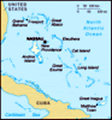
Bob & I just got back from the Straw Market in Nassau as Bob needed a hat to help keep the sun off - standing with our friends at the Nassau marinaSince our last entry we have left the Bahamas capital city of Nassau and are now in the area of the Bahamas called the Exumas. They are as beautiful as everyone said they would be. It is hard to believe there are so many shades of blue and that the beaches can be so white. Everyone told us that you would learn to read the color of the water which is critical as that helps tell you the depth of the water. We still are beginners, but we are starting to get the knack of it - as an example today we were sailing in 10 foot of water and then all of a sudden we came to a very definite line of dark blue that indicated that the water was much deeper. The ditty “water that’s blue is deep and true; as it shades to green, the water gets lean; white or yellow will ground a fellow; if the water is brown, you’ll run hard aground; if the water is black, you’d better tack”. Running aground out here is not like doing it back in the inner coastal waterway, there are no towboat US to come out and pull us
Sunrise in Nassau
A beautiful sunrise the morning we were leaving the Nassau Yacht Haven marina off.
Our first stop after Nassau was Allan Cay – we had to travel over the banks (this is what they call the large, shallow areas of water) but everything went well and we didn't run into that coral head with our name on it(standing joke out here). We were able to do some sailing in this area, but the winds were light so kept the motor on as well in order to get to our destination during daylight. We are learning that it is important to have the sun in the right position in order to better see any coral heads that might be in your path (they appear as dark black circles with a white ring around them). Even though the islands have different vegetation and the color of the water is markedly different, it does remind us of the great anchorages in the 1000 Islands. We enjoy the same peace and quiet and the comfort of sitting on the back of the boat enjoying the view as we did when anchoring out back home. The tides and currents do interesting things to the boat at anchor. If the wind and the tide are opposing each other
The creek we explored
With the water this clear it is hard to determine the depth of the water - it was fun exploring by dinghy the boat points into the wind but the anger trails off behind the boat as a result of being pushed by the current. This situation also creates 2 to 3 foot waves with a very short distance between them resulting in a “rolly” Anchorage, not the best for sleeping. Allan’s Cay definitely has the beautiful white sand beaches and amazing blue water, but it is also known for its rock iguanas. They are only found on 2 islands in the Bahamas and this is one of them. We learned that they can live for 80 years (and some of them look their age!) The next day we set sail for Highbourne Cay with southeast winds of 14-20 knots. For those of you who are sailors we had a reef in the main and a reef in the Genoa. The waves were 5 to 7 feet with occasional larger swells with a 5 to 6 second interval. It was a short run, but a pleasant sail. We did get to baptist our cushions with sea water, as one of the hatches was slightly open when a wave went over the bow – another lesson learned. We thought we had checked them
Mangrove roots
For those that have never seen mangroves this is the extensive root system they have all (another thing to add to the pre-departure checklist). This island is private, but it does have a marina and a small store that are open to the public. We checked it out and were very glad that we provisioned well in the US. Shopping here would have a major impact on the budget as a loaf of bread (which was frozen) was $7 and a package of crystal light ice tea mix was close to $10. We are still traveling with the same 2 boats that we crossed with and have met up with another caliber 40 like ours (Jeff on KoOlina) so had a cocktail hour on the beach which was lots of fun. A few other boats joined in as well as knew some of them from our stay in Stuart FL. You really find out how much dampness is in the air when you set out crackers and a couple of hours later they are stale.
The next island we visited was Shroud Cay which is In the Exuma Sea and Land Park. It was nice to have moorings that we could connect to for only $15. Luckily we got here early enough in the
Watching the clouds
Weather is all important to us now - we watch the clouds more closely - they are still spectacular day that we got a chance to explore both by dinghy and by land. We took the family car for a drive down one of the creeks that actually goes through the island to the other side. The water is so clear that it was hard to determine the depths – at times it looked like it was only inches, but when Bob tried he couldn’t touch bottom with his foot over the side of the dinghy. The center of the island is filled with mangrove shallows. This is a critical part of the ecosystem because it provides the nursery for most of the fish in the Bahamas. It also is important habitat for a large number of seabirds.
Two days ago (March 2nd) we set sail for Warderick Wells Cay where the park headquarters are located. They have numerous hiking trails and 3 mooring fields. The mooring fields are great for a number of reasons – they provide a secure place to tie up but more importantly they prevent people from dropping anchors and damaging coral. The weather predicted was for light and variable winds out of the west and instead we got winds running from 13
Beach cocktail hour
This is a great venue for a get together! Best thing is no one needs to clean up in preparation and we have a great view – 18 knots from the ESE. As we sometimes say, forecast are more like guesses, therefore you need to be prepared for anything when you go out for a sail. We had a great four hour sail today – even had spray over the bow and even into the cockpit when we were heeling at 20 degrees. Just wish we could capture these on film, but we were busy handling the boat instead.
The Exuma Land and Sea Park is one of 26 national parks protected by the Bahamas National Trust. It is made up of 15 major cays (islands) and numerous smaller ones encompassing 176 square miles. In 1953 the superintendent of the Florida Everglades National Park urged explorers and researchers of the importance of setting aside a section of the cays as a buffer area. He received a favorable response from the Governor and Colonial Secretary in the Bahamas. In 1956 a letter from the Governor of the Bahamas confirmed that the crown would set aside 22 miles for one year providing that during that time an organization would be set up to make recommendations and be responsible for financial support of the area. The New York
The beach cocktail hour
The end of the cocktail hour at Highbourne Cay -- the sunset marks the end of the get together on the beach Aquarium was also involved in doing research here and did a survey regarding the setting up of the park. The result was the establishment of the Bahamas National Trust, setting of boundaries of the park, regulations and the need for a park ranger. As a result the park was officially begun in 1959. It is great to hear of such foresight and cooperation among the numerous parties involved to be able to accomplish this feat and preserve this area for all future generations. In walking through the park it is obvious that they continue to emphasis education of the public regarding the impact of humans on our natural world as well as details specific to this area. An example of this is learning about the fact that even though it rains very little here most plants are not able to use salt water. As the island is made up of coral and very porous limestone when it rains the water passes down through the surface of the island and lays on top of the salt water. This creates what they call a fresh water lens. It is this water that plants on the island access to survive in what would
Bob starting up the trail
We took a short hike while on Shourd Cay - this shows the makeup of the island is coral otherwise be an inhospitable environment.
Yesterday we started our exploration of the park by taking a dinghy ride over to the Park Headquarters and then a hike up to BooBoo Hill and the blow hole area over on the Exuma Sound side of the island. This took us up where we could get a great view of the 2 anchorages (North mooring field and Emerald Rock) as well as the wild Exuma Sound. The wind was heavy and we could feel the spray even though we were on the trail 70 feet above the water’s edge. Late in the afternoon we met on the beach with our boating buddies for a social hour, but it ended quickly when the sun went down as the air was cool from the wind. We even had to put on long sleeve tops to keep warm (I know we are not going to get any sympathy from those that live in the north right now!)
Janice is getting to the point that she can receive the weather reports on a regular basis from the SSB which is great. It is a good thing that she is in charge of getting them as
The well
Bob getting a bucket of fresh water from the well on Shroud Cay they come on at 6:30AM and she is the early riser in the family. We are happy that we seem to be receiving transmissions now but still having a problem with transmitting. We (this means Bob) will have to work on seeing what can be done to fix this. A suggestion that was given was to change the ground that we have on the tuner – he is not looking forward to this as it means crawling back into the lazarette into a very small space where it is hard to see or move around. We hope that this will fix the problem as not sure of what else to try. Will keep you posted as we need to have this working in order to receive email via our radio. We really want this functional before we get too much farther south as it is already spotty for getting good wi-fi connections. We will not be able to send or receive any photos but will be able to receive text messages once that is up and running.
Today, March 4th we are to get some high winds so are glad that we are safely on a mooring. It appears
Rock iquanas
Rock iquanas only live on 2 islands in the Bahamas and Allan Cay is one of them. that the predictions are that Sunday will be better so are planning to move further south to Staniel Cay. We are looking forward to that as it will be the first town we will have a chance to explore. Will definitely keep you posted as often as possible. We may not be able to put photos up each time due to the bandwidth available to us but will post those when we can. Best wishes to everyone from Warderick Wells in the Bahamas!
Advertisement
Tot: 0.197s; Tpl: 0.014s; cc: 7; qc: 24; dbt: 0.1758s; 1; m:domysql w:travelblog (10.17.0.13); sld: 1;
; mem: 1.1mb