Advertisement

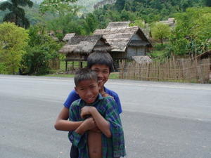
 village kids
south of Luang Namtha, Lao My last day in Lao was quite grueling. The road from Luang Namtha to Houey Xai is now mostly paved with numerous sections still actively under construction. It is a windy, hilly route that passes through primarily brush and small villages.
It got progressively hotter as I gradually descended south out of the mountains of Lao back to the Mekong River that serves as the Lao/Thailand border at Houey Xai/Chiang Khong.
It was a bit of a trip trying to figure out how to get out of Lao once I got to Houey Xai. Immigration is located at the passenger ferry ramp. The guys at immigration were happy to stamp my passport out, but then seemed to have no idea where I needed to go for customs and the car ferry.
Eventually, I found both, got charged an outrageous fee for the ferry and crossed the Mekong over to Thailand.
Much to my surprise, I did not have to pay any fees at either borders. Honest folks working at a border crossing? Amazing!
It only took me the first block to remember to get back over to the left side of the road. Ooops!
Even the sleepy border town of Chiang Khong seemed busy compared to nothern Lao. Motorbikes and trucks whizzing by, bright advertising everywhere, signs in English, women in jeans and shorts...very modern! I had a burrito for dinner.
The next day I made the climb up to the top of Phu Chi Fa. It is a hill on the northeast corner of Thailand that overlooks Lao. It was a fun, well-signed ride up some crazy-steep hills and then a short climb by foot to the top.
Unfortunately, it was cloudy when I got to the top, but what a 360 degree view! Access to the viewpoint was free of charge, nor did I need to hire a guide (hee hee)! And I also had the place to myself.
I descended from Phu Chi Fa and enjoyed the rest of the ride to Chiang Rai.
Chiang Rai struck me as a mini version of Chiang Mai or Nan. Not a whole lot to do in town, but a closer place to access trekking and the hilltribe visits that are so popular with tourists in this area.
I contented myself with wandering around and eating buckets of mangoes
and sticky rice with coconut cream. Ummm, welcome back to Thailand!
My last day on the motorbike was the pretty but uneventful ride from Chiang Rai to Chiang Mai. It was cloudy and some of the National Parks were starting to look suspiciously like parts of southern Vancouver Island along the Malahat Highway.
At around the same time it was occurring to me that I had just ridden about 7200 km only to arrive back in the same place I started. Kind of a metaphor for life, non?
It was good to hit Chiang Mai and be back in a familiar place. I was also most fortunate that buckets of rain began to pour that night and barely let up for the next 4 days. I could have been riding in that!
I have spent the last few days getting reiki level 1 certified, doing yoga, shopping, eating and enjoying the community that Chiang Mai has to offer.
I will be home in a couple of days and getting ready to ride a bicycle to San Francisco.
Advertisement
Tot: 0.085s; Tpl: 0.014s; cc: 11; qc: 28; dbt: 0.0343s; 1; m:domysql w:travelblog (10.17.0.13); sld: 1;
; mem: 1.1mb

 village kids
 brand new section of highway
 valley view from brand new section of highway


