Advertisement
Published: August 25th 2014
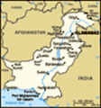
A Trek to the Heart of Hindu Kush TIRICH MIR, FULLY VISIBLE FROM CHITRAL TOWN, is the highest mountain of Hindu Kush Range, straddling the border with Afghanistan in the Chitral District of Khyber Pakhtunkhwa. It has been allured climbers from across Europe, North & South Americas, and Japan in the past few decades. Although a major mountain outside Himalayas, it's rarely been attempted especially after the onslaught of USSR on the neighbouring country, the subsequent war for almost a decade, and the arrival of NATO forces in Afghanistan after the 9/11 attacks. Norwegians were the first who conducted the reconnaissance of Tirich Mir in 1949, and later climbed it in 1950 led by Professor Arne Naees. Later Czechs, Spanish, Japanese and other nationals of different countries climbed the mountain. The main summit soars to 7,708 metres, and the Eastern Summit rises to 7,690 metres above sea-level. The Eastern Summit was also first climbed by the Norwegians in 1964.
Chitral, where the mountain stands high, and overlooking the whole valley, is very peaceful unlike other parts of the country. A jeep drive of about six hours on a rough track from Chitral Bazaar, takes one
into the most beautiful valleys of Chitral, Tirich Valley. Here, in that splendid valley, the mountain stands as a sentinel to the extreme left, throwing down the gauntlet to those who have guts.
There are two base camps of Tirich Mir – the traditional base camp via Tirich Valley – and Shokorshal base camp via Barum side in Lot Owir Valley, used by the Norwegians in the 1950. If one undertakes the Barum/Shahbronz route, it will take a day to reach the base camp. From Chitral Bazaar, it will take about four hours to reach Shahbronz, the last village before undertaking the trek. This trek is not demanding, but unlike the Tirich Valley trek, it lacks stunning views of the towering mountains, because it's in a narrow valley towered by lofty mountains which obscure distant views of the mountains of Hindu Kush. I had been thrice to Shokorshal base camp of Tirich Mir via this route. It's a gentle ascent of about eight hours, beginning immediately in the village of Shabronz, and ends at Shokorshal base camp of Tirich Mir at the snout of North Barum Glacier which is receding at a much faster rate.
A large number of trekkers and mountaineers use Tirich Valley to get to the base camps of the mountains of Hindu Kush. It will take six hours to reach the village of Shagrom in Tirich Valley by jeep from Chitral Bazaar. Here fascinating treks begin for most of the stunning mountains of Hindu Kush. The trek up to Babu Camp, is like the Baltoro Glacier Trek (K2 base camp trek), and offers awesome views of the towering mountains of Hindu Kush straddling all along the rough track. It takes three days to trek up to Babu Camp from Shagrom. Babu Camp is a place from where one can go for any mountain's base camp in Hindu Kush. One can dare out to go for the base camps of Tirich Mir, Noshaq, Dir Gol Zom, Gul Lasht Zom, Asp-e-Safed and Anogol Zom. These are all very lofty mountains dominating the horizon.
This trek demands physical fitness, stamina, past experience, and the will to go for something big. For this trek, one will have to be 100 percent physically fit otherwise one may face troubles beyond one's control. We undertook this trek last year, and as
per our experience, it's rough, arduous and very tiresome.
We, a group of five, planned to adventure into the Upper Tirich Valley, offering one of the most fascinating treks in the Hindu Kush – Tirich Mir base camp trek, coupled with Istor-o-Nal and possibly Noshaq base camps trek. Taking on that arduous trek, was the brainchild of Assistant Commissioner Chitral – Saad Qaisrani – a slimly-built, outdoor audacious thrill-seeker – backed by Amjad Farid, a skillful hunter and a brilliant organiser, and, Rashidul Ghafoor – a valorous trekker having powerful muscular physique.
And about me: a restless soul, crazily love big mountains, and infatuated with trekking and backpacking. And the adventure began for me on a clear, star-spangled twenty-plus August night. Updating status and uploading photos on and to Facebook, a short message appeared on my computer screen. Amjad Farid, a skillful hunter and trekker, residing in Chitral, was asking me to join a trekking expedition they had planned and orgainsed. That night as I walked out, gazing at the starry sky, I was in my thoughts three hundred kilometres away, trying to imagine the wild Hindu Kush valley in Chitral that would soon
be "home".
Travelling from Dir, I arrived at Chitral Town late in the afternoon. While waiting for Amjad, I hanged around the bazaar, and afterwards, Amjad appeared from nowhere. Naeem drove off the vehicle to Governor Cottage where Saad greeted us. Here, loading our gears onto 4WD vehicle, and before heading out onto the main road, Naeem zigzagged down to the main bazaar. Setting out late in the searing afternoon heat from Chitral Bzaar, we'd thought of making it to the heart of Hindu Kush, exploring the stunning landscape, and of course, hunting game birds.
Setting off for Tirich Valley Filling our vehicle's tank at Danin, since a petrol station is usually quite a drawn-out affair beyond Boni, we resumed our journey on Boni-Mastuj Road, and after a drive of almost two hours, arrived across the beautiful town of Boni, dominated by the daunting Boni Zom, a six-thousander. Here we came across some officials (probably Akram Sahib & co), coming from the opposite direction. Here at the turning just east of Khandan, the jeep track climbs steeply up to a shoulder of the mountain separating the Turkho and Mastuj rivers.
On top is a small plateau with pastures known as Kagh Lasht. Climbing a small knoll located higher above the plateau, and glancing cursorily at the daunting peaks of Snow Ghar and Boni Zom, we hiked down, and moved up along the rough jeep-track towards Tirich Valley.
Here the tarred road ends, and a rough jeep track starts towards the valleys of Mulkho, Turkho, Rich and Tirich. After Kagh Lasht, kilometre after kilometre, hour after hour was filled with cliffs, dust, hairpin curves, rutted road – and the rushing Tirich River crashing through the wild gorge on our left. The Turkho Valley is particularly green and fertile, the irrigated patches of settlement blending into each other for most of its length. The lower section of the valley is known as Mulkho, the middle section as the Turkho and the upper section as the Rich Valley. The rough track, carved out of the steep hillside – full of tight bends, rutted, and eroded surface littered with cliffs and rocks. The track descends to the village of Istaru, followed soon after by Warkup. Further there is a bridge across to the village of Nishko on the west bank.
This bridge gives access to the Tirich Gol which drains in from the west, joining the Turkho River higher up, above the village of Raeen. The Tirich Gol is jeepable as far as the village of Shagrom. From Shagrom a trek leads southeast over the Zani Pass and back into the Mulkho/Turkho valleys near Warum, to join the old jeep track along the north bank of the river. Another trek leads west towards Tirich Mir base camp. We moved upstream through some of the most dangerous sections of the track, and followed the main jeep track up the Turkho Valley which continues northeast through Raeen.
While driving up along the river, Amjad, Rashid and Saad were telling their stories of hunting, Naeem was driving up cautiously a rough track, and I was thinking about the upcoming adventure. Now and again I had to read a rough map of the trek I had in my pocket, and if the need be, used to bother Amjad for further information.
Hundred metres down the snow-fed Tirich River gorged hungrily at its rocky sides, while the near vertical strata were a reminder of the unrelenting forces
of the underlying continental plates, pushing the jagged skyline ever upwards. Tirich River was in its alpine stage here, and hence its aggressiveness was worth-seeing. It was using stones and its ferocious power to cut its way through a narrow gorge down towards Mastuj River.
Raeen is a green patch of settlement located down the Turkho Valley whereas its small bazaar is dusty, and it becomes muddy underfoot when it rains. Dusk was falling rapidly and we got to a suspension bridge which gives way in to Tirich Gol, which runs the whole length of the Tirich Valley. We crossed the suspension bridge spanning the muddy, roaring waters of the glacier-fed Tirich River. On the north bank of the river, we stopped for a while to relax our legs after an arduous journey on a bumpy jeep track for about four hours. Amjad entertained us with cold drinks right here. Saad and I wandered off to the middle of the bridge for informal confab. We discussed first ascents in the Karakoram and Himalayas. Saad was telling a gripping account of Hermann Buhl's daring ascent on Nanga Parbat. I impressed by his interesting story of that legendary mountaineer
who successfully scaled 'the Killer Mountain' after many a tragedies battered the German and Austrian climbers.
The landscape here at the start of the valley, however, only begins to grow in scale and splendour. Hills climb to ever greater heights, shaking themselves free of villages, fields and vegetation – and then finally after Attak in Tirich Valley, any remnants of life. Jagged, snow-kissed mountain peaks stretch ever higher. Here and there, a valley river punctuates the monochrome landscape with a ribbon of green, a lifeline in an otherwise impossibly inhospitable environment.
As the dusk thickened up, we resumed our journey towards Tirich – a narrow mountain valley drained by Tirich and Urden Gols. Just as Naeem began driving up a zigzaggedly rough track, a difficult kink in the track, blocked off the vehicle from moving up. At first, Naeem was unable to manoeuvre up the vehicle, but however, he overcame that difficulty after toing and froing the vehicle in a very narrow place, and eventually steered the vehicle upwards. Our bodies were aching all over, particularly mine, as I had been travelling since early morning. Bouncing wildly over ruts and rocks, often following what
looked and felt more like a dry riverbed than jeep track, and causing violent jolts pushing us sideways frequently. I had a window-seat, clinging to a handhold conveniently, and my head was constantly bashing on the door. Later, after a drive of almost half an hour, we could faintly discern the surrounding villages in pitch-black.
Our destination that night was Zondrangram – an idyllic valley village sitting at the junction of Tirich and Roshgol rivers. It's a village of whitewashed houses, wheat fields and poplar trees. Amjad had already conveyed a message of our arrival from Chitral Town to a local house. Finally, our guts thoroughly turned inside out from the brutal 4WD ride, and we reached Zondrangram. A difficulty arose when we set foot in the village. At the onset of night, Amjad and Rashid were unable to locate the house where we had to stay at night. Many a times, we went astray, but fortunately a stroke of luck redirected us. Coming across a boy sitting outside a small retail outlet, Ajmad asked him of the house, and he directed us happily. Minutes later, we arrived at a makeshift entrance, in front of an attractive
home with large windows. "Fingers crossed".
Arrived at Zondrangram We approached the front door, past a garden brimming with apricots having lingering aroma; and were ushered to a drawing room which was very comfortable and spacious. Our host, being in his 60s, gave us rapturous welcome. His twinkling eyes and smiling face appeared a decade younger. Radiating grandfatherly warmth, he greeted us energetically – and beckoned for us to come inside. We made our way into the sitting room, lined with pillows.
Laying down wearily on the carpet, we sank onto our pillows, and sighed with relief. We gossiped for a while, and in the meantime, our host brought in a salver full of juicy apricots. Being comfortably ensconced on the carpet, reclined against the cushions, heads pillowed at the wall, and pigging out ripe apricots before dinner, we chatted with our host who was a very funny person. It was mid August, when the days were bright and warm but nights were already creeping below 0°C. There was about a month noticeable weather difference between the lower valleys of Chitral and the Tirich Valley.
Before the big lavish banquet,
we discussed politics, current affairs, and of course, Tirich Mir base camp trek with our hosts. Our host told us interesting stories of his youth when he used to run as an errand for different mountaineering expeditions in Tirich Valley.
He said, "I had to go to base camps, and carry messages of climbing expeditions to Boni, where telegram facility was available. It used to be an arduous journey for me through some of the roughest terrains. One day, when I got to a base camp from Boni, and upon hearing a tragic news, I became very sad and shed tears. A Japanese climber, who had successfully scaled a 7000 metres mountain, had slipped near the summit and fell to his death. He also added, that once being employed as a porter by a climbing expedition, and hauling up supplies to base camp, I helplessly witnessed the death of a climber who fell into a yawning crevasse".
Downheartedly, I listened to the macabre account of our host, and sad demise of those climbers lured by the majestic mountains of Hindu Kush from across the world. I had already been read about Tirich Mir and
its numerous ascents by different climbing expeditions. One such daring climber was Fritz Stammberger, a German, married to Janice Pennington, an American in 1974.
Fritz Stammberger was one of the accomplished climbers of his day, and perhaps his era’s most discerning connoisseur of precipitous landscapes. In 1975, he tried to climb Tirich Mir solo, but disappeared on the mountain, either buried deep under an avalanche or fell into a crevasse. Like him, dozens of climber perished on those mountains while attempting to summit. I felt a certain morbid curiosity at the thought of so many fallen climbers on the mountains of Hindu Kush, stranded far from loved ones and frozen in time, forever displaying the moment of their death.
The happier moments we had with our host, and the way he really creased us up, are often flashed through my mind when I glance at the pictures we'd taken in Tirich Valley. Being looked fondly at his crinkly face, and enjoying the tales full of humour, our time passed on happily. Our host also told us mythical tales of fairies and demons at length, ascribed to Tirich Mir and its sister mountains in the
Hindu Kush. The tale of a flying-saucer, aroused a lot of curiosity among us. Local people both in Tirich and Lot Owir valleys, are scared of the demonic forces dwelling the higher mountains of Hindu Kush. When trashing out fairy-tales, they will try to prevail upon you that what they believe is true and beyond any doubt. They will proudly relate the tales of fairies and demons, inhabiting the surrounding mountains when asked about. Most of them when hired as porters, won't accompany you beyond a specific point on any mountain you try to climb because of fear of demons, and their excessive credulous belief in devilish forces. They are of the opinion that demons living up the mountains, drop rocks and trigger avalanches on those struggling up to conquer the mountains. I'm neither a philosopher nor an intellectual, but, I'm the opinion, that their proneness to superstitiousness is perhaps due to lack of education, the unrelenting forces under the stratum carving out their terrain, and of course the geography, that determines their way of life.
In the meanwhile our banquet was ready. It was a lavish dinner. After the sumptuous repast, our discussion resumed. Tirich Mir
base camp trek, and current affairs were discussed thoroughly. Politics – a dull subject for most, enlivened when our host fused his humour into it. It was about 11:30 pm, when we retired to beds. Seeing the awe-inspiring mountains in the moonlight upon arrival at that small hamlet, our feelings of adventure, reached its crescendo as the night passed.
A side room was allotted to Rashid and me. It had fabulous views of Rosh Gol, and the distant Shakawar, a 7000 metres mountain, standing tall at the western extremity of the narrow valley. Rosh Gol was running through a narrow valley, towered by awesome mountains crowning snow-capped peaks. Moonlight was reflecting off the snowy peaks, and I was mesmerized by the stunning beauty I stared at so intently through a partly open window. The moon was hung low over the mountains to the west, and nearby mountains were glittering in its light. It was a romantic and very idyll scene I had ever seen. At first, I couldn't take my eyes off the spectacular landscape towards the Rosh Gol, but however, I was to go to bed. Even so, I could see a pale shimmer of moonlight
to the west through one of the windows. Though I couldn't sleep well all night, but was delighted being able to be so close to the majestic mountains of Hindu Kush with like-minded comrades. In the morning, what a sight met my eyes! The window offered a wonderful panorama of the distant mountains. The sun had just risen, and snowy peaks of the nearby lofty mountains were basking in it.
A New Zealand Hindu Kush Expedition had been to Rosh Gol in July to attempt Langua-tai-Barfi 7017m. The two strong Kiwi climbers – Pat Deavoll and Chris – turned around 200 metres short of the summit. It's indeed a good omen for the local people that expeditions have started coming to their valley again. But however, there aren't considerable efforts on both the Federal and Provincial governments behalf to promote tourism, eradicate terrorism, and capitalise on the immense wealth of stunning mountains. It's an irony that a country having five eight-thousanders, hundred of seven-thousanders, and countless six-thousanders mountains; and still doesn't lure sufficient adventurers commensurately.
Hiring Porters at Warimon The louvered, wooden door rattled slightly in the morning. I
opened my eyes, looked at my watch, and got up to wash my hands and mouth. Being woke up early in the morning, we were raring to go. After breakfast, we went to Warimon, a small hamlet, to hire porters for the upcoming adventure. At Warimon, we met some relatives of Amjad Farid. They carried us to their house for brunch. Here, the jeep-track became narrower, and eventually petered out. Once off the vehicle, we strolled over to a nearby shop.Here, we met our porters, Zulfiqar, Khalil and Haji. Haji was an aged-man but still strong and vigorous whereas the remaining two were in their thirties. Later when I was reading about the Greece Hindu Kush Expedition on the internet, I came to know that Khalil had already been employed by the Greeks as well to attempt Raghsar and Gul Lasht Zom. Naeem parked the vehicle in a garage owned by a local shopkeeper. We sorted out our gears, and divided it into 25 kg of pouches. Twenty five kilogram load is a standard weight for porters in Pakistan.
The Ordeal Began We se out at about 10:30 am from Warimon which is
the last hamlet before Ghari, a summer settlement. The trek is reminiscent of Baltoro Glacier Trek (K2 base camp trek), but it's shorter than the later. It has many peaks above 6000 and 7000 metres in a radius of about 20 kilometres. It takes six full days to move up and down the Tirich Glacier to Babu Camp and back to Shagrom.
Tirich Glacier is a large sheet of ice covered with huge boulders, scree and stones. It has been receded considerably due to the impact of global warming. It's the source of Tirich Gol, which is a major tributary of Mastuj River. The river is harnessed near the village of Shagrom for hydroelectricity. The small powerhouse supplies electricity to the villages of Shagrom, Zondrangram and nearby small hamlets.
Warimon is the last human settlement before starting Tirich Mir base camp trek. We took water off a fountain, and soon arrived at the bank of the river. Just ahead of the small hamlet of Warimon, Tirich Gol is bridged at its narrowest point. The wooden structure shows the exquisite craftsmanship and ingenuity of the local people. Saad and I took some shots of the
river, poplar trees and barren mountains from the middle of the bridge. Then we crossed the bridge, followed a rough track, and a little farther, stopped; and to be joined by our fellows who were coming behind.
We took refuge from the blazing sun under a huge rock protruded from a mountain. The shadow of that overhanging rock gave us relief while waiting for our fellows. Soon the remaining members joined us, and we made it to Ghari, a summer settlement where we rested for a while under the shade of trees. The trek, at first fairly difficult, gradually began to ease off up to Sheiniak – overnight camp. Haji – our porter and guide – went on and brought back tea, lassi (a savory drink made from a yogurt or buttermilk base with water) and chapati (a thin pancake of unleavened whole-grain bread cooked on a griddle), from his relative's house.
Further away, our party lined up against a narrow edge of the ablated valley along the Tirich Gol up to the lower glacial moraine. Here the track is along the eastern bank of the river dominated by towering mountains on all sides.
The steep slope beneath the perpendicular cliffs, the noisy, thundering, and rushing river downwards, and the narrow track along the bank of the river; are enough to make you moving up cautiously. One wrong step may result in slipping down to the rushing river.
Arrived at Sheiniak – Overnight Camp Here the valley is narrow, and the track is steep up to Sheiniak, an overnight camp. We arrived at Sheiniak late in the afternoon, but couldn't camp here. While resting for a while, we slaked out our thirst, relaxed, and took photos. A few of us were in favour to set up our camps higher above a morainic ridge at extremity of Tirich Glacier where water was available. So we trekked up through the glacial moraine. A gentle breeze was blowing when we ascended a small hummock of big morainic cliffs. Tired and exhausted as we were, we had no option other than to rest, and relax for a while. As we were resting on the cliffs, a gust of wind blew my hat off behind the morainic ridge. Khalil climbed down the opposite side of the ridge, and fetched my hat. Haji
was staring into a distant site where we could possibly camp for the night. Here at the terminal moraine, there isn't a clearly noticeable track up to the glacier, but one has to make its way through huge rocks, fallen down off the lofty mountains, and sediments that have settled down and carried down by the glacier. Negotiating a sedimentary section of the glacial moraine, we made it to a small tarn among the cliffs, then got over a pitch, and arrived at a relatively level high ground strewn over with boulders smoothed out by the glacier. A strong cold wind was blowing on the plateau chilling us to the bones. The howling wind was ripping at our clothing, cruelly biting into our unprotected flesh. It was so chilly that it set us shivering violently. The moment we ended up at that lonely place, the sun was just setting down in the west over the towering mountains, and we began to pitch our camps before the onsetting of nightfall. It was possible to stay overnight there although there was no established site as such.
First Night at Five Wanderer Camp Zulfiqar, Haji,
Khalil, Amjad and Naeem were busy setting up camps whilst the rest were huddled together for warmth beneath a cliff. Later, Haji lit a fire to prepare night meal, and also we could warm up our chilly bones, cooled off by the chilling wind blowing in that narrow valley. Saad had pitched his camp a little farther on a windier site, and upon my suggestion, he shifted his camp to a site where we had put up ours. We all gathered around the night-fire, except for Saad, who just fell into his sleeping bag like he’d been shot. After a simple night meal, we went to sleep. Naeem and Rashid had to share their tent with me, Amjad was with Saad, while Zulfiqar, Haji and Khalil were huddled in their own camp. I named this camping site as 'Five Wanderers Camp'. Its altitude from sea level was about 11,000 feet. In a while, the wind picked up, and the night became bitterly crystalline.To ward off the bone-numbing chill, I zipped up my bag and tried to fall asleep immediately. But sleep, in this cold terrain, seemed out of the question.At midnight, a severe, and excruciatingly painful left leg woke me
up. There was no water in the camp, so I had to wake up, fast asleep, Rashid. He went outside, and managed to come by water. I took an aspirin, and lied down in my sleeping bag. The aspirin was of no use, and I couldn't sleep well all night. Pained, and hemmed in by my fellows, I, in my thin wool sleeping bag in the hours before dawn, struggled to find a comfortable position.
Second Day of the Trek The day, dawned dazzlingly clear. At 6 o'clock in the morning, we came out of our camps to wash our hands and mouths. Haji had already prepared a simple breakfast for us, and we curled up to have tea, cream sauce and loaves of bread. The sun had just risen above the horizon while we were busy disassembling our camps. After a hearty breakfast, we were off and running for Istor-o-Nal base camp by 7:00 A.M.
We got ready, as soon as possible to negotiate the upcoming difficult morainic section in the morning. Rashid had sunblock, and we applied it to our faces, and other exposed parts of our bodies to protect them
from the ultraviolet rays of the sun when trudging up along the lateral moraine in the blazing sun.
Negotiating Lower Tirich Glacier At about 7:10 am in the morning, we moved up towards a morainic gully, and then turned en route to a ravine, and crossed it to other side of the glacier. The terrain remained largely unchanged: rocky, arid, and strewn over with boulders. Tirich Glacier is one of the largest glaciers in Chitral. It's mostly boulder-strewn, heavily-crevassed, and treacherously difficult to get through. Soft snow had been melt, and cracks were visible. Haji was leading the party on the glacier as he was experienced and familiar with the route over it.
After more than four hours trek, we again entered a morainic section. Higher on the glacial moraine, the weather was hot, without a breathe of wind. At a turning just ahead of the morainic section, we cut short to rest. Amjad and Khalil, went out to scout around the area for game birds, and we lied beneath the cliffs on the right bank of the river in that alpine valley bordered by the towering Istor-o-Nal to the west,
a 7,403 metres high mountain. While waiting for Amjad and Khalil, we were gazing at the steeper slopes of Istor-o-Nal laying wearily on the ground. They turned up without game birds, and we advanced in the direction of yet another large moraine to get through. Making headway through a silty section along the river, we took off our packs and proceeded to brew up some tea beneath the towering Istor-o-Nal. The sweltering sun of 15 August forced us to find out shelter in the lee of a rock. Hauling up heavy load, Haji and Khalil weren't feeling comfortable, so they dumped unnecessary food stuffs among the rocks. Later, halfway on the moraine, Rashid, atop a morainic crest, looked back, and took shots of us, while we were snaking between huge rocks, following invisible but ancient and well-known path ahead. While crossing this enormous and blistering hot moraine, pain began in my groin, and I staggered, swaying a little behind Saad. Having a severe pain both in my left-leg and groin, I was lurching over the scree slope trying to follow my mates who were well ahead.
On a lower slope of Istor-o-Nal, we rested for a while.
Haji, who was hidden behind a cliff a few metres ahead, gestured us meaningfully mumbling that game birds are up the mountain. Saad called out to Amjad, who was coming behind us, to come quickly, but he couldn't hear.
Amjad hunted down a Pheasant Time was running out, Haji was to stalk the game birds on a steep slope, and he did. As we were looking excitedly, he fired at the pheasants, a loud rumble echoed through the narrow valley. But he missed the birds. In the meanwhile, Amjad arrived quickly behind Haji, and climbed a steeper craggy slope within a few minutes. We were impressed to see his speed, swiftness, courage and valour. He scaled up a vertical slope like a snow leopard, that's well-adapted to such terrain. Off ours feet, and looking up eagerly how Amjad's going to hunt down the pheasants, that all of a sudden, the narrow valley boomed out again. Higher above a dangerously steeper slope, Amjad hunted a pheasant. He came down with a pheasant, and couldn't suppress his triumphant smile. We all were moved by his hunting prowess.
Wrapping the
bird in a tissue paper, we resumed our journey, negotiating a mountainside that was difficult to get through. Moreover, there was a danger of rockfall off the precipitous declivities of Istor-o-Nal. Now we had beautiful views of Gul Lasht Zom, Dir Gol Zom and Tirich Mir North. The twin summits of Istor-o-Nal were also partly visible. Saad and I was left behind – Saad being extremely tired, and I'd succumbed to groin injury. We found ourselves hard pressed to keep up with the long-striding, seemingly inexhaustible Amjad and Rashid. Trudging up through loose rocks and scree slopes, and whenever being asked whether feeling okay or not, Saad would curtly nod, perhaps under the telling effects of high altitude and exhaustion. The rocks fallen down off the mountains, were loose and unstable, and when we stepped on, it would tip to one side. However, hiking sticks gave us relief while getting over this difficulty. The lateral moraine and the loose rocks, craving utmost attention, fallen off the steeper slopes of the mighty Istor-o-Nal, put to test our resolve, but anyhow, we were determined and bravely toughed it out. We laboured doggedly on from one rise to the next, treating every single
pitch as an objective in itself, but Istor-o-Nal base camp seemed to be out-of-the-way. To stave off slight hunger on way up, we had dry fruits thanks to Amjad who had penciled in everything very well. Negotiating a steep slope littered with boulders, we moved up slowly.
There appeared a very beautiful blue-tarn among the rocks, but it was on the other side of the track. So I had to traverse a scree slope and got close to it. I took photos of it, and then rejoined Saad who was making his way up among the rocks.
We made it to Istor-o-Nal base camp in the Evening It was about 6:20 pm when Saad and I descended a scree slope, negotiated a small ridge, and then rested for a while. Our fellows had already made it to Istor-o-Nal base camp. I arrived at 7 o'clock in the evening when the sunlight was fading while Saad was far behind, staggering unsteadily among the rocks. He turned up at the base camp very late, very tired and exhausted. Haji gave us dry fruit while busy in arranging different things. He prepared macaroni
for that night which wasn't the sort of food, I would like, but however, I was to eat. Haji, a veteran guide and porter, knew precisely where to camp. The site that he had been chosen: along the moraine, a large boulder, and looming enormously above it all, the steeper slopes leading to the summits of Istor-o-Nal massif.
Saad and I were little taciturn, Rashid had a very powerful, muscular physique and fit for such an arduous trek; Zulfiqar seemed to be a recluse and reticent, and I couldn't get his quiet, reserved demeanour. Whereas, Amjad was delightful. We were all really zonked out after trekking all day, negotiating moraines, fording glacial streams, getting over scree slopes and fighting the injuries. I had a painful groin injury, and was not feeling well but still I was high-spirited. We could hear the distant sound of rushing brooks. Saad was the last who made it to Istor-o-Nal base camp at around 7 pm looking exhausted, stumbled, utterly spent, and plonked down into camp. Despite the extreme fatigue and exhaustion, he showed remarkable resilience, whereas his mien cluing up a rather different story.
Istor-o-Nal is an impressive
mountain, peaking 7,403 metres, and being the third highest mountain of Hindu Kush, its twin summits aren't visible from its base camp. In the local Khowar Language, Istor-o-Nal means "the horseshoe". It has a massif of almost eleven summits above 7000 metres. Its slopes rise sheer from the glacial moraine. Located north of Tirich Mir between the Upper Tirich and Urden glaciers, its main peak rises to 7,403 metres. It was first climbed by an American Expedition via the western ridge in 1955. However, due to bad weather, the Americans had mistakenly climbed the highest summit of the ridge between the Rock Pinnacle and Istor-o-Nal North. The main summit was finally climbed by a Spanish Expedition by traversing south of the main peak, and then climbing over the east peak to the main peak.
Ibexes Interrupted our Sleep After having a simple meal, and being dead-tired, we soon snuggled down in our sleeping bags. We weren't acclimatised properly, and thus couldn't sleep well even for an hour. Hardly had we put our heads down, when we heard a sound not germane to our ears. Loose rocks were falling down on
the steeper slopes of Istor-o-Nal. The exhaustion, and telling effects of high altitude were too much for us to dare out the camps and know for ourselves what sound it was. This peculiar sound, woke up Amjad as well, like us. He babbled on in his camp ascertaining it. I expected a moonlight stroll from Amjad to tell us what sound it was, but he couldn't dare to come out of his camp. He let the doorway ajar, and couldn't resist peeped out. Peeking up, we were greeted by a coal-black sky spangled with floating stars, the scene backlit by the pale shining of the moon. After some time, Amjad called out that it were ibexes that were crossing the scree slopes, and loose rocks were falling down as a result. We sank back onto our pillows, and tried to sleep.
Heading for Babu Camp Saturday 16 August, dawned bright and sunny. We had our breakfast, and headed for Babu Camp. The irresistible love of big mountains, and hunting of game birds, kept us moving. Babu Camp site is the amphitheater of Hindu Kush where one can see towering mountains in every direction. Istor-o-Nal,
Noshaq, Anogol Zom, Asp-e-Safed, Gul Lasht Zom, Dirgol Zom, Attak Zom and Tirich Mir – are all here in a radius of about 20 kilometre.
There was a golden era of mountaineering before the invasion of Afghanistan by USSR in 1979, when the mountains of Hindu Kush were thronged. Later, the War on Terror, brought adventure tourism to a virtual standstill in the area. In fact, Chitral has been remained very peaceful despite located very close to Afghanistan where proxy wars were being fought. Interestingly, it remained peaceful as well, unlike other parts of Pakistan where there were terror attacks. Still there came very few tourists in the recent years. In contrast, more tourists come to Gilgit-Baltistan where there is tourism infrastructure thanks to Karakoram Highway.
I succumbed to severe groin injury Being slightly ticked off at my ill-timed groin injury, I continued despite of that, but as usual, left behind. The long morainic section along the glacier up to Babu Camp, exacerbated my groin injury even more, nonetheless, I kept on. I was now inured to the rough terrain. Agreed with Saad when we were negotiating the Lower Tirich Glacier;
that we would make it to Gul Lasht Zom if permitted by weather, time, and of course – our exhausted bodies. But our resolve was wavering because of the deteriorating weather, and more importantly, the injuries we were fighting. Thereafter, our fortunes suffered a steep decline.It were our bodies that had failed, we decided, not our spirits, and every body had its limits. We, for the first time in our life, had found the absolute limit of ours. Not getting to the base camp of Gul Lasht Zom was unfortunate, to put it mildly.
As we came up and out of the moraine, there was a shoulder that had cut us off from a total view of the face of Istor-o-Nal. Halfway across the shoulder, I looked up and there it was. Rising a full 3,500 vertical metres before me in one magnificent swoop soared a great wall.
I was left far behind. We had left all of our gears at Istoro Nal base camp. I was the last who made it to Babu Camp in gruelling two and a half hour. Amjad, Haji and Naeem were running behind game birds, Saad and Rashid
were pinnacled upon on a small hillock taking shots of Noshaq, and I was climbing a scree slope towards them in extremely painful condition. It took a tremendous effort of will to force my drained mind, and fatigue-wracked body to move up, and make it to the crest. I staggered, swayed the final few metres, and made it to the crest. However, it took me a supreme effort of will to keep moving up.
From the crest, I had clear views of Noshaq and Asp-e-Safed. Noshaq straddling with the border of Afghanistan, and a sister peak of Istor-o-Nal, it's the tallest peak of Afghanistan. Poles, who are being considered pioneers in winter climbing, made the first successful winter ascent of Noshaq in 1973 led by Andrzej Zawada. It has four separate peaks, of which the Main Summit is the second tallest in the Hindu Kush Range, and the 68
th tallest on Earth. It rises to 7,492 metres. First climbed in 1960 along the South East ridge from the Qadzi Deh Glacier in Afghanistan by Japanese and Polish teams, it's the first seven-thousander that's been conquered in the winter as well. Since 1979, it's rarely been climbed. The
hostilities in Afghanistan, triggered off by foreign powers, brought mountaineering to a virtual standstill in the region despite the immense wealth of challenging mountains the region has. The mountain looks beautiful from Babu Camp. View of the highest summit of Tirich Mir wasn't visible due to mist. However, the mist shrouding the valley, had lifted by 10 o'clock, it was still hidden, reluctant to unveil its beautiful face.
Beyond the eastern summit of Tirich Mir, is Lot Owir Valley, whereupon the southeast ridge of the mountain can better be approached on North Barum Glacier. Where the Lower Tirich Glacier issues off, exactly higher above it, is an icy col, separating Tirich and Owir valleys. It's difficult, steep, and potentially dangerous. Haji – our guide, when negotiating Lower Tirich Glacier, told me that once being hired by a mountaineering expedition, he spotted a climber who managed to cross the col into Lot Owir Valley. Having been thrice to the other side, I'm sure he might have ended up atop the Barum Gol Zom, a 6,000 metres mountain overlooking North Barum Glacier. Once at the top, the climber would have climbed down to the glacier, and then, proceeded down
to Shahbronz, the nearest village. Hereupon, it's possible he would have travelled to Chitral by a jeep.
However, getting to and crossing the icy col, isn't an easy task. It involves technical climbing of ice and rocks, and, therefore, it's impracticable for trekkers. It can only be attempted by mountaineers, and especially those, who have guts, and are audaciously bold.
The peaks standing in massively splendid isolation at the westernmost edge of the great Hindu Kush, a link with the mighty ranges of Karakoram to the east, and the Pamir to the west. Peaks whose surrounding valleys are peopled by some of the most hospitable people in Pakistan. For the first time, I cast my incredulous eyes on the towering Istor-o-Nal. What I saw as a sight unequalled anywhere else in the Hindu Kush. Thrusting upward out of one of the largest glaciers in Hindu Kush, Istor-o-Nal surges from a height of almost 4,000 metres at the glacier level to a pinnacle fully 7,403 metres above sea level. From its base camp, the mountain builds ponderously, a spectacular symphony in rock, snow, and ice. Here, from the glacial moraine, the mountain explodes
into a great shimmering, incomprehensibly huge wall. Almost four kilometres, straight up. It was now peeking up, it appeared as a gigantic, confusing massif, crowded with ridges and faces. Now, seen at last close up, it became more intense, less general, more thrusting, immediate and overwhelming.
To the west, for a while, the sky was absolutely cloudless, deepest azure. The snow and ice of the duo – Gul Lasht Zom and Dir Gol Zom – shone white and white, crisscrossed with delicate black ribs.
When I arrived they were leaving downwards. Height of that site was 15,706 feet above sea level. Suddenly the tranquil environ echoed with rumble of gun fires. Amjad had knocked down two pheasants successfully.
Perched on a commanding position, I took shots of Noshaq, Ano Gol Zom, Gul Lasht Zom, Dir Gol Zom, Tirich Mir, Asp-e-Safed and Istor-o-Nal. I took two panoramic shots of Tirich Concordia. When I got down to Babu Camp, I found only Zulfiqar and Naeem, the rest had already left for Istor-o-Nal base camp. Having subliminal effects of those magnificent mountains on my mind, I wouldn't want to take myself off
that splendid place offering spectacular views in every direction. They gave me French fries, took shots of the landscape, and urged me to leave for Istor-o-Nal base camp. At 12 o'clock we ended up at Istor-o-Nal base camp and soon started preparation to leave for Five Wanderers Camp. I took painkillers in order to soothe severe pain of my groin.
Returning back to Shagrom As we left Istor-o-Nal base camp, and started getting over the scree slope, weather began to deteriorate rapidly. A little while later, snow began to fall. Being at the cusp of deteriorating weather, we were to hike down as soon as possible. On the way back, being taken painkillers, I was feeling good. The falling snow soon drifted over our rucksacks. A whiteout situation developed, and, as a result, visibility dropped to a few metres. Despite the bleak weather, we kept on, and soon arrived at the point where we had rested the previous day. Here, we rested for a while, and then proceeded on ceaselessly downwards. Getting through Tirich Glacier on the way back was easy for me. Saad, Zulfiqar, and I were trekking down the
glacier, while the rest were already made it to Five Wanderers Camp. We wound up at FWC at 6 o'clock, and met our fellows who were waiting for us. Here, Amjad and I, made our minds to make it to Shagrom, but at Ghari, we gave in to the persuasion of our exhausted fellows to stop for overnight.
Camping at Ghari on the way back The birds being hunted at Babu Camp, were taken to a nearby summer-hut by our guide, Haji, for cooking. For the night, we had curried meat, chapattis, and spaghetti. Drained off, spent, and no energy left, we cuddled up in our tents. At 2:45 am, we were roused from a deep sleep by a herd of donkeys passing by our tents. The noise, their footsteps were making, woke up everyone except for Saad. We feared that they would stamp on us, but as luck would have it, we spared.
We had our breakfast in the morning, disassembled our camps, and then began trekking down to Shagrom. As the effects of painkillers being run out, I was in pain again, and as usual, left behind.
No sooner had I made it to the wooden structure on the river, than my groin injury became very painful. Hereupon, I hauled my exhausted body down to Warimon, a small hamlet. In a while, I lost the track, and appeared in an orchard. Here, Inzimam ul Haq, a young boy, brother of Abdur Razaq, MD of Tirich Mir Travels, not only showed me the way, but also helped me with my backpack. Then a biker came to us. He had sent up by my fellows to bring me down. I bade adieu to Inzimam ul Haq, sit on the bike, and departed.
After a quarter of an hour, we arrived at Shagrom where my fellows were already ready to leave for Chitral Town. Saying goodbye to Haji, Khalil, Zulfiqar and other people, we loaded our gears onto the vehicle, and left. To pick up my clothes I had left at our host's house, We stopped at Zondrangram. Our host was hanging around at the small bazaar when we arrived. Upon hearing that we had made it to Babu Camp, he delighted, and insisted to stay for night. But we were to go. He wished us bon
voyage, and we bid him farewell. After that, we left for Chitral Town.
Life in Shagrom The country life of Shagrom in particular, and the Tirich Valley in general, seems to be a constant struggle against the odds of nature. The land here is mountainous, barren, arid and inhospitable. Being a hilly area, there are less farmlands, and people tend to heavily depend on domestic animals, and a few crops they grow. I noticed that potato is mostly grown on the terraced fields. The valley has the potential of providing porters to mountaineering expeditions, and, in fact, it has been provided in the past. But due to hostilities, both in Afghanistan and Pakistan, foreign expeditions ceased to come to attempt the majestic mountains of Hindu Kush. In summer, people usually pile up logs at Ghari to dry off, and with the begging of autumn, bring it down to Shagrom on donkeys. Winter in that alpine valley is harsh, prolonged, and restricts movements to and fro the valley.
People are friendly, hospitable, and open in their outlooks. Far-off and very remote, health and education facilities are very basic in Tirich
Valley. Zondrangram has a BHU (Basic Health Unit), and a high school. Children of Shagrom have to walk down and up for four hours every day to attend classes at Zondrangram.
At 3:00 pm, Naeem pulled over at Maroi for lunch. The hotel is on the right side of Boni-Mastuj Road, and offers savoury foods. The treat being offered by Amjad, was comprised of roast-chickens, rice, curried meat, chapattis, cold drinks, and hot tea. After five days in the mountains, it was the first solid food we gobbled down, and afterwards, we felt recuperated.
Once arrived at Chitral Town, we dropped Rashid at Singore, and then moved back to Governor Cottage. Amjad and Naeem left for their homes, and I stayed with Saad. After taken bath, I wanted to charge my mobile phone, but I couldn't find it in my rucksack. I rummaged in my pockets for my mobile phone, but couldn't find it. I also searched my rucksack thoroughly, but in vain. Saad, when told out, contacted Amjad, whether he chanced on the mobile phone or not when they were unloading the gears from the vehicle. He replied, "I'll look for
it". Amjad and Naeem came in the evening, but without mobile phone. Saad then talked to Rashid, but came the same answer.
Thus I lost my mobile phone. It was an act of crass stupidity that I couldn't care much for my mobile phone. I had taken 222 pictures with it, and fully documented our adventure. However, on the way back, I had taken some shots with my Kodak camera, and moreover, Saad had a Canon EOS 1100D. He and Rashid had taken shots with it. I'm sure that the mobile phone had been slipped off of the pocket of my rucksacks when I was riding on the bike. At 12:00 pm the next day, I left Chitral, and got to my home in Wari, Upper Dir at 9:00 pm. Thus, a memorable adventure finally came to an end.
I'm thankful to Amjad and Saad for organising and launching such a fascinating trek to the heart of Hindu Kush. They made it possible, enjoyable, and memorable. Though we faced troubles, battled injuries, fought altitude, and stood up to chilly winds, yet we carried on perseveringly. For three nights, we drifted in and out of
the facsimile of sleep that high altitude inflicts on even those most exhausted. The wind probed at our tents, accompanied by the extreme chill in it. However, it was the spirit of comradeship that made it possible for us to make it to the very centre of Hindu Kush despite the numerous difficulties mentioned above. A genuine camaraderie on our trekking party, the excitement for adventure, and esprit de corps all contributed to success of our trekking expedition.
Some facts about Tirich Mir base camp trek: Minimum elevation: 9000 feet at Shagram
Maximum elevation: 15,706 feet at Babu Camp
Grade: Demanding
Season: Mid June to mid September
Days: 5 days (3 for ascending and 2 for descending)
Rest days: 2 days
Obstacles: Glacial moraines, glacier, scree slopes and huge boulders
High winds are expected both at Babu and Istor-o-Nal base camps.
For further information please contact:
arshad8611@gmail.com
Advertisement
Tot: 0.249s; Tpl: 0.033s; cc: 9; qc: 48; dbt: 0.06s; 1; m:domysql w:travelblog (10.17.0.13); sld: 1;
; mem: 1.4mb


Shaukat ALi Khan
non-member comment
WELDONE
i read detailed account of ur journey. It was wonderful. I was feeling like being with u during the journey while reading the details of journey. I feel sorry for ur injury and for ur lost cellphone which had precious pix of the trip. May u find it soon. You have done great job and documented it very well. It is a guideline for the people who want to visit it. Thanks for sharing......