Advertisement
Published: November 7th 2017
19.04.2017
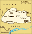
First, something about Bhutan from Wikipedia : "It is landlocked country in Asia and entirely within Himalayan Mountain range.Located in the East Himalayas, it is bordered by China in the north and India in the south. Bhutan lacks a border with nearby Nepal due to the Indian state of Sikkim and with Bangladesh due to the Indian states of West Bengal and Assam.
Bhutan is in South Asia and is the region's second least populous nation after the Maldives.
Thimpu is its capital and largest city, while Phuentsholing is its financial Center. Bhutan was never colonized in its history. Situated on the ancient Silk Route between Tibet, the Indian Subcontinent and Southeast Asia, the Bhutanese state developed a distinct identity based on Buddhisum. Headed by a spiritual leader known as the Zhabdrung Rinpoche, Following a civil war in the 19th century, the House of Wangchuk reunited the country and established relations with the British Empire. Bhutan fostered a strategic partnership with India during the rise of Chinese communism and has a disputed border with China. In 2008, it turned from an absolute monarchy to a constitutional monarchy and held the first election to the National Assembly of
Bhutan.The King of Bhutan is known as the "Dragon King".
Bhutan is pioneering the concept of gross national happiness. The country's landscape ranges from lush subtropical plains in the south to the subalpine Himalayan mountains in the north, where there are peaks in excess of 7,000 metres (23,000 ft). The highest mountain in Bhutan is the Gangkhar Puensum, it is highest unclimbed mountain in the world. There is diverse wildlife in Bhutan. However, Bhutan continues to be a least developed country. Hydroelectricity accounts for the major share of its exports.The Royal Bhutan Army maintains extensive military relations with the Indian Armed Forces. It has only army . No Navy. No Air force. Since the 17th century the official name of Bhutan has been Druk Yul.
When the area was unified by the Tibetan lama and military leader Ngawang Namgyal, who had fled religious persecution in Tibet, To defend the country against intermittent Tibetan forays, Namgyal built a network of impregnable dzongs or fortresses, and promulgated the Tsa Yig , a code of law that helped to bring local lords under centralized control. Many such dzong still exist and are active centers of religion and district administration. After Ngawang
Namgyal's death in 1651, his passing was kept secret for 54 years; after a period of consolidation, Bhutan lapsed into internal conflict. In the year 1711 Bhutan went to war against the Mughal Empire and its Subedars, who restored Koch Bihar in the south. During the chaos that followed, the Tibetans unsuccessfully attacked Bhutan in 1714.
Bhutan is viewed as a model for proactive conservation initiatives. It is committed to the maintenance of its biodiversity. This is reflected in the decision to maintain at least sixty percent of the land area under forest cover, to designate more than 40%of its territory as national parks, reserves and other protected areas, and most recently to identify a further nine percent of land area as biodiversity corridors linking the protected areas.
All of Bhutan's protected land is connected to one another through a vast network of biological corridors, allowing animals to migrate freely throughout the country. Environmental conservation has been placed at the core of the nation's development strategy. The country's constitution mentions environment standards in multiple sections.
It currently has net zero greenhouse gas emissions because the small amount of pollution it creates is absorbed by the forests that
cover most of the country. The entire country collectively produces 2.2 million tons of carbon dioxide a year. Yet the immense forest covering 72% of the country acts as a carbon sink, absorbing more than four million tons of carbon dioxide every year."
Until 1999, Television and internet was not allowed in Bhutan. Now also they do not allow western effect on the community. These visitors are kept under watch. Even they have to pay large sum per day for their stay.Tobacco is prohibited in the country. No plastic is allowed. People have faith in god and their King. Their schooling is free and if talented government helps them. Archery is their game and Taken is their national animal. They have forests so agriculture, hydroelectricity, handicrafts are means of living. They are very traditional and still observe our old traditions , which we are forgetting now.
In Bhutan, there is tradition of putting prayer flags. Flags with prayers written on it are displayed. Big flags, strings of small square flags are seen every where. Particularly at holy places, monasteries, rivers etc. It is believed that with the wind the prayers go in air which eliminates evil on earth.
Same was seen in Sikkim, Pelling also.
It was also observed that the Bhutanese ware their traditional dress everywhere. It is compulsory to ware it in offices , monasteries etc. It is called Gho for men and Khira for women. These are very costly ranging from Rs. 3000 to 30000 also. But from King to common person, all ware the same dress although the prices may vary.
Now, about our tour ....
Paro Airport We observed that last night, our bags were brought to rooms by the ladies in the hotel. It was learned that ladies only do all the work. In the hotel, staff was ladies. In our Himalaya Sikkim tour in 2012 we had observed the same.
Bangladesh Prime Minister's visit to Paro was same day. Hence tight security was there. Our first destination was Paro Airport from top. Due to security, the view point was closed and we stopped little further. Paro is the sole international airport of 4 airport in Bhutan. It is 6 km from Paro in a deep valley on the bank of the river Paro Chhu. With surrounding peaks as high as 5,500 m (18,000 ft), it is
considered one of the world's most challenging airports, as a select number of pilots are certified to land the airport. Landing is allowed in daylight only i.e sunrise to sunset. We wished to see landing of plane but our wish was fulfilled by appearance of plane on runway. Caught a good video.
Paro Dzongkhag In the 15th century local people offered the crag of Hungrel at Paro to Lama Drung Drung Gyal, a descendant of Pajo Drugom Zhigpo.
Drung Drung Gyal built a small temple there and later a five storied Dzong or fortress which was known as Hungrel Dzong.
In the 17th century, his descendants, the lords of Hungrel, offered this fortress to the Drukpa hierarch, Ngawang Namgyal, the Zabdrung Rinpoche, in recognition of his religious and temporal authority.
In 1644 the Zhabdrung dismantled the existing dzong and laid the foundations of a new dzong. In 1646 the dzong was reconsecrated and established as the administrative and monastic center of the western region and it became known as "Rinpung Dzong". Paro Dzongkhag is situated in the north-western part of the country. It is located at an altitude of 2,250m above the sea level.
It covers a total area of 1293 Sq. km
The Dzongkhag has National Highway links to both Phuentsholing and Thimphu.
Paro Dzongkhag is administrative office of Paro. Outside the main dzong is the Deyangkha Temple. Just below Rinpung Dzong is a wooden bridge on Paro Chhu.
National museum of Bhutan
On the hill above Rinpung Dzong is a seven-storied the watchtower fortress or Ta Dzong built in 1649. In 1968, this was established as the home of the National Museum of Bhutan.
The National Museum has in its possession over 3,000 works of Bhutanese art, covering more than 1,500 years of Bhutan's cultural heritage. Its rich holdings of various creative traditions and disciplines, represent a remarkable blend of the past with the present and is a major attraction for local and foreign visitors.
Collection of Thankas, various Masks, tsechu dances, various incarnation of god , bronze statues and paintings, birds of Bhutan, Mountain Gold information can be seen.
Druckgual Zong Drukgyal Dzong was a fortress and Buddhist Monastery now in ruins, located in the upper part of the Paro District. The Dzong was probably built by Tenzin Drukdra in 1649 at the
behest of Ngawang Namgyal Zhabdrung Rinpoche to commemorate victory over an invasion from Tibet. In the early 1950s, Drukgyal Dzong was almost completely destroyed by fire.
In 2016, to celebrate the birth of His Royal Highness The Gyalsey, as well as to commemorate two other significant events, namely, the arrival of Zhabdrung Ngawang Namgyal to Bhutan in 1616 AD and the birth year of Guru Rinpoche, the Prime Minister announced that the Dzong will be rebuilt and reinstated to its former glory. The announcement and ground breaking ceremony took place a day after the Prince was born.
The fortress is in ruin. There is rout with steep steps and we come to a ruined remains. There is a door which takes us to the monastery there. But the door was closed due to reconstruction work. Hence, frustrated, we came down. However we saw a walking track below and thought that this will take us there and we walked the way. It took us there but the monastery was closed. From there , we saw our bus and thanked god that we don't have to go back all the way. A short slope and we reached our bus.
Taktsang Monastery Paro Taktsang also known as the Taktsang Palphug Monastery or the Tiger's Nest, is a prominent sacred site and the temple complex is located in the cliffside of the upper Paro valley in Bhutan.A temple complex was first built in 1692, around the Taktsang Senge Samdup cave where Guru Padmasambhava is said to have meditated for three years, three months, three weeks, three days and three hours in the 8th century.
Padmasambhava is credited with introducing Buddhism to Bhutan and is the tutelary deity of the country. Today, Paro Taktsang is the best known of the thirteen taktsang or "tiger lair" caves in which he meditated.
The temple devoted to Padmasambhava (also known as Gu-ru mTshan-brgyad Lhakhang, "the Temple of the Guru with Eight Names") is an elegant structure built around the cave in 1692 by Gyalse Tenzin Rabgye and has become the cultural icon of Bhutan. A popular festival, known as the Tsechu, held in honor of Padmasambhava, is celebrated in the Paro valley sometime during March or April.
According to the legend related to this Taktsang which literally means "Tiger's lair", it is believed that Padmasambhava (Guru Rinpoche) flew to
this location from Tibet on the back of a tigress from Khenpajong. This place was consecrated to tame the Tiger demon. It is said that wife of an emperor, known as Yeshe Tsogyal, willingly became a disciple of Guru Rinpoche (Padmasambahva) in Tibet. She transformed herself into a tigress and carried the Guru on her back from Tibet to the present location of the Taktsang in Bhutan. In one of the caves here, the Guru then performed meditation and emerged in eight incarnated forms (manifestations) and the place became holy. Subsequently, the place came to be known as the “Tiger's Nest”.
The monastery is located 10 kilometres (6.2 mi) to the north of Paro and hangs on a precarious cliff at 3,120 metres (10,240 ft), about 900 metres (3,000 ft) above the Paro Valley, on the right side of the Paro Chu (‘chu’ means ”river or water”). The rock slopes are very steep (almost vertical) and the monastery buildings are built into the rock face. Though it looks formidable, the monastery complex has access from several directions, such as the northwest path through the forest, from the south along the path used by devotees, and from the north (access
over the rocky plateau, which is called the “Hundred Thousand Fairies” known as Bumda (hBum-brag). A mule track leading to it passes through pine forest that is colorfully festooned with moss and prayer flags.
As it takes 3 hours to reach, no one from our group was interested to go. So we did not go there. Only a far away distant view was given. But now, we feel that we should have gone at least upto bottom of the hill.
We came to Hotel and had tea. Then went for shopping. Purchase woolen hat and scarf.
Advertisement
Tot: 0.07s; Tpl: 0.012s; cc: 8; qc: 27; dbt: 0.0261s; 1; m:domysql w:travelblog (10.17.0.13); sld: 1;
; mem: 1.1mb