Advertisement
Published: January 18th 2007
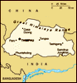
Six days into the trip and I can finally rejoice at the pleasure of having caught some kind of cold or mild influenza. Having finally managed to fall asleep in the early hours my body protests violently at the thought of having to get up and about already. At least the stomach is feeling mildly better, but I am not in the mood of taking any chances since we will spend most of the day on the narrow ledge that passes for a road between Jakar and Mongar town, so I skip the breakfast. At 200 kilometers today's stage is the longest of the trip, and we are calculating at seven hours at a minimum, stops not included. I go down to the restaurant to say goodbye to the other travellers still in Jakar for the tsechu and the proprietor to Mr. Dorji and his excellent staff. Before long we are in the car and en route for Ura Village, the easternmost of the valleys that interconnect to form Bumthang region. Ura is a well known village on the cultural trek, and kind of the last outpost for the larger groups that start out of Paro, unless they are continuing all
 Ura valley
The cluster of houses making up Ura village can be spotted on the farther side of the valley.the way east to exit the country at Trashigang.
I am quite excited for as we now leave the city of Jakar behind us we will finally break into the eastern section of Bhutan, where cities are few and far in between, where the infrastructure is less developed and the spoils of civilization not so pronounced as in the western part of the country. In fact, the eastern parts have long been somewhat neglected in the government's efforts to increase the standards in the western parts, and unsurprisingly there is a steady pace of migrators moving away from these provinces in search for a better future. However, things are beginning to change; as the situation in the east has received new attention. The government realizes that the region is being deprived of its young, and many projects are planned or in progress to raise the standard of living and improve the infrasturcture here. As I was soon to learn, the building craze is just as apparent here as in the west.
Ura lies some 48 kilometers east of Jakar, and the road driving out of Jakar the road soon starts to climb towards Shertang La pass before dipping
down into the Ura valley. The village itself is picturesquely located on the side of a big plain, its white houses clustered around a slightly larger lhakang with its typical golden roof. Tshering explains to me that potato is the common crop in this area, but that the farmers are having poor yields due to marauding deer that feed off their lands. It is not unlikely that they will have to switch to other crops in the near future. We depart from the main road and creep downhill on a terrible dirttrack down to the village center. "Don't step in the good luck", Tshering warns as Dorji manages to park the car in a section of the road that looks more like a minefield of cow dung. Ura village at 3.100 meters is a bit chilly, even though the sun is now beginning to shine ever so warmly. Walking through town there are few people around, we meet a kid playing with a little trolley in a side street, some hens strutting around and the occasional crow. The lhakang remains a popular place though, and we can find a number of kids playing in the courtyard, the elder women and
men faithfully completing their daily beats around the temple structure, spinning their prayer wheels and mumbling their mantras. It is a very beautiful place and very relaxing. However, we are bold explorers, and have little time to mill about so after taking in the atmosphere we are on the road again half an hour later.
The road starts to wind its way up the hillsides again, its forest of pine and evergreen leaving a chilling impression. We leave Ura valley behind as we reach
Trumshing La pass, the gateway to the east at an altitude of 3750 meters. it is definitely cold up here, and my cold doesn't improve on things, but I make an attempt to climb the nearest prayer flag-coated hill hunting for the ever present yet well hidden peaks of the Himalaya. Of course, at noon the air is so covered in misty clouds that it is hard to even make out the hills across the valley. Leaving Trumshing La we immediately start going downhill again, and the road really starts to get creepy now. Snaking its way through fiendish bends and hugging the cliffs not to collapse into the slide prone ledges you really have
to be on the lookout for traffic. The dusty climate lends itself well to shooting boulders and collapsing roadbeds of sand and dirt. The hills have many indications of where the soil gave up and tore big holes in the otherwise green coating of the mountainsides, grey stone peeking out and looking down at the mass of trees, brush and dirt below.
Down safe and sound on solid ground again we are coming up on Sengor town, situated roughly halfway to Mongar, and a common stop for packlunching. The most famous viewpoint is already claimed by two busloads of travellers having their lunches in the sun, sowe drive on through Sengor looking for another place to rest. The road through Sengor is currently going through major overhaul and widening, just outside of town two excavators are busy at work on a narrow slope just above road. It looks very... exotic.
We find a nice spot near the road and walk a maze of cow dung to sit down and have a boxed lunch on a small field overlooking a river. I stay with the sandwiches and juice to avoid any stomach related problems. The sun is once again
obscured by clouds and it is getting quite chilly just sitting around in the light wind, so I am kind of eager to get going again. Leaving Sengor we soon start climbing a hillside again and here are some really naked slopes, brown earth, sand and dust sprinkled with small stones and large boulders dangling like ripe fruit above the road. A roadsign wants to make us aware of shooting boulders and suggests we
confirm safety before proceeding. Keeping one eye on the road and the other up the hill to spot any tumbling boulders of death fortunately means you don't have to stary down the steep mountainside into the deep valley below. I am caught completely off guard at the magnificent scenery that slowly starts to unravel. As the road keeps hugging the hillside the mountains disperse leaving a vast green valley far below the road. For the first time we can even see our goal, the city of Mongar, some tiny white specks on a hillside, still several hours away.
Constructing this road was a grim task, and it is estimated that roughly 300 workers were killed in the process. A number of small roadside stupas pay
tribute to these brave souls. Tshering points out another place where a long distance bus recently went off the road, and we come to talk about philosophic topics such as life, death and reincarnation. I guess a place like this lends itself well to these kinds of pondering. Not far from where the trail started there is a huge waterfall passing just below the road, and a small bridge and temple have been constructed here. A perfect place to stop and take in the truly vertical characteristics of this place. I could easily spend a whole day here just staring out into the open, yet our driver Mr. Dorji is not of the patient breed, and soon he has found some nice rocks to throw down into the valley for some much needed action. We all stare in disbelief as the rocks just vanish from view before crashing into trees far below, the sound hardly managing to find its way back up to us.
The sun is out in force again and as we slowly start descending we happen upon very lush and dense forets, overgrown with vines and brush. We start to see cows waltzing around in the
middle of the road again, and soon we come up on the vertical villages at Namling and Yongkla. The climate in this valley is much warmer and the vegetation is that much greener. Farmhouses are digging in their heels in steep slopes and hills, and cornfields climb the mountain sides. In Khedra we catch sight of a dozen or so people performing some kind of celebration in the fields on the opposite side of the valley. We stop and talk to a woman at work in the rice fields next to the road and ask if she knows what is going on. She says over the past days there was an influx of immigrants from Ura who have moved here, presumably hoping to have more success with the farming here. We continue our odyssé through these vast green fields and slopes, the sun has already begun gliding down towards the horizon. Over on a nearby hill sits the ruins of Shongar dzong, or whats left of them anyway. The vegetation has claimed this once strategic hillock and the remaining walls are overgrown with vegetation. Back in the 11th century it was a power house due to its strategic location, but
became sidelined and finally claimed by flames in the 19th century. The new dzong now stands in Mongar town, a town that also inherited its name. Mongar is a dialectical variant of Shongar and thought to be an evolution of the original name.
We continue through the peaceful farming villages... Zimgang, Menchugang, Lingmethang, Kuri Zam... schoolchildren waveto us and some of them bow in a welcoming gesture as we pass by. Dorji gets charmed by the beauty of a girl sitting next to the road and we nearly go for some downhill offroad excitement. Tshering and I laugh and ask him not to take any shortcuts. I can't help but feel we've somehow reached the end of civilization. Each village we encounter promises to be the last, nothing but fields and mountains surrounding it. Then the road makes a sharp turn around a cliffside and opens up to yet another valley, and so it continues until we reach the bridge across the river at Kuri Zam. Mongar is now only 26 kilometers away, but daylight has almost escaped us and our average speed is reduced. A large chorten stares down at us from the other side of the river
as we begin to climb the hills yet one more time, on our final push to Mongar town. This last stretch of road seems to drag on forever, past terraced fields and lush forest until we can finally se the lights of Mongar as the world has turned dark around us. The first thing I notice is the construction of several multistory buildings, whereever we seem to go, the construction boom will follow. We drive through the heart of town, an arching road lined with shops in typical Bhutanese style on the lefthand side. A closer inspection reveals that these houses are actually built in a slope just next to the road, the entrances to the shops are located on the top floors of three and four storey buildings.
A bit further up the road lies the Druk Zhongkhar Hotel, which proves our expectations wrong. In fact, this place turns out to be one of the best hotels I have stayed at in the whole country, with what seems to be a limitless supply of hot water. After having checked in to our rooms we all turn to our respective pleasures, I spend half an hour in a steaming
Trumshing La mountain pass (3750m)
As is often the case, the clouds hide the Himalayan peaks hot shower and Dorji enjoys the wonders of Indian television. I have a small room in the attic complete with a little balcony and a nice bed. Needless to say I sleep like a baby after an exhausting but rewarding day.
Advertisement
Tot: 0.085s; Tpl: 0.015s; cc: 11; qc: 29; dbt: 0.0357s; 1; m:domysql w:travelblog (10.17.0.13); sld: 1;
; mem: 1.1mb