Advertisement
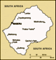
The highest mountain in Lesotho, the highest mountain in Southern Africa, the highest mountain in Africa for over 3100 km, the highest mountain in Africa south of Mount Meru in Tanzania – the highest south of Kilimanjaro if you believe the marginally inaccurate boasts of the tour companies who offer guided hikes up there. Thabana Ntlenyana reaches 3482 m and, unlike most of the other Drakensberg peaks, can be hiked in a single day.
The view along the way is beautiful and constantly changing though kind of always the same. We had first viewed Lesotho from the top of Mont-aux-Sources, a slightly lower mountain sitting on the border that you climb via the Amphitheatre chain ladders above Royal Natal National Park in the Northern Drakensberg. The high peaks you observe from the South Africa side are just endless low hills when seen from Lesotho as the whole country sits on a high plateau. In fact, one of my favourite pub quiz facts that people rarely guess correctly is that Lesotho has the highest low-point of any country in the world – the whole country being above 1000 m (above 1400 m to be precise). The view from the summit is
of rolling rocky tree-less hills disappearing into the distance into Lesotho and down the escarpment to green valleys and hazy plains of South Africa.
Some of my most well-read blogs, at least the ones with a lot of hits – who knows if anyone actually goes on to read them, are those concerning climbing some mountain somewhere in the world (see Margherita Peak, the highest mountain in Uganda/DRC (
https://www.travelblog.org/Africa/Uganda/Western-Region/Rwenzori-Mountains/blog-125285.html), Chirripo, the highest in Costa Rica (
https://www.travelblog.org/Central-America-Caribbean/Costa-Rica/blog-285495.html), or Triglav, highest in Slovenia (
https://www.travelblog.org/Europe/Slovenia/blog-201798.html) – you’ll also find the high points of Cameroon, Andorra, Armenia, Liechtenstein and probably a few others in there too if you really look). Maybe that’s because people use this website to help plan treks, as I do, or maybe it’s just because photos of mountains are always nice. Whichever, I thought my Lesotho blog could be about Thabana Ntlenyana. Given that I didn’t really do anything else in Lesotho, I didn’t have much choice.
As for the route up: there is no path. And the map is apparently not that great either. The best map I found was on the mountain-forecast.com website. Not only was their map pretty clear when screen grabbed, but
their weather predictions at different altitudes turned out to be accurate – indeed that is the website they use at Sani Mountain Lodge when planning tours. We followed the excellent route description (ignoring the author's patronising asides) presented on the generally excellent summitpost.org website, which covers most mountains in the world and is a very useful hike planning asset if you haven’t discovered it already. The route description also gave GPS waypoints, which we painstakingly punched into a little GPS in case the inevitable Drakensberg fog should come in at some point during the hike.
We were up at 5:20am in pitch darkness – the incredibly clear sky still filled with stars. I shivered out from beneath the numerous thick and heavy blankets and quilt of Sani Mountain Lodge backpackers hut outside and then into the next-door hut that contains the bathroom and kitchen. We didn’t rush, having a cup of tea, bananas, and banana bread before we felt there was enough light to set off at 06:20.
The first GPS waypoint was to lead us to stepping stones across the river to avoid getting our feet wet. It turned out this was unnecessary as the river, along
with all the others we had to cross throughout the hike, were reduced to a bit of a trickle and could be crossed anywhere. I made up for that by stepping almost immediately into an ankle deep bog thus having thoroughly sopping feet 1 km into the 30 km hike.
We soon passed a shepherd’s rondavel (traditional round stone house – actually known as a mokhoro in Lesotho) where we got a wave and were wished well on our journey. That shepherd would be the only person we would see all day.
The path was sometimes clear, sometimes a network of vague paths, generally nothing at all. However, the general route is very obvious, with or without our downloaded map, which only showed contours anyway: Head northwest from Sani Top for about 6 km, go round the shoulder of the mountain and head north down to the stream-crossing then up an increasingly steep side valley passing through the lowest point on the ridge ahead (about a 300 m climb). At the top of this pass you get your first view of Thabana Ntlenyana. A steady descent follows to another stream-crossing and then a less steep and less high
 Dawn at Sani Top
Taken at 06:15am as we set off.climb, still always heading north, takes you to another pass. From there you just follow a clear path around the contours then up on to the rocky summit.
It took us four hours to get to the top from Sani Mountain Lodge and a bit longer to get down as we stopped a lot, it being such a lovely day. The guided tours say 9-11 hours round trip, whereas the chap who posted the route description and GPS waypoints somehow took 14-hours. Though he had some bad weather while we had it glorious all day. Anticipating a much longer hike, we took a lot of food – most of which was scoffed on the relaxing jaunt back. We also took a lot of clothing for all weathers, and despite the lovely day, I wore waterproof trousers for most of the walk as additional protection from the wind, which also had me donning a woolly hat on the top. We carried a map, compass and GPS. You could get away with only the first one on a clear day like we had but experience from earlier in the week in the Drakensberg of the near invisibility when the clouds come
in meant the already well-used compass was brought along and the GPS just gave extra confidence.
The total distance is about 30 km and the total height climbed is about 700 m so it’s a decent day’s hike. What makes it a bit tougher is the lack of a path leading to energy sapping weaving around heather clumps, spiky grass tussocks, and boggy spots. Combine all this with the altitude and there is a recipe for a challenging day. We had been walking in the Drakensberg for a week so the heart-pounding we experienced on the little climb of the first afternoon’s stroll at around 2600 m was now only felt on the steepest of climbs – and it would very quickly subside. It still surprises me how it can feel as though your heart will thump out of your chest if you take one more step and then after just 20-seconds rest you are ready to carry on.
The trip to Lesotho was the culmination of a week of hiking in the Drakensberg – an area so stunning that I can’t figure out why I haven’t been before given that this is my third time
in South Africa. The trip to South Africa was once again for PhD fieldwork in Limpopo (see a few blogs ago), fortunately coinciding with a conference that my ladyfriend was attending in Pretoria. Thus, we gave ourselves a week off at the beginning for some exploration.
Hiring a car made things easier, though we didn’t attempt to take it up Sani Pass. The road is extremely rough and ludicrously steep on the final zig-zag section to Sani Top. We caught a local minibus up there with music at ear-splitting volume rendering any conversation in the back sign-language only. There had been no signs of a minibus, nor any other traffic, all day when we wanted to descend so we set off walking, only to be offered a lift after about 100 m in a passing pick up. The view from sat in the back was lovely though I had quite a sore bottom when I jumped out at the border post.
While planning the trip we had intended spending a lot longer in Lesotho as I was keen for Magdalena to see “real” Africa rather than just South Africa on her first trip to the continent (Tunisia doesn’t
Shepherd's rondavel
Blend in pretty well don't they. count). However, we discovered at the last minute that a Polish passport requires a visa for Lesotho, necessitating a trip to London or a few days in Pretoria or Johannesburg (we never did manage to find out which). We then found out that a special permit could be obtained if entering and leaving via Sani Pass for a fraction of the cost and bureaucracy. This turned out to be not quite as official as we had been led to believe but at least, rather than being pocketed, the money got put in a tin labelled “Christmas Fund”.
Apparently, the name Thabana Ntlenyana means “beautiful little mountain”. It is neither little nor beautiful but the setting certainly has a stark loveliness about it. Absolutely nothing for as far as the eye can see and not another human in site. It wasn’t as tough as we expected and it is definitely worth braving the road up Sani Pass in order to have a go. For those who like blissful isolation, this is your place.
Advertisement
Tot: 0.064s; Tpl: 0.013s; cc: 12; qc: 27; dbt: 0.0315s; 1; m:domysql w:travelblog (10.17.0.13); sld: 1;
; mem: 1.1mb