Advertisement
Bienvenido a Guatemala
In a land studded by volcanoes, where Mayan temples rise above the jungle canopy and ancient pagan rituals are kept alive, it's easy to get overwhelmed. Add to the picture the colonial elegance of Antigua, the majestic beauty of Lago de Atitlan and the multitude of natural reserves and you see why many people come to Guatemala for a short holiday and end up falling in love with the place, returning whenever they can.
There are caves to explore, volcanoes to climb, markets to dazzle the eyes, treats to tempt the taste buds. Peace has finally come to Guatemala (in a relative sense) and it's as if the whole country is waking up from a bad dream. Travel here, once fraught with danger and discomfort, is now characterized by ease - you can do pretty much whatever you want, and your experience will only be limited by your imagination.
Intro to El Remate
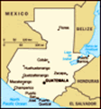
Once little more than a few thatched huts 35 kilometers northeast of Santa Elena on the Tikal road, El Remate keeps growing, thanks to the tourist trade. Halfway between Flores and Tikal, it allows you to be close to Tikal but still on the lake. El Remate is known for its wood carving. Several handcraft shops on the lake shore opposite La Mansion del Pajaro Serpiente sell local handicrafts and rent canoes, rafts and kayaks. With their new found prosperity, Rematecos have built a balneario municipal (municipal beach) just off the highway; several cheap pensions and small hotels have opened here as well.
Our Experience
We left San Ignacio about 7:30 AM. John offered to drive us to the Belize-Guatemala border. On the Belize side of the border we were met by officially licensed money changers. We changed some US dollars to Guatemalan quetzales, said goodbye to John, and walked through immigration. It was really simple.
Once we cleared immigration we were in Guatemala. We took John's advice and walked from the border, across the river, to a Shell gas station where he said a colectivo (local minibus) would stop to pick us up. And, sure enough that was exactly what happened. After about 7 minutes of waiting a minibus stopped. The driver charged us $3 US per person to take us 50 or so kilometers to El Cruce. When we got on the minibus was full. Just enough room for us to squeeze in between the locals. However, we soon found out that the minibus was not full. The driver finally stopped picking up people not when the seats were full, but when there were people sitting on all the seats and the floor and the door wouldn't simply wouldn't shut
 View from our Room
The place we stayed at was really cool. Think Swiss Family Robinson treehouse at Disney all the way up a hillside. No joke.if one more person got in. When it was all said and done, there were 21 people crammed into the colectivo.
The 50 kilometer drive to El Cruce took about an hour. It was a hot, bumpy ride. El Cruce, it turned out, was nothing more than a fork in the road. Luckily, El Remate (our destination) was only a mile down the road. So, in good backpacker fashion, we carried our packs from El Cruce to El Remate.
Note to Dad and Mom: Thanks for the new pack. It is absolutely amazing. So comfortable. Such a difference. Thank you, thank you, thank you!
El Remate is a lovely little tourist town set on the shores of Lago de Peten Itza. It is about 25 minutes from Tikal and 45 minutes from Flores (on the other side of the lake). Lago de Peten Itza is a spectacular lake. I told Joe it looked like someone had taken a piece of the Caribbean Sea and turned it into a lake. The water was a beautiful aqua blue and crystal clear.
As we were walking into El Remate a local kid on a bicycle pulled up along side
us, chatted us up about the World Cup (which actually didn't work so well ... we ended up thinking he said Portugal had beaten France and only realized this wasn't the case a day later), and led us to a nearby hostel. The kitchen staff (some Italian expatriates) showed us a "room" on top of the kitchen. The room had two beds with mosquito nets, a hammock, and two chairs. The roof was thatched and the walls stopped about waist level. Basically, the room was an open air thatched hut perched atop a building, high on a hill overlooking an enormous lake. The view was absolutely breath taking! We felt like we were living in the Swiss Family Robinson's tree house... you know, the one in the Magic Kingdom.
The Italians were super nice. The arranged for a minibus to pick us up at 6:30 AM the next morning and take us to Tikal. Since it was only 11 in the morning (we crossed into Guatemala early, remember?) we decided to walk around the area and have lunch at a small restaurant. After lunch, we changed into our swim suits and went swimming in the lake. There are several
docks along the lake shore with small thatched cabana-looking shelters at the ends. We walked to one and went swimming from there. The water was lukewarm or lukecool depending on where you stood. Joe swam for at least a couple of hours. We watched a thunderstorm pass us by in the distance. It was a really nice afternoon.
After our swim, we went back to our hostel and had supper. As I mentioned, the kitchen crew is from Italy, so as you might imagine we had some amazing Italian food. Joe ate some of the best Carbonara he has ever had, and I had some delicious pasta with pesto. After dinner we showered and went to sleep.
Joe's Note: After showering I actually took advantage of the hammock in our room to watch a mindblowing lightning show across the lake. It was something straight out of the Discovery Channel, but it was happening right over the lake. Amazing. It finally died down after quite a while, and I pulled out my flashlight and read for a while. I finally got to bed around midnight.
Intro to Tikal
Towering pyramids poke above the jungle's green canopy to catch the sun. Howler monkeys swing noisily through the branches of ancient trees as brightly colored parrots and toucans dart from perch to perch in a cacophony of squawks. When the complex warbling song of some mysterious jungle bird tapers off, the buzz of tree frogs fills the background and it will dawn on you that this is indeed hollowed ground. Certainly the most striking feature of Tikal is its steep-sided temples, rising to heights of more than 44 meters. But Tikal is different from Copan, Chichen Itza, Uxmal and other great Mayan sites because it is deep in the jungle. Its many plazas have been cleared of trees and vines, its temples uncovered and partially restored, but as you walk from one building to another you pass beneath the dense rain forest canopy. Rich, loamy smells of earth and vegetation, a peaceful air and animal noises all contribute to an experience not offered by other Mayan sites.
History Tikal is set on a low hill above the surrounding swampy ground - which might be why the Maya settled here around 700 BC. Another reason was the abundance of flint, used to make clubs, spearheads, arrowheads and knives. Flint could also be exported in exchange for other goods. Within 200 years, the Maya of Tikal had built stone ceremonial structures, and by 200 BC a complex of buildings stood on the site of the North Acropolis.
Classic Period The Great Plaza was beginning to assume its present shape and extent two thousand years ago. By the dawn of the early Classic period, about AD 250, Tikal had become an important, heavily populated religious, cultural and commercial city. King Yax Moch Xoc, whose reign began around AD 230, founded the ruling dynasty. Under King Great Jaguar Paw (who ruled in the mid-4th century), Tikal adopted a new, brutal method of warfare used by the rulers of Teotihuacan in central Mexico. Rather than meeting their adversaries in hand-to-hand combat, the army of Tikal encircled their enemy and killed them by throwing spears. This first use of "air power" among the Maya of Peten enabled Tikal to conquer Uxaxctun and become the dominant kingdom in the region. By the middle of the Classic period, in the mid-6th century, Tikal sprawled over 30 square kilometers and had a population of perhaps 100,000. In 553, Lord Water ascended to the throne of Caracol (in southwestern Belize), and by 562, using the same warfare methods learned from Tikal, conquered and sacrificed Tikal's king. Tikal and other Peten kingdoms suffered under Caracol's rule until the late 7th century.
Tikal's Renaissance
Around 700 a powerful king named Moon Double Comb, also called Ah Cacau (Lord Chocolate), 26th successor of Yax Moch Xoc, ascended Tikal's throne. He restored not only its military strength, but also its primacy as the Mayan world's most resplendent city. He and his successors were responsible for building most of the surviving temples around the Great Plaza. He was buried beneath the staggering height of Temple I. Tikal's greatness waned around 900, part of the mysterious general collapse of the lowland Mayan civilization. No doubt the Itzea's, who occupied Tayasal (now Flores), knew of Tikal in the late post-Classic period (1200-1530). Perhaps they even came to worship at the shrines of their old gods. Spanish missionary friars left brief references to these jungle-covered structures, but these writings moldered in libraries for centuries.
Rediscovery It wasn't until 1848 that the Guatemalan government sent an expedition, under Modesto Mendez and Ambrosio Tut, to visit the site. In 1877 Dr . Gustav Bernoulli of Switzerland visited Tikal and removed lintels from Temples I and IV to Basel, where they are still on view in the Museum fur Volkerkunde. Scientific exploration at Tikal began with the arrival of English archaeologist Alfred P. Maudslay in 1881; others who continued his work included Teobert Maler, Alfred M. Tozzer and RE Merwin. Tozzer worked at Tikal from the beginning of the century until his death in 1954. Tikal's inscriptions were studied and deciphered by Sylvanus G. Morley. Since 1956, archaeological research and restoration has been carried out by the University of Pennsylvania and the Guatemalan Instituto de Antropologia e Historia. In the mid-1950s an airstrip was built to make access easier. In the early 1980s the road between Tikal and Flores was paved, and direct flights abandoned. Tikal National Park was declared a UNESCO World Heritage Site in 1979.
Our Experience
Our day at Tikal didn't exactly start out as we had planned. I had my alarm set for 5:45 am to give us plenty of time to eat breakfast and catch our 6:30 minibus. I was even awake well before that because I didn't sleep well. All the sudden at 5:25 am the hotel guy starts whispering up to our room that we're going to miss our bus. Then we realized our mistake. Belize doesn't observe daylight savings time, and apparently Guatemala does. Our clocks were all set an hour slow on Belize time. We bolted. They were nice enough to give us our yogurt/granola breakfast to go, and we barely made the bus. On a side note, we had to wait on two people further down the road because they had done the same thing we did, so we didn't feel all that bad.
The trip to the ruins only took about a half hour. Once inside, we made our way towards the most remote temple (Temple of the Inscriptions) with plans to make a huge loop around all the ruins. The site itself was amazing: everything was in the
jungle. You basically walk through jungle paths until you come right up to a temple or plaza. Trains of ants were all over the ground, and bugs were pretty much everywhere. We even saw a few monkeys, and we heard some kind of really loud monkey near the Temple of the Inscriptions.
The temples themselves were spectacular. We were allowed to climb a few of them to see out above the jungle canopy. They no longer let people climb the Jaguar Temple after two people fell to their deaths. The ones that they let us climb weren't all that much safer actually. One wrong move and you're toast. Some of them had wooden staircases built to make climbing easier and safer, but that only occurred at two of the temples.
After walking around for quite a few hours, seeing almost everything, and climbing whatever we could, we ducked into some ruins to avoid the rain and consult our map to make sure we hadn't missed anything. Once the rain stopped, we made our way out of the ruins, back to the minibus area, and hopped a ride back to El Remate. Here we sat down to a very
well-deserved lunch (another fantastic Italian meal) before catching another minibus to Flores.
Up Next...
Flores and Santa Elena on Lago de Peten Itza in northern Guatemala.
Advertisement
Tot: 0.132s; Tpl: 0.023s; cc: 10; qc: 52; dbt: 0.0486s; 1; m:domysql w:travelblog (10.17.0.13); sld: 1;
; mem: 1.2mb


Tiney
Christine Ho
Wow, the pictures are amazing. Joe is getting hairy, hehe.