Advertisement

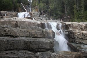
 Lower Myra Falls
... and Craig if you look closely!Today is our last day on the island. At 7:30 tomorrow we will be driving onto the
Northern Expedition and setting off on our 15-hour voyage to Northern BC.
After we left Campbell River last Saturday, we headed west into the Strathcona Provincial Park. The park is centred around a 14 mile-long lake, called Buttle Lake. Lots of snow covered mountains, and more than a few waterfalls.
On the drive to the park we saw another bear. This one just sitting in a carefree-type way in the middle of the road. He ran off as soon as I tried to get my camera out (
although, Craig did suggest that he was going to die of old age before I was ready to take his photo).
We stayed the first night at a campsite called Ralph River, at the southern end of the lake. We walked to the Lower Myra Falls, and trekked to the Upper Myra Falls (about an hour through the forest).
On Sunday we moved to the other end of the lake, to a campsite named after the lake itself. We called in at a few short hiking trails on the way (Karse Creek, Lupin

 Cascade
on the way to the Upper Falls.Falls, Lady Falls), but the main event was a long hike up the Elk River Trail. The full deal is supposed to be a six-hour there and six-hour back hike, but we decided against that and made a three-hour round trip instead. The Elk River Valley is supposed to be teeming with Roosevelt Elk: and yes, you've guessed it, we didn't see a single one!
We left Strathcona on Monday and travelled via the Upper Campbell Lake and the lower portion of Elk River to a place just outside of Campbell River called Elk Falls. We stopped on the way at the Strathcona Dam - but we both agreed that it really wasn't worth the effort of driving 5km down a gravel track!
On Monday evening it started raining. It stopped again this early this morning (Thursday). Between the two, we visited the tiny sea port of Sayward (and stayed in its even tinier neighbour Kelsey Bay). We watched a cruise ship pass down the coast, and wandered to the breakwater constructed from four world-war-two battleships.
Yesterday we left Kelsey Bay and drove through the cloud-covered mountains to Telegraph Cove. We had planned to stop on the

 Upper Myra Falls
Not quite as spectacular as the Lower Falls.way and do a few walks, but the monsoon put us off. Instead we continued to Telegraph Cove (which we are sure looks lovely on a sunny day!) and wandered through the drizzle around the harbour. Telegraph Cove is supposed to be a haven for Killer Whales, but I think even they decided it was too wet to put in an appearance.
Today we have driven almost to the northerly tip of the Island. We had a brief stop-off in Port McNeill, and then continued to Port Hardy. Where the sun FINALLY broke through. We now have a lovely evening to enjoy our last night (for a while) on Vancouver Island, before we head towards the warmth of the arctic tundra in the Yukon next week.
So I guess this is the end of Chapter 1 of our journey. Chapter 2 next week folks...
Advertisement
Tot: 0.193s; Tpl: 0.015s; cc: 14; qc: 49; dbt: 0.0609s; 1; m:domysql w:travelblog (10.17.0.13); sld: 1;
; mem: 1.1mb

 Lower Myra Falls
 Cascade
 Upper Myra Falls


Mark W
non-member comment
Ferry Watch
We're tracking you by satellite on bcferries.com. Well there's not much to do on a Friday night!