Advertisement
Published: December 21st 2011

 The highest national capital in the world
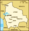
High in the Andes, the altitude of La Paz ranges from about 4058m to 3100m above sea levelAfter our Machu Picchu adventure we were certain we’d seen enough ruins for possibly our entire lives and welcomed the prospect of being in a big city once more. We were on our way to La Paz, the administrative capital of Bolivia. Since we realised we were quickly running out of time (six months isn’t enough) we immediately planned our route to Chile where we were going to spend Chris’ 30
th birthday. This involved a rather hurried highlights tour of Bolivia from Copacabana on the Peruvian border to La Paz and then into Chile via the hit-or-miss 4x4 trip from Uyuni to San Pedro de Atacama. And we only had nine days in which to do it. Amazingly, on top of this, Berni somehow managed to fit in the tough 3 day trek up the 6088m peak, Huayna Potosi.
Once our bus delivered us safely to La Paz, we (mainly me) struggled huffing and puffing under the weight of our increasingly heavy backpacks to our hostel, Cactus Hospedaje Economico Centrico. Being the world’s highest national capital it doesn’t take much to give the lungs a good workout… especially when you are carrying an extra 20kgs! La Paz which
The World's Most Dangerous Road
We biked down the World's Most Dangerous Road from La Cumbre (4700m asl) to Coroico (1700m asl) is high in the Andes ranges from about 3100m to 4058m above sea level. It’s one major thoroughfare (the Prado), follows the canyon of the
Rio Choqueyapu from where the more touristy areas and posher suburbs climb steeply skywards. They say if you get disorientated in La Paz, head downhill and you will inevitably end up on the Prado. Once we settled in and assessed our surroundings we decided to only spend the one night. Aside from the spacious double room which we were only paying a mere US$9.50 for, I felt there were a few crucial things missing which by now we were quite used to in a hostel – Wi-Fi and powerpoints. Plus the shared facilities weren’t terribly clean and smelt like sewerage. It would do for the night but we were determined to find somewhere else where we would be more comfortable. After a quick shower to freshen up we went out for dinner. This is when we first discovered the delights of Luna’s, a lovely café we liked so much we went most nights.
The following day we moved hostels. We settled for Hostal Maya on Calle Sagarnaga, one of the busier tourist streets. It
Riding like a pro
On the World's Most Dangerous Road close to Coroico. The drop wasn't nearly as sheer had all the necessities for US$22.00 including Wi-Fi and powerpoints. And the ensuite only sometimes smelt funny... we’d discovered the city’s water supply runs alongside its sewer pipes! One flyer we were reading said something along the lines of,
“don’t drink the water, don’t brush your teeth with it… in fact don’t even look at it.” After we checked in to Hostal Maya, we went out to explore the city on foot. We began with the
Mercado de las Brujas or Witches’ Market. Located amidst the flurry of the tourist market between Illampu, Santa Cruz and Sagarnaga, the Witches’ Market is where you’ll find everything from dried herbs, seeds and various parts of frogs and insects to the properly disturbing dried llama fetuses. We then headed down Calle Sagarnaga to Plaza San Francisco to see the impressive 460 year-old cathedral, the city’s landmark. After a quick look in the cathedral we crossed the Prado and trekked uphill to Plaza Murillo for more touristy sightseeing. Afterwards we found the Prado once more, where we followed it to Plaza del Estudiante. From here we explored the posher suburb of Sopacachi and the busy Avenida 20 de Octubre, the city’s nightlife district. Eventually
Berni, Chris and Noe celebrating as they reach 5000m asl
On Day 2 of the climb up Huayna Potosí, stopping for a photo opportunity at 5000m asl just in case they don't make it any further we ended up in Plaza San Pedro where exists one of the world’s most bizarre tourist attractions –
El Penal de San Pedro. Renowned for being a society within itself, inmates have jobs, buy or rent their accommodation and often live with their families. From here we found some delicious
Saltenas (much like empanadas, beef filled often with egg, but are slightly sweeter) for lunch and spent the rest of the afternoon relaxing before meeting up with Chris for dinner.
The following day was comparatively uneventful, apart from the arrival of our friends Peds and Liss. But we needed to unwind before the events of the following week which begun the next day with biking the World’s Most Dangerous Road. We decided to go with Gravity Assisted Mountain Biking, which Berni and I both highly recommend. There are lots of other companies which offer the ride, that are cheaper but Gravity Assisted Mountain Biking invented the ride and come with the best reputation, i.e. no fatalities. So on Thursday morning we set off for the meeting point where we met our Guide, Bryce from New Zealand and our group including Derek whose introduction went
“my name is Derek, Berni and Chris after reaching the summit at 6.00am
Early on day 3 of the climb after reaching the summit at 6088m asl and making it into the 6000m club! I’m from Australia and I like to party.” Berni and I shared a pained look. To get to the starting point in La Cumbre we had a 45 minute bus ride during which we were given our safety clothing and equipment. Then once we arrived we were allocated with a duel suspension bike which we got to practice on briefly before we set off on the 63km downhill ride. The first 20km were on the new highway which was downhill for the most part. Once we set off, I found I was a lot more scared than I imagined I would be – the speed, traffic and necessity to overtake slower semi-trailers and buses terrified me. I took it easy at first, trying to get used to the speed and duel suspension bike which was unlike any bike I had rode before. Leaning into the bends took the most getting used to, alternating which knee is up, according to the bend, but I eventually I began to feel more confident and started to really enjoy the ride. Once we made it to the entry point and passed through the drug check, we needed to pay our 25 Bolivianos each to
"Hi Mum"
Berni with his homemade sign for his Mummy - at the summit of Huayna Potosí. The other boys liked it so much they each had a turn too ride on the old road. The money goes to its upkeep. We then faced a tough 8km uphill section, affectionately known as Heartbreak Hill. Some of the group decided to attempt it on the bike, including Berni, but most of the group, including me and
“I like to party” Derek (big night) got back on the bus to follow behind the riders. It was slow going… some of the riders eventually gave in and jumped back on the bus, but Berni pushed on through the pain and altitude to make it the entire 8kms. We had then reached the gravel old road with its extreme sheer drops of at least 600m, single lane width – most of the road no wider than 3.2m and serious lack of guard rails. After a few tips from Bryce we were off. We stopped several times along the 43km route. I rode hesitantly at the start, nervous of the rough gravel and potential to hit a rock. However, it became a lot easier as we made our way down although it does require a lot of focus. The road is scattered with crosses marking the points where vehicles have fallen. In 1983, a bus
Crevasse
Berni taking the narrow ice ledge over the deep crevasse veered off the road and into a canyon, killing more than 100 passengers in what is said to be Bolivia's worst road accident. Tourists have died on the road too. The most recent was a Japanese bike rider a few months previous. By the time we’d made it to the end, in Coroico at 1700m above sea level, we had transitioned quickly from cool alpine terrain to rainforest. We then enjoyed a nice rewarding lunch at La Senda Verde animal sanctuary where we saw a spider monkey for the first time. To get back to La Paz we had a 3 hour dive in front of us. When we asked Bryce why it takes so long, his reply shocked us a little, we were driving back up the old road in the bus! There was outcry amongst the group – one Irish guy was prepared to get a taxi from Coroico via another route but Bryce assured us our driver, an ex-rally car driver would get us through it. I stupidity sat on the window side overlooking how close we came to the sheer drops. We also had to pass 2 minivans full of drunken Bolivians. I feared for them!
Salt production on Salar de Uyuni
Salar de Uyuni is the largest slat flat in the world, estimated to contain 10 billion tonnes of salt We slowly made it to the new highway… I clapped our driver when we did. He is the only driver in the whole of South America who I trust completely. Overall it was a memorable experience. And that night over dinner at the Moroccan restaurant Marrakech with Liss and Peds were able to recount all our stories. Turns out they had a few stories of their own from their first day in La Paz. In the morning they’d helped out an Australian girl who’d been robbed then later Peds spent half an hour being interrogated INSIDE San Pedro Prison after unknowingly taking photos of the building.
Berni As a quick introduction Huayna Potosi, Bolivia is located approximately 30km from La Paz (the highest national capital in the world at 3600m). Its peak stands at 6088m (19 974 feet) and is sometimes referred to as the 'easiest 6km peak in the world'. However to put the climb into some perspective the highest peak in Australia (Kosciuszko) stands at 2228m and Mount Cook in New Zealand is 3754m. There are also no 6000m peaks in Northern America, Oceania, Africa or Europe with only South America (The Andes) and some Asian
Berni, Chris and I on Isla Incahuasi
In the centre of the Salar is Isla Incahuasi famous for its giant cacti. The oldest is an amazing 900 years old and 9 metres tall summits (Everest etc.) boasting higher climbs.
Our adventure began at 9.00am outside the trek company where we met our fourth novice climber, Noe from Switzerland. From the beginning we were a bit of a motley crew with Chris having only just recovered from a severe bout of food poisoning, Peds having only come from sea level two days before hand (they recommend at least a week), and Noe a reformed smoker of 12 hours. But spirits were high and, after a brief stop at the company storehouse, we were soon decked out in our snow attire including coveralls, fleece, boots, helmets, headlamps, cramp-ons and an ice ax. It was a beautiful day and after driving to our initial base camp at 4700m we were fed a hearty lunch of alpaca steak (which they initially tried to pass off as fox meat). We had all also chosen the lengthier 3 day option so we could spend the first afternoon 'practice climbing' on a nearby glacier (4900m) to familiarise ourselves with the equipment. It was good fun and after two hours or so we made our way back at camp and settled in for the night all feeling pretty confident in
Squashed
One of our many attempts to get the perspective shot right. Courtesy of Chris ourselves.
On rising the second morning three of the four of us were still in good spirits although it soon became evident that Peds hadn't faired so well overnight and was starting to feel the altitude. We had a lazy morning however after lunch, when it came time to start our climb to second base camp, Peds had to pull the plug. As it turns out from sea level to almost 5000m in two and a half days is just a touch over ambitious although a good attempt. This left Chris, Noe and myself to push on with our 2 local guides Mario and Felix. The climb to second camp (5300m) was not technically difficult and did not involve any snow climbing however having packs loaded with 15kg of equipment combined with the altitude did make it quite breathless work. None of us were sure how far we would make it so we stopped to take photos at the 5km mark just in case we didn’t reach the summit. After three and a half hours we all staggered into the base camp which consisted of a small bright orange shed with a dozen or so thin mattresses lined up
My little angel and little devil
More experimental perspectives shots on the Salar. It was actually quite difficult to get right side by side and covered in what looked to be feathers from a pigeon or other bird that had snuck in and shed everywhere. Still it had great views and felt like an accomplishment in its own right. We had an early (4.00pm) dinner then it was a 6.00pm bedtime for a midnight wake up call.
The ascent to the summit began at 1.00am as it allowed you to reach the top by sunrise then descend before the morning sun increased the risk of avalanches. When our guides woke us at 12.30am it was pretty clear that again the altitude had struck as we slept. Despite feeling ok when we went to bed, we all woke feeling rubbish. Both Chris and I had constant indigestion bordering on nausea and the lethargy made the simple task of getting dressed into a half an hour ordeal. Basically it was like starting a lovely little midnight mountain climb with one of the worst hangovers you’ve ever had! As it was pitch black we walked by the light of our headlamps. We were also tied in together via our harnesses, Noe and I with Felix and Chris with Mario. Although it was far
Jump
A pose the three of us have perfected well from 'Touching The Void' (for those of you who have seen it), it did leave me wondering what we would do if one of us did actually fall as this had been skipped in our induction to the mountain (and I realised en route that I didn't have a knife and secretly hoped the others didn't either). The trail itself was little more than a foot or so wide although you really couldn’t see much of what was either side anyway as the headlamps simply seemed to shine off into the distance both up and down the mountain. It wasn’t until about an hour in or so that I took a closer look at some of the dark patches that seemed to appear every now and then beside the trail, yep crevasses!! We were stopping pretty often to catch our breath and although we'd been advised to bring along some chocolates for energy none of us could really stomach them so our guides (who told us they generally did the climb 2-3 times/month) quite happily devoured them for us. At one point we reached a 30-40m section where it became steeper so Felix dashed off ahead to install a snow
Just the usual behaviour from Berni and Chris
If they weren't taking 'penis' photos posing with various 'penis' looking objects often including trains and giant cacti they were working on their sweet ninja moves nail to anchor us all should anyone fall, which luckily we didn’t. Probably the scariest part (and not only for me who is terrified of heights at the best of times) was as we were approaching the summit and were met by a section in the trail completely divided by a deep crevasse. To cross it meant we had to step across the black abyss at the narrowest part which we soon discovered was a thin ice shelf either side which would have been 30cm thick if that. But after 5 hours of huffing, puffing and contemplating at which point it wouldn’t be worth pressing on we found ourselves at the summit. There had been some other companies setting out on the same night as us but we had managed to reach the top first giving ourselves 15 minutes or so alone to rejoice in and photograph our achievement. Chris had brought his camera but the altitude had started to shut down his brain so I became photographer as he was almost unable to string together a sentence let along operate a point and shoot camera. It was pretty amazing (a word I don't use lightly as I have come
Pink flamingos of Salar de Uyuni
The lagoons of Salar de Uyuni are home to three species of pink South American flamingos: the Chilean, Andean and rare James's Flamingos to detest its over use by travelers who describe everything they have done as 'absolutely A-mazing'😉. Watching the sunrise from above the clouds on one side of the mountain whilst having uninterrupted views over La Paz and all the way back to Lake Titicaca on the other.
The trail back down was easier technically but having reached the summit I seemed to lose the motivation that comes with having a goal and became zombie like with exhaustion. Twice I somehow veered off the fairly obvious path and came to within a few metres of falling down a crevasse when tugged back into reality by one of my companions who were fortunately still tied on through the harness. Even re-crossing the scary crevasse wasn’t as hard although we were sure to take some photos in the daylight. The worst part was the sun which made our 6 layers of clothing (which were perfect for the -15C at the summit) feel like we were wearing a personal oven suit. After a brief rest at the second base camp we pressed on and descended the entire distance back to the first base camp. We had trekked for around 13 of the preceding
El Arbol de Piedra
South of the Salar en route to San Pedro di Atacama is the 'Stone Tree'. Naturally sculpted by the howling winds 24 hours and reached our goal at 6088m. We must have looked quite a sight as we almost collapsed back through the doors just in time for the next group of 2 young guys to start their attempt. The bus ride back to La Paz was a very somber affair and all we wanted was a good night sleep but unfortunately it was not to be as we'd booked yet another overnight bus trip to start out salt flats tour the following day!
Claire After the bumpiest overnight bus ride ever we made it to hot, rubbish-strewn town of Uyuni to begin our 3 day tour. We were lucky to only be in a group of 5, Berni, Chris and I plus 2 other Australians, Prue and Shane. It gave us a little more leg room in the Toyota Landcruiser. Our driver’s name was Wanka… he also doubled as our cook and guide. He was lovely and immediately took a liking to Chris who sat next to him in the front. Day 1 started at the
Cementerio de Trenes, a graveyard of rusting locomotives only a short drive out of town. It was an interesting sight except I
Laguna Colorada
At 4270m above sea level is this amazing and colourful lagoon. You might be able to see the thousands of pink specks scattered across the black...they're all the flamingos! think the derelict beauty of the place was lost on Berni and Chris who thought it was hilarious to take ‘penis photos’ posing with the engine as their gigantic penis. This was something they kept up (with various other objects) over the course of the next few days. I’ve purposely not included any of the photos as this will just encourage them so you’ll just have to use your imagination. From here we only had a short drive before we reached the Salar de Uyuni, the largest slat flat in the world, estimated to contain 10 billion tonnes of salt. The white salt was blinding, especially with our overtired, weary eyes. But the effect of the white salt against the bright blue sky was incredible. Plus the environment is so enormous and so bare it completely skews your sense of perspective. Along with the beautifully intriguing landscapes, this is what travelers come for, the opportunity to capture weird photos which mess with perspective. We attempted a few, but couldn’t get the focus quite right. Chris managed to get a good one, it just happens to be the one where Berni is stepping on me. In the centre of the Salar
Warming my frozen hands by the Geysers
The coldest I've ever been in my life. At 5.00am in the Toyota Landcruiser on our way to the Geysers de Uyuni we drove to Isla Incahuasi famous for its giant cacti – again more ‘penis photos’. The oldest is an amazing 900 years old and 9 metres tall. Here Wanka impressed us with his cooking skills and served up steak, quinoa and boiled vegetables which we wholeheartedly enjoyed. We then had a long drive to San Juan on the outskirts of the salt flats where we spent our first night in a salt hotel. We were very lucky to score such good accommodation as when we arrived there was no availability at any of the larger, basic lodgings. We were actually mentally preparing ourselves to spend a freezing night huddled together in the Landcruser. But Wanka came through with the goods and negotiated with the hotel owner to let us stay.
Day 2 we entered the Reserva Nacional de Fauna Andina where we slowly made our way to its centerpiece, Laguna Colorada. This journey took most of the day as we stopped on several occasions to see the flamingo filled Laguna Canapa, Hedionda and Chiarkota. I had never seen a flamingo before so found the experience very amusing. We then drove through the Siloli Desert home to several
When the sun rose over Aguas Termales
We arrived at the thermal baths around 6.00am when the sun came up. As tempting as it looks, none of us went in unusual rock formations caused by wind erosion including the
Arbol de Piedra or Stone Tree. Next stop was Laguna Colorada which we got to see from both sides. When we first arrived we had an overall view of the lagoon with its wild colours. Wanka pointed out the thousands of tiny pink specks which we discovered were flamingos. So many of them! Wanka then drove us to get a closer look of the water’s edge. It was extremely windy by now as we were at 4270m above sea level so we only quickly abandoned the comforts of the Landcruiser to go admire the flamingos up close in the amazing deep red water. That evening we were in basic accommodation with the masses. No private salt hotel luxury anymore! Wanka’s cooking skills seemed to take a turn for the worse, which we suspected earlier at lunch when we presented chicken from the back of the eskie-less Landcruiser and sausage for dinner which had been sitting on the dashboard until then. The majority of us stayed clear of it (Thank you Tahlei!!!) but Chris enthusiastically tucked in. Food poisoning set in only hours after the suspect sausage and he spent the night
Driving through the Dale desert
Our final leg before we reached the border crossing into Chile was the Dali desert. Aptly named because of the surreal Dali-esk rock formations vomiting blood.
On day 3 Wanka woke us at 4.15am! It was freezing. Probably the coldest I’ve ever been in my whole entire life. The Landcruiser had ice on the inside of the windows which didn’t help comfort levels. We left around 4.30am, after Chris had spewed blood yet again, and drove to the geysers, our first stop. When we arrived we woke the sleeping Chris who, despite being on his deathbed got out of the car and struggled over to the biggest geyser and posed for a ‘fart photo’. Well played. The sun was only just coming up before we set off for our next and final destination. Chris had started to perk up having seen the geysers and after some Zofran from Dr. Frost, so when we arrived at the
Aguas Termales (hot springs) he was the first one of us to contemplate going in for a dip. You’ve got to admire his tenacity. Wanka made pancakes for breakfast which we appreciated but ate cautiously… the chance of food poisoning still prevalent. We then had a long drive to the Chilean border where we thanked Wanka before he left, to return to Uyuni. The 5 of us then waited as other 4x4’s arrived delivering more and more travelers to get the bus to San Pedro de Atacama only a short drive away. Once we arrived, the bus waited as we went through immigration processes, and then delivered us close to the main plaza. I loved the vibe in San Pedro de Atacama, albeit a town in the middle of the desert it had a laidback beach feel to it which I really enjoyed. However, we didn’t stay long… after a quite bite to eat and a stop at an internet café we bought bus tickets to the nearby town of Calama.
By this stage none of us had showered for 4 days, nor slept properly so looked and felt completely worn out. But it wasn’t over. We had to then decide whether we were going to get straight onto a 20 something hour overnight bus to Santiago or fly the following day. Now all of you can guess which option I was leaning towards. But flying was significantly more expensive ($90.00 versus $180.00) and I had with me 2 boys who didn’t care too much that we hadn’t showered, so was overruled. As I came close to tears in the middle of the bus station we quickly discovered the buses were fully booked for that evening (now I had tears of happiness). And because we were working to a deadline – Chris’ 30
th birthday which we’d arranged to spend in Vina del Mar we didn’t have any time to spare. So, we booked a triple room and flights for the following morning. Overall, despite some freezing cold temperatures, the hours and hours of driving and a bout of food poisoning, we really enjoyed our salt flats experience. We had read some terrible reviews of the 3 day tour, including drunken drivers, rolled 4x4s and poor organisation, but we went with an open mind and little to on expectations so we all came away with positive feelings and good memories… even Chris. We saw some beautiful landscapes, laughed a lot and thought it was a fantastic was to get to Chile.
Advertisement
Tot: 0.133s; Tpl: 0.016s; cc: 7; qc: 51; dbt: 0.0434s; 1; m:domysql w:travelblog (10.17.0.13); sld: 1;
; mem: 1.2mb