Pitcairn Islander Geography, Pitcairn Islands Geography
Advertisement
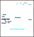
Location: Oceania, islands in the South Pacific Ocean, about midway between Peru and New Zealand
Geographic coordinates: 25 04 S, 130 06 W
Map references: Oceania
Area: Total: 47 sq km land: 47 sq km water: 0 sq km
Area - comparative: About 0.3 times the size of Washington, DC
Land boundaries: 0 km
Coastline: 51 km
Maritime claims: Territorial sea: 3 nm exclusive economic zone: 200 nm
Climate: Tropical; hot and humid; modified by southeast trade winds; rainy season (November to March)
Terrain: Rugged volcanic formation; rocky coastline with cliffs
Elevation extremes: Lowest point: Pacific Ocean 0 m highest point: Pawala Valley Ridge 347 m
Natural resources: Miro trees (used for handicrafts), fish note: manganese, iron, copper, gold, silver, and zinc have been discovered offshore
Land use: Arable land: NA% permanent crops: NA% other: NA%
Irrigated land: NA
Natural hazards: Typhoons (especially November to March)
Environment - current issues: Deforestation (only a small portion of the original forest remains because of burning and clearing for settlement)
Environment - international agreements:
Geography - note: Britain's most isolated dependency; only the larger island of Pitcairn is inhabited but it has no port or natural harbor; supplies must be transported by rowed longboat from larger ships stationed offshore
Advertisement
The information here has been derived from Public Domain Sources such as the CIA World Factbook. No liability can be taken for any inaccuracies.
Tot: 0.032s; Tpl: 0.008s; cc: 5; qc: 8; dbt: 0.0093s; 1; m:domysql w:travelblog (10.17.0.13); sld: 1;
; mem: 1mb
 Pitcairn Island was discovered in 1767 by the British and settled in 1790 by the Bounty mutineers and their Tahitian companions. Pitcairn was the first Pacific island to become a British colony (in 1838) and today remains the last vestige of that emp...