Advertisement
Published: November 18th 2007

 Benbecula
completely flat, a contrast to the rest of the Outer HebridesThis was a mammoth ride so cycle stats first
5 hours, 3 minutes of cycling
55.1 miles traveled
10.9 mph average speed
29.5 mph max
It was absolutely pouring down again when we woke up so we decided to laze in the tent until 11am when we ate baked beans and canned tomatoes for breakfast in the tent.
We did however set off by 12pm stopping off at the co-op again for a massive 5 litre bottle of water (that went in one of my panniers -- hmm! ) as the bladder carrier we had had started to leak.
Fortunately for us we had mostly tailwind helping us along the mostly flattish but slightly undulating road north. However the weather was pretty damp.
Just before we got to the causeway that would take us to the next island, Benbecula we stopped in DJ's cafe, which actually had a picture of some technics decks on the walls. There we happily munched a beanburger and chips for our lunch.
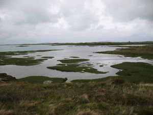
Benbecula was as flat as a pancake and pretty bleak. Where South Uist was undulating with dramatic mountain scenery to the east, boulders littering the landscape, Benbecula continued

 Andy
Andy
riding the main road that travels through the Uistson the boulders theme, but flat and lochy. We pretty much cycled straight through. We considered taking the apparently more scenic route around the west coast but we had already decided that we wanted to get to Berneray the same day so we headed on.
We crossed another causeway to Grimsay and then another to North Uist where the road headed west and we met our first headwind. The scenery once again started to become more rugged and dramatic. Still bleak but undulating, rocky and like South Uist, mountains to the east.
We had planned to follow the main road around the west of the island then to Sollas and across the causeway to Berneray, however we found a B road signposted Sollas to the right and fed up with the headwind we took it. This was definitely the right decision as we rode up into the moorland surrounded by peat bogs and some really beautiful scenery.
Stopped briefly at Sollas for another chocolate energy top up and then took the turning to Berneray and followed 5 miles of winding twisty roads past a hostel full of school kids and pitched again on the dunes.
I

 Benbecula
my bike and mewas pretty saddlesore by this point and Andy discovered he had buckled his wheel - he had damaged one of the spokes or nipples, basically his wheel didn't have enough spokes for proper touring being more of a performance wheel but that is hindsight etc. However we were very pleased with our progress considering the weight of our panniers.
Berneray was beautiful with undulating (I'm using this word a lot I notice) green hills, still littered with boulders a la South Uist, Benbecula and North Uist. Again, a perfect white beach backed with dunes and machair and a crystal calm blue sea with views over to the mountains of our next destination, Harris. While walking down the beach I spotted the heads of a few common seals bobbing out of the water, about 10m away from me. The weather had become much better with blue skies. There was still enough wind for some kite flying, we were weirdly watched by this elderly couple sitting in their van for ages. Weird.
The previous night in South Uist the sky was still light past 11pm. At 9pm in Berneray it was extremely light.
Advertisement
Tot: 0.088s; Tpl: 0.011s; cc: 9; qc: 56; dbt: 0.058s; 1; m:domysql w:travelblog (10.17.0.13); sld: 1;
; mem: 1.1mb

 Benbecula
 Andy
Andy
 Benbecula


