Advertisement

 Bowness-on-Solway
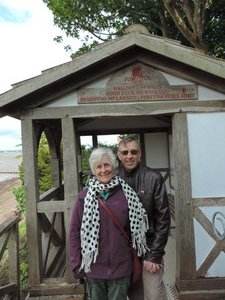
The start of our journeyWe arrived at the start of the Hardian's wall path yesterday afternoon after driving from Fort Augustus on Loch Ness to Glasgow and then by train to Carlisle and taxi to Bowness-on-Solway. The weather has cooperated so far and we are hoping it continues to do so for the next 10 days of our walk to Newcastle. The trail, 135 km from end to end, follows the course of Europe's largest surviving Roman monument, a 2nd century fortification built on the orders of the Roman Emperor Hadrian in 122 AD. The wall marks the northern limit of the Roman Empire. Building the trail was problematic as it followed the course of the UNESCO World Heritage site. Before every fence post, sign post and way marker was driven into the ground an archaeologist had to be present to ensure the integrity of the wall. It took ten years to build the pathway before it opened to the public in 2003. By comparison it had taken the 2nd and 6th legions of the Roman army only 6 years to build the actual wall!!
Advertisement
Tot: 0.556s; Tpl: 0.013s; cc: 15; qc: 81; dbt: 0.324s; 1; m:domysql w:travelblog (10.17.0.13); sld: 1;
; mem: 1.2mb

 Bowness-on-Solway
