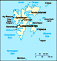
 First discovered by the Norwegians in the 12th century, the islands served as an international whaling base during the 17th and 18th centuries. Norway's sovereignty was recognized in 1920; five years later it officially took over the territory....
 First discovered by the Norwegians in the 12th century, the islands served as an international whaling base during the 17th and 18th centuries. Norway's sovereignty was recognized in 1920; five years later it officially took over the territory....