Advertisement
Published: March 19th 2018

 and-so-it-begins
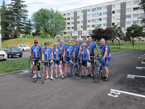
All dressed up with plenty of places to go With the sun shining and breakfast consumed it was time to get this tour officially started! We stayed together working our way through the city (only occasionally missing a turn) before eventually splitting into smaller groups. Distressingly, the sky soon turned overcast with ominous clouds.
At Perouges the group I was with seemed uninterested in exploring the town so I ventured into it alone. Just as I was getting ready to leave, however, everyone appeared: it seemed the guys had had a change of heart and had waited for the rest of the folks to coalesce before entering the village. Since by this time I was getting cold from not riding, I forged on ahead, and didn't see anyone else until the end of the day - which really put a damper on taking photos, as empty roads just aren't interesting (except possibly this one) .
Although there is a nominal route for the tour, most days have at least one option for those interested in extending their experience (read "climbing"). Today's choice involved almost a doubling of total vertical climb (1740m vs 920m), although the col it passed over was actually lower than the one on the nominal
route (759m vs 864m); it also had steeper climbs, mostly on minor roads that were barely more than cart tracks. This was only a minor annoyance when ascending, but a problem for me when descending, since the rough patches, slimy conditions, and loose pebbles/rockfall suggested to me that braking often was a good idea, especially when you never knew when the next switchback would appear, or when a car (there were only a handful) might emerge from around a bend. I lost a lot of brake material today, and hit a maximum of only 52kph, which still felt pretty reckless at times.
When I finally reached the signed col, after having already gone up and over one range, the road up was both in better shape and not as steep as what had gone before. Then, surprisingly, there was even more climbing before the road finally descended to the valley floor, at which point going upriver at 20kph seemed positively swift. Unfortunately it was not to last: as the road crossed the river and pulled away from its banks, the pitch increased and the sun came out as well, making it a long slog to our hotel but at

 perouges
Mediaeval cobblestones were much rougher than later ones, it seems.least definitively answering the question "why do you think they call it Hauteville anyways".
Along the way I got good and hot on the climbs and chilled on the descents, and that was with cloud cover. Let's see what tomorrow brings (I am hopeful 'recovery' is among the offers). Today's lesson: be wary of roads that have alphabetic suffixes e.g. D12 was nice, D12b not so much.
Advertisement
Tot: 0.106s; Tpl: 0.012s; cc: 9; qc: 48; dbt: 0.0489s; 1; m:domysql w:travelblog (10.17.0.13); sld: 1;
; mem: 1.3mb

 and-so-it-begins
 perouges


