Advertisement
Published: October 12th 2011
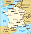
Tour du Mont Blanc is one of the classic and most famous walking routes in Europe circling some 170 km around the Mont Blanc massif. The route passes through France, Italy and Switzerland on an easy to follow and well trodden trail offering some very scenic and outstanding mountain views along the way. Thousands of people complete the TMB every year and normally it can be done in 8-12 days. Good weather is not always a guarantee. When I did the walk in June I experienced 4 seasons in less than 24 hours with rain, snow and wonderful sunshine hitting the trails leaving me in full winter gear at one moment and T-shirt just a few hours later.
Kevin Reynolds guidebook " Tour of Mont Blanc " was very informative and useful to bring along. I would also recommend getting a map as well of the entire route to get a broader and more detailed perspective of the areas you are walking in. Since I did many of the variants on the TMB a map was extremely helpful for me
Day 1 : Les Houches 1010 m. - Refuge de La Balme 1706 m. 8h55m
via Col de
Tricot
Rain was pouring down with significant force once my bus left Geneva airport in the evening heading for Les Houches, my starting point for the Tour Du Mont Blanc walk. This was not excactly the kind of weather I had been looking forward to but I could only hope that by tomorrow it would clear up at least a little bit.
Arrived quite late at Gite Michel Fagot which is situated in the center of Les Houches offering simple dormitory rooms, a fully equipped kitchen, dinning room and lounge for 17 Euros pr.night. I was welcomed by the friendly owner, Olivier, who showed me around and informed me that the weather forecast for tomorrow looked better :-)
Rain had stopped but clouds were still sitting deep in the valley when I stepped out of the Gite ready to take on my first stage on the TMB.
Left Les Houches at 7.30 am and headed left up into the hills from Hotel Slalom at the edge of the village. The walk up to Col de Voza was not very interesting. The clouds and fog did not give away any views as I walked on a jeep road
for most of the time passing many chalets and a ski lift on the way.
When I reached Col de Voza 1650 m. at 9 am the clouds started to crack up for the first time revealing at least some mountain views.
With weather improving I decided to go for the TMB-variant over Col de Tricot instead of the lower level normal route.
From Col de Voza I followed the tramway all the way up to Bellevue at 1770 m.
The Mont Blanc tramway is 12,4 km long and operates between Le Fayet/St Gervais and Nid d'Aigle at 2372 m. The train is very popular among tourists, trekkers and mountaineers. The normal French route to Mont Blanc starts at the tramway's terminus Nid d'Aigle
At Bellevue a sign guided me in the right direction and the trail cut sightly right into a forest where it narrowed a bit. Very soon I had some excellent first views of Aguille de Bionassy 4052 m. through the trees and for the first time this day I had a good reason to keep my camera busy for a while. Aguille de Bionassy is apparently the last 4000 m. peak on the Mont
Blanc ridge in western direction.
I took me 35 min to reach L'Are 1760 m. which marked the end of the forest and the beginning of more open terrain. Again a sign pointed me in the right direction. Overall I must say I was really impressed with the signs that were put up on the trail particularly in France. In most cases they left no doubt on were to go.
A suspension bridge soon after L'Are took me up the colourful V-shaped valley to Col de Tricot. On my left I had superb views of Aiguille du Gouter 3863 m., Aiguille de Bionnassay 4052 m. and Glacier de Bionnassay.
Reached Col de Tricot 2120 m. at 10.55 am. A small french group was about to leave when I arrived. From the grassy saddle I had great overview of the Miage Valley, Refuge de Miage and the Mont Truc ridge above.
The zig-zag walk down to the valley floor was not as knee-crunching as the guidebook suggets but still a bit steep and slippy in places.
Reached Refuge de Miage 1720 m. at 11.35am. The Refuge is set in a very idyllic valley of pastureland with Dome
de Miage 3673 m. making a perfect background.
Decided to have my lunch at this quiet and picturesque place and if I ever do this trek again I would definately consider spending a night here. Trekkers I met later on the TMB raved about this place.
A short uphill walk took me to the Mont Truc ridge which had an orientation table showing names of the different mountains and peaks from this particular angle. A few steps later the inviting Auberge du Truc appeared. Except from the gardien there seemed to be no other people here when I passed.
The 550 m. descent to the village of Les Contamines was mainly a walk down through a forest with frequent signs guiding me safely in the right direction.
Reached Les Contamines 1167 m. at 1.20 pm and decided to have my second break here since Les Houches.
Most shops and offices were closed when I arrived and everything seemed very quiet with just a few people here and there on the mainstreet. I decided to wait until 2 pm when the Tourist Information Office reopened again so I could check out the weather forecast for the coming days. The
staff wee very helpful and provided me with the information I needed. Internet cost a staggering 3 euros for 15 mins !!!
Shortly after I had left Les Contamines I could start to feel some light raindrops again and by the time I reached the famous Notre-Dame De La Gorge at 3.20 pm drops had turned into drizzle.
Notre-Dame De La Gorge is apparantly an ancient place of pilgrimage and people still come in huge numbers every day to visit this popular church .
The church marked the end of the road and start of the mountain path leading all the way up to Col du Bonhomme. The gradient was quite steep at first but it soon got a little bit better. I saw quite a few walkers coming down, but by the time I reached the colourful Relais Le Sollie 1400 m. at 3.55 pm the wide trail/jeep road was almost deserted again.
The Relais Le Sollie was a great place to take a break and hang out for a while. The gardien was very inviting and he could tell me that the last bit of walk to my destination this day, Refuge de la Balme,
was very easy. A Coca Cola and a big cheese baguette cost 6,60 Euro here.
The gardien was right. It took me an easy 30 mins to reach the Refuge de la Balme 1706 m. which sits at the foot of the Pennaz needles and just a couple of hours walk down from Col du Bonhomme.
There were only a few other people spending the night here this day which really was an indication that the TMB season had not kicked off quiet yet. I did not really mind that. With just a handful of people sharing a big dormitory, hot showers and good food, paying 35 Euros felt like a bargain ( dormitory, dinner & breakfast ).
Day 2 : Refuge de La Balme 1706 m. - Refuge de Mottets 1870 m. 6h40m
via Col des Fours
Once I woke up in the morning and looked out of the window I knew that my trekking outfit this day would be my raingear. Everywhere I could see it was all wet and grey. Not even a tendency to a clear spot on the sky in sight.
I was the first person to leave
the Refuge at 7.50 am. With me and my backpack covered up I started the steady climb up to Col du Bonhomme. The trail was just as wet as the sky and it did not take long until my feet were soaked as well.
The climb up was easy and the only obstacle was to cross a big patch of fragile snow, with some streams running through it, about 30 mins below the Col. It took me a few minutes to find a good way of crossing this area as I did not want to risk getting more wet plunging through a snow bridge.
When I reached Col Du Bonhomme 2329 m. at 9.10 am I was hit by strong winds and more rain and I had to escape into the small wooden shelter which sits here to protect from bad weather.
Views are supposed to be very nice from this Col but not today.
Soon I was joined by other trekkers and with four wet people and four wet big backpacks gathered at once there was not much space left in this tiny hideaway
From Col du Bonhomme the trail turned left and started to climb
again in a more rocky terrain .There were red & white paintmarks and small cairns guiding the way on regular intervalls, on the narrow strip of trail, all the way up to the big cairn at Col de la Croix 2483 m. Just a few minutes below is Refuge de la Croix du Bonhomme 2443 m.
I arrived at the Refuge at 10.05 am and decided to take my lunch here and perhaps dry up a little bit as well.
A big group was about to leave when I arrived and once they were out of the door I took the opportunity to move my things closer to the heated stove in the spacious dining hall.
The Refuge was apparently renovated a few years ago and according to Office de Tourisme in Les Houches it has 109 beds available.
After talking to the Gardien about the trail conditions on the Col des Fours variant to Refuge des Mottets I decided that I wanted try and go for it despite the rain and the medium visibilty.
With my socks completely dry again and my camera starting to pick itself slowly back to normal after too much exposure to the
wet elements, I left The Refuge at 12 o'clock and headed up the hills again.
At Col de la Croix there was a sign pointing to Col des Fours and Tete des Fours and I followed the broad trail going up. I knew it would take me about 30 mins to get there with normal speed.
Rain continued to be miserable and as I came a little bit higher up visibilty went from medium to poor. Red & white paintmarks which were initialy easy to spot just after Col de la Croix were now hidden in the patches of snow or gone in the fog. At 12.25 I reached a wall of snow which I think must have been the top of Col the Fours, the highest point on the TMB ( variants ) at 2665 m. together with Fenetre d'Arpette.
From Col des Fours I had to descend on a snow slope before entering a wet,slippy and muddy downhill-section which felt like a potential landslide area.
20 mins after leaving Col des Fours I reached a yellow sign again which pointed down to la Ville des Glaciers.
From the sign the trail continued to go
down on the right hand side of a stream which seemed to contain a lot of water this day turning it into a waterfall in some places. Further down I had to make a tricky crossing of this roaring flow.
It was quite encouraging to come down the slopes and finally get a view down to Refuge des Mottets and La Villes des Glaciers. The last steps from Le Tufs and down to the valley floor was on an easy to follow jeep road. I could see quite a few people coming up from the normal route via Les Chapieux.
The last bit up to Refuge des Mottets at 1870 m. ( 2.35 pm ) was easy and I was more than happy to get off my soaking wet gear and pay 38 Euros for a nice warming dining hall, a dormitory bed, dinner and breakfast.
Refuge des Mottets is situated in the Vallee des Glaciers and is the last accomodation before Col de la Seigne and Italy. From its doorstep there are some great views of the impressive Glacier de l'Aiguille.
In the afternoon the stove in the dining hall became the big epic center
for drying boots and trekking-gear :-) Some even had their underwear on display there
The dinner which was served later in the evening was absolutely delicious. :-) First a very tasty vegetable soup, then a main course of meat rice/potatoe + bread/fromage before rounding it all off with an excellent caramell pudding. This was better than best :-)
Day 3 : Refuge de Mottets 1870 m. - Courmayer 1222 m. 7h35m
The sound of rain hitting the roof of the dormitory woke me up on several occasions during the night but in the early morning hours it had calmed down again.
After crawling out out of my sleeping bag I was surprised to see that a white blanket of snow was covering the upper parts of the mountain slopes and the clouds starting to crack up with some sunlight breaking through.
The excellent staff at the Refuge prepared a simple but tasty breakfast and set up a long table in the cosy dining hall for all the guests to join in.
Left at 7.50 am. A sign just outside the Refuge says " Col de la Signe 1h55 " and the trail is very
easy to follow.
Compared to my two previous days it was quite chilly in the air this morning. The climb up the open grassland was gradual and steady and looking back, after gaining some height, I could see Col des Fours covered in white colours.
About 40 mins after leaving the Refuge I reached the snow-line on this side of the valley. Not much, but still enough to get that feeling of winter back again.
As I closed in on the summit, clouds started to cover the whole area and visibility dropped from good to zero within minutes. Along with the clouds came some strong icy winds and when I finally reached Col de la Seigne 2516 m. at 9.25 am it was bitterly cold even by Norwegian standards.
Col de la Seigne is the gateway into Italy ( or France ) and is supposed to be one of the finest viewpoints on the TMB-route with a 360 degree panorama view.
I only spent a few minutes on the Col before heading down again. I was now officially walking on Italian ground !
From the La Seigne Pass I now entered the upper parts of the beautiful
Val Veny which is located in Valle d'Aosta, the smallest and least populous region in Italy.
Coming down it did not take long before the bad weather was behind me and views down the valley started to open up. By the time I passed the old Italian custom house, La Casermata, 20 mins below the Col it had all cleared up again.
La Casermata was closed when I passed. The house was apparently renovated in 2006 and works now as museum & information center. The only thing that seemed to be up and going here this morning were the huge number of marmots who were literally running all over the place :-) Fascinating !
Coming down to Rifugio Elisabetta 2195 m. ( at 10.15 am ) was a fairly short and straightforward walk. The Rifugio was built in 1953 and sits beautifully at the foot of Aiguilles de Trèlatète 3923 m and the arms of Glacier de la Lex Blanche and Glacier d'Estelette. It can accomodate for 80 people and fill up very quickly, especially in high season. Decided to take my lunchbreak here ( 1 Coca Cola = 1,50 Euro )
I was really impressed by
the standard of the hut with its nice interior, great location and cosy atmosphere.
Left the Rifugio at 11.00 am and descended down to Lac Combal. Some commercial groups were coming in the opposite direction and looking at the size of these groups I think I timed my departure from Elisabetta perfectly.
At the end of the lake the route ascended to the mountain pastures of Arp Vieille and reached its highest point at 2430 about 1 hour later. The views on the way up were absoluetly superb. With the whole south face massif of Mont Blanc emerging perfectly clear in front of me this was one of the finest panoramas on the whole circuit.
From the high point the the trail traversed up and down across the slopes of Mont Favre. Views along the way were of the highest standards and it was a real pleasure to be walking here this day. The icy conditons I had at Col de la Seigne just a few hours ago was gone and summer was smiling again.
Reached Col Checroui and the colourful Refugio Maison Vieille 1956 m at 1.45 pm. Again I was impressed by the standard
and quality of the place. A big cheese sandwich + sprite cost 7 Euros
On the final descent to Courmayer I had to go down an open ski area before entering a forest and finally emerging at the small village of Dolonne at 3.10 pm - the sister town of Courmayer.
Reached Courmayer at 3.25 pm and paid 37 Euros for a simple room w/breakfast at Pensione Venezia.
The historic mountain town of Courmayer is one of the oldest and most famous Italian alpine resorts and is sometimes referred to as " The Pearl of the Alps ". There are apparently 14 4,000m plus mountain peaks above the town contributing to its superb scenery.
Day 4 : Courmayer 1222 m. - Rifugio Walter Bonatti 2025 m. 5h40m
via Mont de la Saxe
I knew I would be up for a very scenic day on the trail today. Weather was absolutely brilliant in the morning with perfect clear blue sky for the first time since leaving Les Houches about 4 days ago.
At the Carefour Express shop, just down the road from my hotel, I bought some drinks and snacks before starting my walk
at 7.50 am from Courmayer.
The walk out of town was easy. First on a quiet paved road passing local houses and gardens which changed into a gravel road after a while. About 40 mins after leaving my starting point a sign pointed away from the gravel road and I started to climb up through the forest on a more narrow trail.
The gradient was quite steep and fairly challenging The views were blocked by the forest for most of the time on the way up to the Bertone hut, and it was not until the end of the 763 m. ascent from the bottom to the rifugio that the birds eye views started to open up. From here and onwards they only got better and better.
Reached Rifugio Bertone 1989 m. at 9.25 am. This Refuge was built in 1982 in memory of the turin alpinist Giorgio Bertone, an alpine guide of Courmayeur who crashed with his plane on the Mont Blanc du Tacul.
There are some great views of Mont Blanc and Aiguille Noire from its doorstep.
A quick snack-break in the quiet atmosphere and I was on the trail again.
Just 5
mins above the Rifugio I reached a trail junction which took me up the long broad, grassy Monte de la Saxe ridge towards Tete Bernada, Tete de la Tronche and Col Sapin. Very steep at first but once I was up there the walk was easy, beautiful and spectacular.
The views were absolutely phenomenal ! The south face of Mont Blanc, Glacier de la Brenva, Grandes Jorasses, Dent du Geant, Grand Rochere, beautiful alpine flowers, reflecting ponds, almost no people, quiet. It was all there at the same time creating the most magic mountain atmosphere.
When I reached the top of Tete de la Tronche 2581 m. at 11.15 am the only thing disturbing this perfect frame were trillions of ants dotting the summit area. I am sure I was not the reason why a marmot fled the area when I arrived :o)
Col Sapin 2435 m. was just below Tete de la Tronche and it took me some knee crunching steep 5-10 mins to get there. From Col Sapin I entered the Arminaz Valley and followed the trail to the valley floor before climbing up again to Pas d'entre-Deux-sauts 2524 m. ( 12.40 pm ). In the
Arminaz Valley the trail and the marking was not always easy to spot and I had to redirect myself a couple of times.
From the Pass it was easy walking down through the Malatra Valley all the way to Rifugio Walter Bonatti 2025 m. where I arrived at 1.30 pm
I decided end my walking here this day.
This was by far the most luxurious refuge I had stayed in so far on the TMB. New, modern and almost too comfortable to be a hut in the mountains. This really felt more like a hotel.
43 Euros for the most comfy dormitory bed, excellent dinner and and a breakfast buffe felt like a bargain :o)
From the terrace there were some wonderful views of mont Blanc and Les Grandes Jorasses.
Day 5 : Rifugio Walter Bonatti 2025 m. - La Fouly 1610 m. 6h15m
It seemed that I was one of the first persons to leave the Rifugio at 7.30, in yet another wonderful day in the Alps.
The walk from Bonatti was easy and very gentle at first undulating across the slopes above Dora de Val Ferret through nice colourful alpine terrain with some
grand views of the south side of the Mont Blanc massif along the way.
After about 1 hour the trail bent down to the floor of the Val Ferret and after passing Chalet Val Ferret 1784 m. sitting next to the quiet Dora river I had the choice between a vehicle track and a more direct path to Rifugio Elena some 250 m. higher up.
Decided to go for the latter steeper option and arrived at Rifugio Elena 2062 m. at 9.10 am.
The Rifugio sits at an excellent location at the foot of Mont Dolent and opposite the impressive 3,6 km long Pre de Bard Glacier. The huge front terrace makes a great viewpoint.
A TMB-sign just behind the hut pointed up towards "Col Grand Ferret 1h10min " and the trail was easy to follow. A long series of bends took me quickly higher up the stiff slopes and views along the way were again tremendous. Some bikers were coming down from above but other that the trail was pretty much deserted.
Reached the well defined ridge of Grand Col Ferret 2537 m. at 10.35 am.
This pass is located between the canton of Valais
in Switzerland and the Aosta Valley in Italy and separates the Mont Blanc massif from the Pennine Alps. The panorama views from the summit are commanding and extensive.
Looking east into Switzerland the Grand Combin 4314 m. , one of the highest peaks in the Alps located in the far west of the Pennine Alps, rises majestically next to Mont Velan 3727 m. Looking back into Italy the length of Val Ferret and the rocky southern side of Mont Blanc massif / Les Grandes Jorasses range is at a wonderful display.
In the north-west direction the popular snow capped Mont Dolent makes a nice background. What a great way of entering a new country :o)
A long line of bikers were sweating their way up when I started my long descent to La Fouly far down in the valley somewhere.
The walk was comfortable and easy on a good and dry trail. The scenery got greener and greener for every step I made down the slopes.
It took me less than 1 hour to reach La Peule 2071 m. A great place to grab a cold drink and sit down in one of the sun chairs, stretching
out and just admire the nice,warm weather and the beautiful alpine views. That was exactly what I did :o)
A jeep road took me down to the valley floor and I reached Ferret 1700 m. at 1.15 pm. From here a path cut to the left side of La Dranse de Ferret river away from the road for a while before returning to the vehicle road just before La Fouly.
Reached La Fouly 1610 m. around 2 pm.
The small village is surrounded by well known peaks such as Mont Dolent, Le Tour Noir and Aiguille d'Argentiere and is a popular ski resort in winter. A few hotels, a supermarket and a local sports store makes this a handsome place to stay and stock up on some food and drinks for upcoming walks.
Paid 45 euros for a dormitory bed , dinner and breakfast at Hotel des Glaciers.
In the evening it started raining again and according to the staff at the small tourist information center in town this would last for at least two more days. . . .
Day 6 : La Fouly 1610 m. - Relais d'Arpette 1627 m. 6h00m
The
weather forecast was right. Drizzling rain and wet conditions was back with me once again, but since this was one of the easier and less scenic stages on the tour I did not really mind that.
Left La Fouly at 8.35 am crossing over to the left bank of the River Dranse, walking across a campsite before continuing with an easy stroll down the valley. Except from some herdsmen bringing their cattle down from higher pasturelands the trail was pretty much empty. It was not until I reached the tiny village of Issert 1055 m. at 10.50 am that I bumped into some big groups of hikers accompanied by guides and mules coming in the opposite direction.
From Issert the trail climbed into a forest up on the left side of the valley. The most interesting thing about walking here were all the TMB-related hand-carved wooden figures, like wild pigs, squirrels, ibex, mushroom, frog etc, dotting and decorating the trail.
Reached Champex 1466 m. at 12.05 pm.
Champex is a traditional mountain village on the shore of Lac de Champex in the shadow of the Le Breya mountain. It is also known as "little Canada"
All
the shops had just closed when I arrived and would not open again until 3.30. I had a feeling that I ran into this mid-day-break in every little town and village I passed along the route which felt a bit annoying. Instead of stocking up on food and drinks I normally ended up buying more expensive items and snacks at refuges and bars instead of waiting for the supermarket to open hours later.
After having lunch in a Champex restaurant I continued on my last leg up to Relais d'Arpette.
The fullest signpost so far on the trek, just at the edge of the village, pointed to the left away from the vehicle road and into the woods. The trail was easy to follow and after some moderate climbing up through the forest I emerged at Relais d'Arpette 1627 m., the entrance to Val d'Arpette.
After some small sunny spells on the way up here intermittent rain showers hit the area later in the afternoon. Higher up in the valley, where I was heading tomorrow, I could hear the sound of thunderstorms hitting the mountains.
The weather forecast for the upcoming day did not look particularly good
and if the prognosis were right there would be snow above 2000 m.
Day 7 : Relais d'Arpette 1627 m. - Trient 1279 m. 4h30m
via Fenetre d'Arpette
The valley was soaked in morning mist and clouds and from the little view I had of the valley I did not see any fresh snow, not even in the mountains higher up.
With no rain and decent temperatures as well this was enough to convince me that crossing Fenetre d'Arpette today was safe and doable.
After a good breakfast I left Relais d'Arpette at 7.35 am.
A wide path took me gently up the valley until I reached a signpost ( 1822 m. ) after 25 min which took me right on to a smaller trail winding its way up through shrubland.
The trail was supported by regular red & white paintmarks and was easy to follow for most of the time despite the sometimes low visibilty.
Higher up another trail junction appeared. Going straight would eventually end up at the Col de Ecandie Pass 2796 m. , described as a dead end for walkers but still offering some tremendous views of the Trient glacier.
This was definately not an option for me today so I continued going up to the right. Less than 1 km separates Col de Ecandie Pass and the Fenetre d'Arpette.
About 45 min before reaching Fentetre d'Arpette I got my first view of it sitting as a narrow notch between Le Genepi 2884 m. to the right and Ponte des Ecandies 2796 m. to the left.
To get there I had to walk up some tricky terrain of huge boulders and rocks. The red&white paintmarks were not always easy to spot here. A steep zig-zag push up a grassy area finally took me to the fabolous Fenetre d'Arpette 2665 m. where I arrived at 9.45 am.
Along with Col de Fours, this is the highest point on the TMB-route. The pass is apparently also part of the Walkers Haute Route going from Chamonix to Zermat in Austria
Despite clouds filling the valleys on both sides of the Pass I had some decent views of the to the west with the impressive Plateau du Trient and Glacier du Trient standing out.
Looking south-east in the same direction I came up I could only see some distant far away mountains.
On a clear day I can just imagine how spectacular the views really are from this small and narrow col.
As some of the clouds in the distant looked a bit dodgy I did not stay long. The descent from the pass was steep at first and a bit slippy in places as I followed a narrow path down towards Vallee du Trient. The first trekker I met this morning coming in the opposite direction was wondering how long he had left of his long climb up the steep trail. With some uncertain weather closing in I think he was very happy to hear that he was nearly there.
A little after 11 O'Clock I reached Chalet du Glacier 1583 m. which was closed at the moment. From here I stayed on the right hand side of the Le Trient River walking on an easy level broad path until I started a descent to Trient just before Col de la Forclaz. On my way down through the forest I could hear thunderstorms and when rain suddenly started to pour down heavily I escaped under some trees in the woods. I was very happy I had come down this
far and did have to experience this change in weather higher up on Arpette.
Once the heaviest showers had passed and I could finally leave my hiding place and finish the last bit down to Trient, my destination this day.
Trient is a small village, sitting at the north end of the Mont Blanc massif, in the Martigny district in the canton of Valais in Switzerland. There are about 150 people living here
Stayed at Relais du Mont Blanc. Paid 57 Euro for a dormitory bed, dinner and breakfast. This place even had free internet computer for their guests.
Day 8 : Trient 1279 m. - Refuge Lac Blanc 2352 m. 7h35m
The dormitory at Relais du Mont Blanc was the biggest I had slept in so far on the trek and I think there must have between 20 and 30 people sharing the room this night.
Before 6 am in the morning some of them were already up and moving and within less than an hour the big room was almost completely empty.
Left Trient at 7.10 am. The weather this morning looked much more promising than the previous two days despite
some mist and clouds still hanging around in the Valle di Trient.
I overtook a few small group of hikers on the asphalt road on the way out of Trient and by the time I stepped on to the jeep road and then the zig-zag walk up through the woods I was all by myself again.
I kept good pace up through the forest on a broad and solid path. For most of the time the views were blocked by the trees, but after having walked for little more than one hour the scenery finally started to open up ahead of me. Far up there I could see the green ridge of Col de la Balme for the first time through the thin layer of mist still occupying the valley.
From this point the walk became a little bit more gentle, but still I had some altitude metres to pick before I could cross into France again for the second time in one week.
When I finally reached Col du la Balme 2191 m. at 9.05 am. I was surprised to witness that the Refuge was closed. Maybe it was too early in the season yet ?
The views from the Swiss-France frontier could have been superb, but clouds and mist were still disturbing my panorama degrading the views to good.
Coming into France again I continued down to Col des Posettes some 200 altitude metres below the La Balme and Refuge. My intention was to follow the normal TMB route up to Aiguillette des Posettes at 2201 , but for some reason I ended up on a slightly lower trail beneath the Col. Luckily I managed to pick myself up again on a trail which took me back up again to the scenic Les Frettes ridge just below Aiguillette des Posettes. Coming up there I rewarded myself with a good break admiring the views I had in all directions, including Mont Buet, which I would go on to climb later.
Walking down the ridge all the way to Tre-le Champ was a pleasure. Being so close to the Chamonix Valley the trail was understandebly more busy with day-hikers than I had encountered so far since leaving Les Houches.
Reached the cosy Auberge la Boerne in Tre-Le-Champ 1417 m. at 11.25 am and had a tasty portion of local tartieflette and salad on the
terrace in beautiful warm sunshine.
Just up from Tre-Le-Champ I crossed the main road running through Chamonix- Argentiere - Vallorcine which had a signpost saying "Aiguillette d'Argentiere & Le Lac Blanc" guiding me up into the woods on the north side of the Arve Valley.
As I gained height I had some great views back all the way to Col de la Balme and the small villages of Le Tour and Montroc at the far end of the Chamonix Valley.
As I was sweating and breathing my way up the mountains-side I suddenly walked straight into an Ibex who was standing just a few feet away from not moving an inch. I have heard that their horns can be up to 1 metre long !!!
At 1.30 pm , about 1 hour after leaving Tre-Le-Champ, I reached the rock pinnacle of Aiguillette d’Argentière which seemed to be busy with climbers.
Now it was my time to climb ! From Aiguillette d’Argentière a series of iron ladders and hand made iron steps took me up a steep and exposed cliff making this the most thrilling part of the TMB-route. I did not dare to admire the views
in a relaxed way on this particular passage and climbed up sticking to a safety-comes-first-principal in a nice and slowly manner.
Shortly after finishing the ladder-section I reached a big cairn at Tête aux Vents 2136 m. I was now officially walking on the famous Le Grand Balcon Sud on the western side of the Chamonix Valley at the foot of Aiguilles Rouges. The Balcony path offers unparalleled views of the Mont Blanc massif.
Several signposts on the cairn pointed in different directions and I followed the path taking me up passed Lac des Cheserys and finally on to Lac Blanc 2352 m. where I arrived at 2.45 pm.
The Refuge has a great location with some amazing mountain views standing next to the turquioise Lac Blanc. With its wonderful reflections of the Mont Blanc massif in its waters the lake is a huge favourite among photographers.
With no reservation and somewhat late arrival I think I was lucky to get a bed at the Refuge this night.
In addition to some TMB-trekkers there seemed to be quite a few day-hikers coming up from Chamonix to spend a night here. When dinner was served in the evening
the Refuge seemed to be nearly completely full.
Day 9 : Refuge Lac Blanc 2352 m. - Les Houches 1010 m. 7h55m
via Col de la Gliere & Col Cornu
Someones alarm clock went off at 4.30 am and I knew this had to be one of the two german guys with all the photo-equipment who were up here for the only reason to take grand morning photos of the Mont Blanc range reflecting in the still waters of Lac Blanc.
This was still a bit too early for me and the rest of the guests, but once breakfast was starting to come out a couple of hours later most people were up on their feet. I was sharing table and the latest trail news & stories with some french, dutch and belgian people most of whom were here to walk the TMB like me.
As I was about to leave the refuge Lac Blanc was lying perfectly still and calm inviting rookie amateur photographers like me to catch some excellent shots in the reflecting water. Standing on the edge of the water myself on this beautiful morning it was easy to understand why this
is a favourite top spot among photographers. Even my photos looked great :-)
While one of the german photographers decided to stay for a couple of more days at the lonely refuge to take more photos and wait for the ultimate golden moments, everyone else including me started to leave the place around 8 am.
Instead of dropping all the way down to the normal TMB-route on the famous Le Grand Balcon Sud, I decided to walk on a higher trail , following red & yellow paintmarks which took me through some rocky terrain passed the ridge of Aiguilles Crochues to the ski lifts at L'Index. Views along the way were great and I had it all by myself.
It was not until I reached the top of the ski lift at L'Index about 50 minutes later that I stumbled upon the first people this day.
At L'Index a signpost pointed to Col de la Gliere. With beautiful weather and absolute perfect walking conditions I decided to be a bit adventorous and embrace this option on my last day on the TMB, instead of descending all the way down to La Flegere some 400 metres below.
From the signpost a rocky trail dropped down a bit before climbing again along the wall of Aiguille de la Gliere ( 2852 m. ), where some early morning mountain climbers were attempting what is considered to be one of the major peaks of the Aiguilles Rouges.
While they were hanging on to their ropes and carabins in the beautiful sunshine I was pushing myself hard up the slope.
Just before reaching the Col I was assisted by some iron handles and steps to overcome a somewhat sketchy area and adding some thrill before I could finally put down my bag on Col de la Gliere 2461 m. about 1 hour after leaving L'index.
From the Col I had view down to Lac Cornu - the Horned Lake and towards Col Cornu were I was heading next. The signpost that was supposed to give directions had been knocked to the ground and could not be trusted so I had to depend on my map to pick the right way.
The short traverse to Col Cornu took me about 15 minutes on a rugged trail of boulders and rocks below Aiguille Pourrie. Apparently the french word "pourrie" means “rotten"
in english !
Col Cornu 2406 m. was marked by a big cairn offering some specatucalar views of the Mont Blanc range. This definately is a great place to go on a day-trip from Chamonix.
Just when I thought I had this wondeful viewpoint all by myself I was hit by the roaring sound of an announcer and samba music drifting up from Chamonix some 1400 m. down breaking every inch of silence I had up until now. I knew this was the big marathon day in the valley, but what I did not know was that the entertainment would reach up as far as this :-)
A trail coming down the slopes of Aiguille de Chailanon took me from Col Cornu and all the way down to the main TMB-route at Planpraz. Coming down I bumped into lots of people doing different hikes in the area. Looking into the Chamonix Valley I could see a huge number of paragliders circling between the various peaks and aiguilles almost like birds in the sky.
Instead of following the main TMB route from Planpraz over Col du Brevent to Le Brevent I ended up, for some reason, on another
wide trail which looked more like a ski slope quite close to the cable car.
When I finally reached Le Brevent 2525 m. at 11.55 am I had finished my last uphill walk on the TMB and now it was only one way to the finish line in Les Houches : Down !
Before taking on the last knee-crunching stage to the the bottom of the valley, I spent some time enjoying the excellent panorama views from Le Brevent. This really is a great spot to admire the valley and its surroundings at its best.
The final 1500 m. descent to Les Houches took me about 2h30m. On the way down I spent some quality time in a sunchair soaking up the atmosphere and brilliant views from the terrace at Refuge de Bellachat 2152 m. What an outstanding location !
When I reached Les Houches at 2.45 pm I had completed the Tour du Mont Blanc in 9 days and walked effectively for 61 hours & 5 minutes.
Side trip : Le Buet 1350 m.- Mont Buet 3096 m. - Le Buet 6h15m
Mont Buet is a popular mountain situated just north of the
Aiguilles Rouges and the Mont Blanc massif.
Many people use this mountain as a warm up to aid their training and acclimatisation before attempting Mont Blanc. It can be climbed all year round and can be particularly crowded during the summer-months
Mont Buet is also known as "Le Mont Blanc des Dames" - The Lady's Mont Blanc, among locals.
The extensive views from the summit are exceptional. With Matterhorn, Mont Blanc and many other snow capped mountains framing the panorama this walk gives a great opportunity to see some of the most beautiful mountainscenery in Europe.
After a well deserved rest-day in Chamonix I was back in my trekking gear again ready to conquer the mountains again and cross the 3000 m. line for the first time this year.
Weather was absolutely perfect and for the third day in a row I had an almost clear blue sky and temperatures in the high 20s.
Trains go regularly up and down the Chamonix Valley and with the free Carte d'Hôte Pass it is possible to travel for free not only on the buses in the Valley and but also on the the trains running between Servoz
and Vallorcine.
I was at the Chamonix Mont Blanc Train Station for the train leaving at 8.43 am. It was a slow, but comfortable ride up the valley. It took about 30 minutes to reach the tiny village of Le Buet my starting point for the walk up the mountain, situated just a few kilometres south of Vallorcine. This place did not seem to have much more than a small train station platform, a hotel and a few scattered houses here and there.
From the train platform I went through the village area and up into the forest where I hit the trail that would eventually take me all the way to the top.
This was probably the hottest day so far on my trip and I was happy that I had brought a good amount of water and soft drinks with me in my backpack.
The first 45 minutes of the walk went up through a forest with high trees giving some nice protection and cooling shade from the very genereous sun litting the sky this morning
About 20 min up from Le Buet I reached Cascade de Berard at 1420 m. which has
a nice waterfall and a cave which are popular attractions in the area. The Chalet de la Cascade à Bérard sits next to these sights.
A clearly visible signpost near the cascade pointed further up through the forest saying " Refuge de la Pierre a Berard 1h45m , Col de Salenton 3h45 and Col de Berard 3h30m ".
Compared to many of the other stages on the TMB-route the gradual walk up towards the Refuge de Berard was nice, steady and gentle.
At 9.55 am I finally reached the end of the tree line and along with this the beautiful Valle de Berard emerged in full figure with its sparkling green, grey and white colours. Walking a little bit further ahead I could see Col de Berard and Breche de Berard at the far end of the valley and the Refuge de Berard sitting well below.
Reached the rustic Refuge de Berard 1924 m. at 10.35 am. nestled under a giant rock to protect against potential avalanches in the winter.
Decided to take a short break here. Stretch my legs, drink some much needed fluids and just admire the fine views down the valley from the
refuge terrace.
I was a little bit worried if snow/ice would cause me problems further up the mountain, but when I asked the gardienne about this issue I was relieved to hear she say that the conditions were perfect. With this encouraging news I started my last push to the summit.
Just outside the hut I followed the signpost pointing to " Col de Salenton 2h00 ". A steep climb up the slopes under the Aiguille de Salenton was followed by a traverse over a boulder field with red arrows and dots pointing in the right direction. These waymarks were not always easy to spot !
A big rock with a big red arrow saying " BUET " marked the end of the waymarks and the beginning of a more visible but tiny strip of path up through a section of scree, rocks and fields of snow. The moon-like-landscape up here was really impressive and with every step more and more views and perspectives were unveiled.
High up there on the wide ramp called La Mortine sits the Abri de Pictet shelter next to some clearly visible antennas with the Mont Buet summit just a few
hundred metres to the right.
The last walk up to the ramp was a very steep zig-zag climb which took quite some energy. As I pushed myself up the slopes another walker was on his way down and by looking on his steps I could see he was struggling big time with his knees. Judging by the gradient on this slope this definately is not a place that will give you the right therapy on sore joints.
Motivated by the tremendous views and increasing summit fever I managed to battle myself up the last section and when I arrived at the antenna I only had to traverse the easy La Mortine ramp to reach my summit this day.
Reached Mont Buet 3096 m. at 12.40 pm. A total time of 3h25m from Le Buet
The summit was marked by a big cairn with prayer flags.
The undisturbed views as far as my eyes could se were absolutely tremendous. Snow clad mountains, impressive glaciers, Mont Blanc, Matterhorn, La Chaine des Fizs, beautiful valleys and a breathtaking 360 degree panorama. This place had everything !
Ranked "only" as the 987th highest mountain in France, this number does not
justify its amazing views. Judging by its wonderful panorama this has to be among one of the best in the country.
The descent to Le Buet took me 2h20m. On the way down I met quite a few people coming up. When I reached the boulder area I caught a glimpse of the "knee-man" again who still seemed to wander in his own slow steady and aching way moving very discreetly through the ocean of big rocks and tricky steps.
Reached the end of my walk in Le Buet at 3.30 pm. It had taken me a total of 6h15m to walk up and down the mountain. And my knees were still feeling great . . .
Advertisement
Tot: 0.104s; Tpl: 0.032s; cc: 11; qc: 18; dbt: 0.066s; 1; m:domysql w:travelblog (10.17.0.13); sld: 1;
; mem: 1.3mb


Paulo Miranda
non-member comment
Hi Ronny, I\'m reading your TMB-journal and it\'s very interesting: nice photos and good informations. As I intend to hike the TMB in july/2011, I would like to make some questions about the trail. Do you mind?