Advertisement
Published: December 4th 2010
GEOLOGICAL TOURS
“North Pakistan Adventure” is arranging geological tours and geological study tours in the North of Pakistan. We organize tours to the local mines of precious and semi-precious stones in the mountains. The local people doing classical mining in various regions of Northern Areas and sell the stones in local markets. There are several mines in various regions of Skardu, Haramosh, Deosai mountains, Nanga Parbat, Hindukush and Hunza Nagar Valleys.
Gem pegmatites are abundant in Chitral, Gilgit, Hunza and Skardu in the northern part of Pakistan. The entire northern area of Pakistan comprising the high Hindukush, karakoram, which bears large extensive batholiths, contains pegmatite fields along the granitic margins. This region is located in one of the most geologically dynamic environments in the world that is at the suture zone along which the Indo-Pakistan and Asian crustal plates have collided. It is comprised of three major crustal elements or domains. From north to south, these are the components of the Asian Plate, which are thrust over the andesitic Kohistan Island arc their boundary being marked by the Main Karakoram Thrust or MKT, the Kohistan Island Arc which has been obducted onto, the elements of Asain Plate. The boundary between
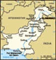
 Map of North Pakistan
Geological map of North Pakistan and surrounding areasthe latter two components is marked by the Main Mantle Thrust which is location of a past subduction zone and is the western continuation of the Indus-Tsangpo suture zone. The MKT and MMT are characterized by outcrops of ophiolitic and meta-volcanic rocks which record the suturing of the Kohistan arc to the Asian continent to the north and to the Indian subcontinent to the south. Through hundreds of thousands of pegmatites occur in various pegmatites fields of northern Pakistan.
Along the karakoram Highway you can observe different geomorphological structures and different type of rocks. There are mainly metamorphic, meta igneous volcanic and some sedimentary rocks. The geology of Kohistan is different and unique in the area, containing mafic and calalkaline type of rocks. Kohistan constitute about 36000 sq. kilometers of the territory located between Indo-Pakistan and Eurasian plates, on the north western side of the Himalayas. This part is known as the tectonic zone of Karakoram. The area of Gilgit and Baltistan are mostly over lying by sedimentary rocks of younger age. There are large and small outcrops of intrusive acidic, intermediate and ultramafic rocks. In the eastern part near Chilas and Besham the ultramafic rocks exposed. Bulk of
Aquamarine crystal
Aquamarine crystal from Northern Areas of Pakistan kohistan sequence consists of Amphibolites, Diorites and associated volcanic rocks. Structural observations show that due to collision of two plates, Hindu Kush, Himalayas, Karakorams and other mountains were built different structures shows the subduction and also obduction of two plates. The oceanic plate is heavier than the continental plate so, oceanic plate subducted under the continental plate. Geologically there are three main parts of region, Indian Plate or Indian Mass, Asian Plate or Asian Mass and Kohistan sequence.
In Swat Valley this suture is represented by talc carbonate schist, which is the host for gem quality emeralds. In Kohistan the basement is represented by deep crystal and upper mantle rock (ultramafics and garnet granulites) of Jijal complex, followed by metavolcanics of Komila amphibolites belt, and the Chilas complex (layered intrusion consisting of gabbros (Norited, Choromitites and ultramfics). Volcanic arc of Kohistan is represented by Chalt volcanic, which is overlain by marine sediments of Yasin Group.
The MKT, Main Karakuram Thurst that is the collision of the Indo-Pak and the Eurasian plate located at the Chalt-Nagar Valley. The history of tectonic evolution has very close relationship with different period of organic movement caused by under thrust of Indo-Pakistan (Indian)
Blue Spinal ( Sapphire)
Blue Spinal from Hunza Valley plate, north below the Eurasian Plate. Geologically millions of years ago, now the Northern Areas of Pakistan were submerged under a sea called "Tethyn" between Indo-Pak and Eurasian plate. During this collision Indo-Pak plate sub-ducted under the Eurasian plate, which is still going on, about 5cm per year. During this organic movement Tethyn Sea disappeared and reduced to now Arabian Sea when plates became closed. The remained material of the sea and newly erupted material by lava formed two Island arcs, Kohistan Island arc (Jajil to Chalt) and Ladhk Island arc (some parts of Baltistan is on Ladhk Island arc). Both plates have now continental parts. Due to this continental collision raise of Karakuram and Himalayas took place, which are highest as well as youngest mountain ranges in the world. Indo-Pak plate is still sub-ducting under the Eurasian plate. The mountain chain being squeezed upward as the Indo-Pak plate pushes against the Eurasian plate. The mountains are rising at an average rate of 7mm per year. Actually the mountains are raising highly due to this effect the rate of denudation is also high. In this way canyons and gorges become deeper and deeper.
THE GEMSTONES MINES OF NORTHERN AREAS
Geological map of Pakistan
Geological map of Pakistan (GILGIT- BALTISTAN):
In SHIGAR VALLEY-Skardu Baltistan
1-Dassu mines
2-Sibdi mines
3-Biasanpa mines
3-Istak mines
In KHAPOLO VALLEY - Skardu Balistan
1-Hussainabad mines
2-Gursay mines
In HARMOSH AREA
1- Biarchi mine
2- Shengus Mines
3- Bulachi Mines
ASTOR
Astore Mir Malik mines
In NAGAR VALLEY
1-Summyar Chumar Bakur mines
In HUNZA VALLEY
1-Ganish mines
2-Ahamedabad mines
3-Dorkan mines
4-Hassanabad mines
CONTACT:
northpak@isb.comsats.net.pk
northpakistan@dsl.net.pk
ishaq_jan@yahoo.com
Tel: 0092-51-2510374
Tel/Fax: 0092-51-2855440
Mobile: 0092-333-5276586
0092-344-9477670
www.north-pakistan.com
www.trekkingpakistan.com
www.travelblog.org/Bloggers/NORTH-PAKISTAN
Postal address :
NORTH PAKISTAN ADVENTURE
Trekking, Tours and Expeditions
P.O Box 746, Islamabad - Pakistan
CONTACT IN FRANCE:
*Mr. Fabrice OUDIN
Fabriceoudin777@gmail.com
contact@travelsocialclub.fr
Cell: 0033-619323372
*Claire-Emilie
claireemilie81@gmail.com
Cell: 00 33.6.16.67.60.79
Home: 0033.5.56.47.02.44
ITALIAN:
TOUR GEOLOGICI
La “North Pakistan Adventure” sta organizzando tour geologici di studio nel Pakistan settentrionale per visitare le locali miniere di pietre preziose e semi-preziose situate nelle zone di montagna. La popolazione locale pratica l’attività mineraria tradizionale in varie regioni delle Northern
Areas e vende pietre nei mercati locali. Ci sono parecchie miniere nelle regioni di Skardu, Haramosh, nelle montagne del Dosai, nella zona del Nanga Parbat, nelle valli dell’Hindu-Kush, di Hunza e di Nagar.
Le gemme di pegmatite abbondano nelle zone di Chitral, Gilgit, Hunza e Skardu. L’intera area settentrionale del Pakistan che comprende l’alto Hindu-kush e il Karakorum che contengono grandi quantità di batolite, presenta bacini di pegmatite lungo i suoi margini di granito. Questa regione è situata in una degli ambienti più dinamici del mondo dal punti di vista geologico, cioè nella zona di sutura lungo la quale la placca crostale indo-pachistana e quella asiatica sono entrate in collisione. E’ formata da tre fondamentali elementi crostali detti anche domini. Da nord a sud essi sono i componenti della Placca asiatica che si trovano nella zona di sovrascorrimento sull’ arco andesitico delle isole del Kohistan (è una stretta catena di isole vulcaniche che è stata compressa e contorta durante la collisione tra le due placche) e il loro confine è segnato dal principale scorrimento del Karakorum (sigla inglese: MKT; l’Arco di isole del Kohistanche è stato trascinato sugli elementi della Placca asiatica. Il confine tra gli ultimi due componenti è
Aquamarine Crystals
Aquamarine Crystals from Haramosh Valley of Gilgit Baltistan segnato dal Main Mantle Thrust (MMMT)lo scorrimento del mantello principale che è il luogo di una passata zona di subduzione ed è la continuazione occidentale della zona di sutura dell’Indo-Tsangpo. IL MKT e il MMT sono caratterizzati da affioramenti di rocce ofiolitiche e meta-vulcaniche che ricordano la sutura dell’Arco del Kohistan con il continente asiatico a nord e al sub-continente indiano a sud. Centinaia di migliaia di pegmatiti si trovano nei bacini di pegmatite del Pakistan settentrionale.
Lungo la Karakorum Highway si possono osservare strutture geomorfologiche diverse e diversi tipi di rocce. Ci sono soprattutto rocce metamorfiche, meta- igneo vulcaniche e alcune di tipo sedimentario. La geologia del Kohistan è diversa e unica nella zona perché contiene tipi di rocce mafiche e caloalcaline. Il Kohistan costituisce circa 36.000 kmq del territorio situato tra la placca Indo-pakistana e quella asiatica., sul versante nord-occidentale dell’Himalaya. Questa parte è nota come zona tettonica del Karakorum. Le zone di Gilgit e del Baltistan sono per la maggior parte ricoperte da rocce sedimentarie di età più recente. Ci sono grandi e piccoli affioramenti di rocce intrusive acide intermedie e ultramafiche. Nella parte orientale, vicino a Chilas e a Besham le rocce ultramafiche sono affioranti .
La maggior parte della serie kohistana consiste di amfiboliti, dioriti e rocce vulcaniche associate. Le osservazioni strutturali mostrano che, a causa della collisione delle due placche, l’Hindu-Kush, l’Himalaya, il Karakorum e altre montagne erano costituite da strutture diverse e mostrano anche la subduzione l’obduzione delle due placche. La placca oceanica è più pesante di quella continentale e quindi quella oceanica ha spinto sotto quella continentale. Dal punto di vista geologico la regione presenta tre parti: la placca indiana o massa indiana, la placca asiatica o massa asiatica e la serie kohistana.
Nella valle dello Swat questa sutura è rappresentata da scisti di carbonato di talco che sono un serbatoio per una gran quantità di smeraldi. In Kohistan il basamento è rappresentato da cristalli profondi e da rocce del mantello superiore (ultramafici e granulati di granati) del complesso di Jijal, seguito da una cintura di anfiboliti di Komila e dal complesso di Chilas, cioè un’intrusione fine stratificata che è formata da gabbri (Noriti, Choromititi e ultramifici). L’arco vulcanico del Kohistan è rappresentato da rocce vulcaniche di Chalt che sono ricoperte dai sedimenti di origine marina del gruppo di Yasin.
CONTACT:
northpak@isb.comsats.net.pk
northpakistan@dsl.net.pk
ishaq_jan@yahoo.com
<!--[if
!supportLineBreakNewLine]-->
Tel: 0092-51-2510374
Tel/Fax: 0092-51-2855440
Mobile: 0092-333-5276586
0092-344-9477670
www.north-pakistan.com
www.trekkingpakistan.com
www.travelblog.org/Bloggers/NORTH-PAKISTAN
Postal address :
NORTH PAKISTAN ADVENTURE
Trekking, Tours and Expeditions
P.O Box 746, Islamabad - Pakistan
CONTACT IN FRANCE:
*Mr. Fabrice OUDIN
Fabriceoudin777@gmail.com
contact@travelsocialclub.fr
Cell: 0033-619323372
*Claire-Emilie
claireemilie81@gmail.com
Cell: 00 33.6.16.67.60.79
Home: 0033.5.56.47.02.44
Advertisement
Tot: 0.056s; Tpl: 0.012s; cc: 12; qc: 27; dbt: 0.02s; 1; m:domysql w:travelblog (10.17.0.13); sld: 1;
; mem: 1.1mb


Naseem nawaz
non-member comment
provision of facilities
The govt. should provide opportunity to thoes students who can not see thes beautiful places of our country.Like me.