Advertisement
Published: June 29th 2010

 Nanga Parbat by Rahikot Face
View of Nanga Parbat from Fairy Meadow ( North Face)NANGA PARBAT 8125M CLIMBING EXPEDITION PAKISTAN
Nanga Parbat means “Naked Mountain” and alternative name is “Diamir Peak” that means “The King of the Mountains” is the 2nd highest peak in Pakistan after the mount K-2 and 9th position in the world, located at the furthermost Western end of the Himalayas, where the range of Himalayan mountain ends and Karakoram starts and it is the Western end pillar of the Himalayas. The central Himalayas are located in Nepal, while the Eastern Mountains extend to the border of Bhutan and Sikkim and Western end is in the Northern Areas of Pakistan. The massif of the Nanga Parbat forms the border between the districts of Astore to the East, and Chilas-Diamir to the West. Indus River flows to the North at about altitude of 1200M, creating an impressive difference in hight and marvellous sceneries. The Peak can view from the Karakoram Highway that rises near the famous curve of Indus River close to its confluence with Gilgit River and the homonymous town. The Nanga Parbat is lying in the main air route from Islamabad to Gilgit and Skardu, can be seen its full majesty and fury from the air.
The Nanga Parbat
Nanga Parbat from Daimir Face
View of Nanga Parbat from Daimir Face that is North West Route also called Kinshofer Route has been discovered in the nineteenth century by Europeans, Schlagintweit brothers from Munichen-Germany in 1854 and drew a panoramic view of this mountain that is first known picture of Nanga Parbat Peak. After that the world came to know about Nanga Parbat in the Himalayas and curse of it has been begun. It has been climbed first time by German-Austrian Mountaineer Mr. Berman Buhl in 1953 and became in the focus of the mountaineers in the world. Before 1953 some expeditions tried to summit but they could not success to scale and many of them lost their lives on the way to summit. The Nanga Parbat is one of the most challenging mountains in the world to climb and has the largest history of disaster and failures than any other mountain in the world and has claimed more lives than any of the mountain in the Karakoram and the Himalayas thus became the most murderous peak in the world and always been associated with tragedies and tribulations until it was climbed in 1953. Therefore, it has the reputation of the “KILLER MOUNTAIN” and also reknown by this name.
CLIMBING ROUTES ON NANGA PARBAT:
The Nanga Parbat main peak has
Nanga Parbat from Rupal Face
View of Nanga Parbat 8125M, from Rupal Face that is South route a height of 8125M/26660 feet and has three vast faces forming threes, glaciers and rivers respectively. They are named after the villages that lie beneath.
RAKHIOT FACE that is the North Face of Nanga Parbat, dominated by the north and south silver crag and silver plateau. This route is the heaviest in distance from the main summit and demands enormous preparation, as well as vigour to climb. Many German climbers tried their luch by this route and most of them ended with many casualities and tragedies of their members and therefor it was named “The German Fateful Mountain. This mountain was successfully climbed first time by this route in 1953 by the distinguished mountaineer Mr. Hermann Buhl from Austria, was a member of the German- Austrian Expedition leded by Dr. Kar herlighoffer.
DIAMIR FACE, which is West or Northwest Face that is rocky in the beginning. It converts itself into ice fields around Nanga Parbat Peak. It was first climbed by this route by the another German Expedition 1962 by the same leader, when Tony Kinshofer, A. Mannhardt and S low reached the summit and got accident, died while descending down. This route was latter called German
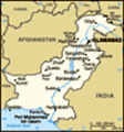
Map of Nanga Parbat
Map of Nanga Parbat Area or Calssical route also known as normal route or Kingshofer Route.
The RUPAL FACE that is South Face, which is the highest wall 4500M in the world with average slope of 57 degree, a marvellous creation of nature. It was climbed first time by this route in 1970 by two German speaking brothers from Italian Tyrol, Mr. Reinhold and Guther Messner and expedition was leded again by Dr. Herlighofer.
Many lives casualties during the climbing on Nanga Parbat are due to the enormous hight, with all consequences to human organism at altitudes above 7000M, called death zone, togather with extreme weather conditions. The latter, in part a result of the specific geographical position of the mountain, monsson periods, tropical climate in the surrounding valleys, leading to drastic temperature changes during the day and night also in altitude (-30 to +30 degrees Cesius), quick dynamic change in conditions; sudden storms; hurricane winds; excessive ice-falls and avalanches, combined with rapid glacier movements and change in crevasse relief. All this has led to acquiring Nanga Parbat a bad reputation, assigning it the name “KILLER MOUNTAIN”.
TIME SUMMERY:
These are the itineraries to have just an idea of the routes and
Nanga Parbat from Fairy Meadow
Nanga Parbat Range from Fairy Meadow Chilas number of days but you can adjust them with respect to your available days for climbing..
NANGA PARBAT PEAK
BY NORMAL ROUTE (DIAMIR FACE/KINSHOFER ROUTE)
Duration: 40-45 days around from Islamabad to back Islamabad
Day 01: Arrival to Islamabad air port, meeting with our guide, transfer to the hotel
Day 02: Meeting with liaison officer and formalities at the Ministry of Tourism
Day 03: Drive to Chilas, overnight at hotel
Day 04: Drive to Bunar and trek to Kachal/camp
Day 05: Trek from Kachal to Zangot/camp
Day 06: Trek to Nanga Parbat Base Camp
Day 07 -38: climbing activities
Day 39: Trek back toZangot/tent
Day 40: Trek to Bunar and drive to Chilas
Day 41: Continue to Islamabad
Day 42-43: Ministry formalities at Islamabad
Day 44: Departure from Islamabad (drop to the airport)
NANGA PARBAT BY RAHIKOT (NORTH FACE)
Duration: 40-45 days from Islamabad to back Islamabad
Day 01: Arrival to Islamabad air port, meeting with our guide, transfer to the hotel
Day 02: Meeting with liaison officer and formalities at the Ministry of Tourism
Day 03: Drive to Chilas, overnight at hotel
Day 04: Drive to Rahikot bridge then transfer to local
Nanga Parbat Diamir Base Camp
Base camp of Nanga Parbat from Diamir side that is Northwest Face jeeps to Tato and trek to Fairy Meadow/camp
Day 05: Trek to Bayel /camp
Day 06: Trek to Nanga Parbat Base Camp
Day 07 -38: climbing activities
Day 39: Trek back to Fairy Meadow/tent
Day 40: Trek to tato then drive to Chilas/hotel
Day 41: Continue to Islamabad/hotel
Day 42-43: Ministry formalities at Islamabad
Day 44: Departure from Islamabad (drop to the airport)
NANGA PARBAT BY RUPAL (SOUTH FACE)
Duration: 40-45 days from Islamabad to back Islamabad
Day 01: Arrival to Islamabad air port, meeting with our guide, transfer to the hotel
Day 02: Meeting with liaison officer and formalities at the Ministry of Tourism
Day 03: Drive to Chilas, overnight at hotel
Day 04: Drive to Astore- Tarshing / tent or hotel
Day 05: Preoaration of the trek to base camp /camp or hotel
Day 06: Trek to Herrligkoffer Base Camp
Day 07 -38: climbing activities
Day 39: Trek back to Trashing /tent or hotel
Day 40: Drive to Chilas/hotel
Day 41: Continue to Islamabad/hotel
Day 42 : Ministry formalities at Islamabad
Day 43: Departure from Islamabad (drop to the airport)
A HISTORY OF THE ASCENTS ON NANGA PARBAT:
•1895 Albert
Nanga Parbat 8125M
View of Nanga Parbat 8125M from the plane F. Mummery from Britain died during his attempt to climb Nanga Parbat from the Diamir (West) face.
•1934 Several mountaineers die during German expedition in a snowstorm
•1937 An avalanche killed 16 mountaineers (including 9 Sherpas) of a German expedition.
•1953 Herman Buhl reaches the summit. The expedition was the first led by Herrligkoffer.
•1962 the Bavarians Toni Kinshofer, Siegfried Löw and Anderl Mannhardt climb for the first time the Diamir-slope.
•1970 the south-tyrolian brothers Reinhold and Günther Messner climbed the highest face in the world (Rupal face) and traverse to the Diamir face. During this first traverse of an 8000m peak Günther Messner lost.
•1990 A ski-expedition (Germans, Polish, Jugoslavians) led by Herrligkoffer fails to reach the summit via the Diamir Glacier and the Diamir West Face.
•1991 again an expedition led by Peter Wörgötter tries to reach the summit via the 1990 route. Herbert Rainer could reach 7400m.
•2000 Hans Peter Eisendle, Wolfgang Thomaseth and Reinhold Messner reach 7500m on the Diamir West face, where it joins the Czech route from 1971.
•2005 the Americans Steve House and Vince Anderson open a new route on the Rupal slope.
“North Pakistan Adventure” may propose you all the
Diamir Valley of Nanga Parbat
View of Diamir Valley of Nanga Parbat services to the Base Camp including everything on an all-inclusive basis and can assist you at each step of your expedition to make it success. We may also provide partial services such as transportation, service of guide and cook, hotel reservations, arrangement of porters (low and high altitude), providing kitchen equipment etc.,
Our full package covers the following services,
•Transportation from Islamabad airport to back Islamabad airport (bus, coaster, hiace van and 4-Wheel Jeeps where would be needed /domestic airfares according to requirement.
•Hotel accommodation with meals (breakfast, lunch and dinner)
•Camping food during the trek and at the base camp as well as you will be in the base camp
•Wages of the porters for the base camp and their insurances, including their food and kit
•Follow up and in contact with Ministry of Tourism to expedite the processing of the climbing permit.
•Arrangement of briefing and de-briefing at the Ministry of Tourism
•Sleeping tents, Mess and kitchen tents, sleeping mattresses, toilet tent, bath tent, tables and chairs, plastic sheets for the base camp
•The arrangement of high altitude porters and any other crew pertaining to the requirement
•Kitchen appliance, crockery, stove, fuel etc. for the base camp
Nanga Parbat Diamir Face
Nanga Parbat by normal route/Kinshofer Route •Service of cook, assistant and their insurances and kits
•Services of guide, assistant for the base camp and their insurances and kits
•Porters for personal baggage (personal climbing equipment and high altitude food etc)
•Providing EPI gas cylinders
•Insurance of guide/liaison officer
•Liaison officer/guide’s food for the base camp
•Assistance in the clearance of cargo (climbing equipment and high altitude food etc)
•Arrangement of import/export permits from Ministry of Tourism for the cargo
•Assistance upon arrival and departure
•Toll taxes, parking fee and camping
•The guarantee of environment security of 1000 US dollar
•Payment of pollution fee, which is 2000 US dollar per peak
•Payment of royalty fee of the peak
NORTH PAKISTAN ADVENTURE
Trekking, Tours and Expeditions
P.O Box 746, Islamabad-Pakistan
Tel: 0092-51-2535766
Fax: 0092-51-2855440
Mobile: 0092-333-5276586
northpak@isb.comsats.net.pk
northpakistan@dsl.net.pk
ishaq_jan@yahoo.com
www.north-pakistan.com
Advertisement
Tot: 0.142s; Tpl: 0.013s; cc: 9; qc: 50; dbt: 0.076s; 1; m:domysql w:travelblog (10.17.0.13); sld: 1;
; mem: 1.2mb