Advertisement
Published: February 2nd 2022
The trip wasn’t supposed to be all about Tusheti, but that’s what happened. We had almost two weeks in Georgia and the Shatili to Omalo trek was always going to take up a large chunk of it. We didn’t realise just how good it would be and consequently anything else just couldn’t compete.
The Shatili to Omalo trek jumps into my top 3 treks ever, and I have done a few good ones around the world. Fairly recently the Heights of Alay trek in Kyrgyzstan (
The Heights of Alay Trek) made it into that list, probably overtaking various Andean and African treks. The Shatili to Omalo trek might overtake them as well.
The trek is anything from 70 to 90 km and 4 to 6 days depending how quickly you walk and which route you take, though for most of it there’s only one route.
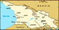
The trek starts with a long marshrutka journey from Tbilisi along ever worsening roads up into the Greater Caucasus Mountains. Actually it starts the day before while still in Tbilisi, sorting out food supplies and, importantly, gas canisters. We had brought some of the “just add boiling water” meals from home in the
Netherlands so that we could just bring a kettle rather than a pan and other cooking equipment. However, we still needed lunches and breakfasts so stocked up on dried fruit, nuts, crackers, bread and tinned fish from one of Tbilisi’s nice supermarkets.
The marshrutka leaves Didube Bus Station at 9am on Wednesday and Saturday mornings (it’s running as normal during covid times) and eventually climbs over the 2689 m Datvisjvari Pass. The road was pretty hairy but not as bad as we’d been led to believe during internet research. After about six hours with two short stops, once at a village shop containing not very much and once at the top of the pass where the views are cracking, you reach Shatili. It’s a stunning place. The ruined and rebuilt towers that make up the fortified part of town are great to explore, clambering up steps and through passages, sometimes emerging on the tops of cliffs or halfway up defensive towers. It sits in the mountains above a rushing river where a few valleys come together, not far from the border with Chechnya. The proximity of this border explains the defensive towers and forts that are the signature of
this region. Raids were common across the border, which led to retaliatory raids, which led to further retaliatory raids, ad infinitum.
After the final night in a comfortable guesthouse and the obligatory massive and wonderful Georgian dinner, the hike began early the next morning (after the obligatory massive and wonderful Georgian breakfast). Actually it began with a taxi 13 km to Mutso. We, and the other three that we shared the taxi with, had read online that it was better to start the hike this way to skip the “boring” 13 km dirt road section. I think if I was to go again, I would walk it. Yes, it’s a dirt road, but the scenery is still great as the mountains close in and the valley gets narrower and deeper. You would also have more time to explore the Anatoli ‘House of the Dead’ where human bones are still visible at the site of a village which all but succumbed to an ancient plague (a single child was found to be the only survivor).
We were dropped off and dropped bags at the base of Mutso Fortress then set off up to explore. Like Shatili, there
are partially rebuilt towers, ruins, scrambles up and over and along ledges and stairs, all with great views up and down the valley and the odd human skull peeking out of more necropolises (necropoli?). If you walked from Shatili you could spend the night here (there’s a guesthouse), or keep going past the army checkpoint up the first decent climb where you come across the isolated little hamlet of Khonischala, where you could also spend the night at a lovely looking guesthouse. These guys were lifesavers as we realised at this point in our hike that, despite being happy to have easily found gas and food and feeling smug with our complete self-sufficiency, we had forgotten to buy a lighter. An ancient shepherd who looked older than the mountains but was probably only about 50 directed us back to the guesthouse where they gave us two boxes of matches. They wouldn’t take anything for it, we had to force them to accept a stick of
churchkhela (nutty fruity candlestick-like snacks, also known as “Georgian Snickers”) for their kids, and he still tore it into two and gave us half back (which, in hindsight, maybe means they are sick of the
stuff).
The hike continues alongside the river for a while before a spring marks the turn off up onto the ridge. Fill up all bottles at this spring because you’ll need a lot of water for the next bit. Walking from Mutso as we did means you arrive here late morning as it’s getting hot and it is a beast of a climb – another reason to spend the night at Khonischala (or Mutso assuming you explored the fortress the day before). There is little shade and it’s about 900 m of zigzagging up the steep dusty slope. The ever-improving views of the higher snow-capped peaks and increasingly distant wooded valley bottom provide a nice distraction but it is tough going. Suddenly, you pop out of the trees onto high meadows where we were very surprised to come across a small café near the army checkpoint. Note that the spring at the back is the last place to obtain water for a while.
There are many great camping spots on the gradually ascending Khidotani Ridge, however, there’s no water. We kept going beyond the meadows until the path again narrows skirting the edge of the mountain. There are
occasional springs here but no flat spots to camp. Therefore, we continued to the end of the valley to the base of Atsunta Pass where there are streams and flat(ish) areas at about 2800 m. Fortunately, we were first to arrive (ultimately there were only another five people there) so could have a freezing shower of sorts in the stream. Cooking dinner was exciting as the thunder started and the sky went black. We just managed to cook and eat before the heavy rain and lightning hit, confining us to the tent for a nerve-wracking 20 minutes or so. Afterwards it was clear and calm so we got the stove out again to knock up a Polish angel-delight-style desert with a French couple who were spending months hiking around Georgia. It soon got chilly after sunset.
The morning was a similar story. We initially enjoyed breakfast looking over great views and clear skies when it started going dark so we gulped it down and packed up in a hurry. Perhaps we should have been in less of a hurry and hunkered down in the tent because not long after starting the climb the wind and rain hit.
It was a steep zig-zagging path climbing up quite loose black scree – probably much better to ascend than descend. There is no shelter and the strong wind catching in the raincoats occasionally knocked us off balance, which was quite precarious on the exposed slope.
By the way, we had checked the forecast before leaving Tbilisi and it was good. We even delayed the trek a few days to avoid a poor forecast and explored a bit of Kakheti. Avoiding rain is not just for reasons of making the hike more pleasant, but due to the necessary river crossings that can be dangerous if there’s more water about. We discovered from people more familiar with the area that the previous days had been fine and you just never know how the weather will be.
The rain stopped during the hour or so it took us to reach the summit of the Atsunta Pass, the highest point of the trek at 3400 m. The rock cairns that mark the summit were utilised as wind breaks while enjoying the new vistas but we didn’t pause for long knowing that descending would get us out of the wind.
The descent
was a long gradual one traversing the scree and eventually reaching a deep grassy valley. Lower down there is an excellent camping spot in a flower-filled meadow just above where two valleys come together surrounded by beautiful mountains (it’s marked on the ever reliable maps.me). However, we reached it at about midday so enjoyed lunch on the big flat rock and continued down the valley. The first stream crossing is reached at this point – stream crossings and shepherds’ dogs being the main two hazards on this trek according to all the blogs we had read. Shoes off, sandals on, it was quite easy, if a little chilly being glacier fed.
At this point it got pretty hot as we walked in a rocky canyon. There are springs appearing in the banks fairly frequently enabling bottles to be refilled. Though just as quickly it went dark and we found ourselves in another short but fierce thunderstorm. The rains had us concerned over the necessary stream crossing to reach the camping spots at Kvakhidi Meadows. Internet research had thrown up some videos of hikers crossing the thigh deep raging torrent and it didn’t look pleasant. It should be tackled early
in the day when water levels are lower (due to overnight freezing temperatures higher up) but it was now early afternoon. Therefore, we decided to stick to the left bank of the river high up the valley side and camp further on than Kvakhidi Meadows. This would make the later days of the trek more manageable in length (so we thought…). All was going well, even though the view across to Kvakhidi Meadows made it look very appealing, until we reached a quite boggy area that we didn’t want to cross. In hindsight, we should have made more of an effort to cross it because looking back later in the day it seemed a decent short cut. Instead, we dropped down to the riverbank thinking we could walk along the river edge. This was not possible due to landslides essentially creating loose cliffs. So we had to cross the river after all.
In normal circumstances I definitely wouldn’t have crossed it. However, we didn’t think we had much choice. Walking up and down didn’t reveal anywhere that appeared narrower, shallower or more slowly flowing. It was about 10 metres wide, flowing very fast, with water coloured grey by all
the glacial rock dust so we couldn’t guess the depth or pick out boulders. Sandals were strapped on very tightly so the current wouldn’t whisk them away. At this point my dislike of hiking with sticks seemed a poor decision as they would have been very helpful for both support and to measure the depth. Learning from Bear Grylls, I undid the straps of my rucksack so it could be ditched if I was knocked over. I found the best way through was a kind wide stanced shuffle. A wide stance to support against the fast flow and shuffling my feet along the bottom to avoid being tripped by unseen boulders. The water was about up to my lower thighs (I’m 185 cm tall, or 6 foot 1), though higher on the upstream side because it was flowing so fast. It wasn’t a very enjoyable experience but I made it – very slowly – then dropped the bag and turned around and went back. Crossing without a rucksack was not much easier. Then I collected Magdalena’s rucksack and went through the ordeal for the third time. Finally I could throw the sandals back over the river – we only had
one pair between us with tight straps – and cheer on Magdalena as she went for it. I may be overdramatising it a little because it wasn’t necessarily life-threatening and I wouldn’t want put anyone off doing the trek. Though falling in would be annoying, you may lose some of your stuff, and the very cold water and boulders might cause problems. Apparently the shepherds ferried people across on horseback for a small fee before covid times when there were more hikers about.
A kilometre or so downstream, past the shepherds’ huts, where apparently you can camp, get food and even take a shower, there is a narrow rickety bridge as the river enters a gorge. From here we could see that we probably could have made it down the left bank by sticking high above the river. We aimed for another 5ish kilometres and questioned approaching hikers about possible camping spots. They told us there weren’t any. For a long way the path climbs and traverses steepish valley sides – great views, plenty of springs, but no flat spots to camp.
The path drops again to the river and there is a point where you have to
get into the riverbed and traverse some stepping stones and ledges on a little cliff. It is easy to pass, but might not be if the water level was higher. Immediately downstream there’s a kind of island, which is flat enough and grassed enough to pitch a tent. It was a lovely spot to camp. There is a spring for water, a pool for having a bath in (if you can brave the water temperature), and there are enough boulders to sit on, cook on and put things on. It is only about 10 metres from the path so I initially felt quite exposed. But it was now late afternoon and we hadn’t passed anyone for ages. Also, it’s only about a metre above the river level in a quite narrow gorge. Oh the irony of a hydrologist being swept away in an overnight flood. The water level usually drops at night and I put a marker in the river – it did drop overnight – though I kept waking up wondering if the roar of the river had got louder, and even went outside to check a few times.
The following day was possibly the best
of the whole hike. The weather was beautiful and the path climbed then clung to the valley side high above the river. The valley opened out and we had great views of high mountains either side. We were often walking backwards to take in the views back up the valley to the snow-capped peaks around Atsunta Pass. It turned out that if we had walked a little further there were loads of camping spots as occasionally the path passed through high plateau meadows.
The first shepherd we reached greeted us in Polish; most of the people we met on the hike, and generally travelling around Georgia, were from Poland (WizzAir to Kutaisi is probably the cause of this). Therefore, many locals have learnt a few words of Polish. The shepherd directed us to a group of shacks towards his shepherd mate for some tea. As discovered during the 2019 trip through the Baltic States, along the Trans-Siberian Railway, and back through Central Asia, travelling with someone who speaks Russian comes in very handy in former Soviet Countries. We ended up staying for about two hours. Fascinating conversations with the shepherd (the first shepherd’s boss) led to homemade beer and
wine, food, the appearance of a very shy grandson, a tour of their cheesemaking hut, a big wedge of cheese to take with us, and a mysterious note with a name on it to hand to someone when we got down to Girevi, which is the last village accessible by road from the east and half a day’s hike away. The shepherds spend around 3 months up here in the mountains with their sheep and goats making cheese during the summer then make the long trip out of Tusheti with all their animals for the winter. Apparently, the population of Tusheti ranges from a few thousand in the summer to a few dozen hardy souls in the winter who stick it out even when the only road access becomes unpassable.
We had to peel ourselves away knowing we still had a long way to go. The trek continued being beautiful, a highlight being the ruined abandoned village of Chontio. The village’s Tueshetian Towers are the first to be seen on the trek and suddenly appear as you round a bend in the valley. They are worth a little explore and looking back over your shoulder you see them for
miles and miles as you continue towards Girevi. From this point onwards, once you get your eye in, you start to see ruined towers on all the ridges and rocky outcrops in the most inaccessible places with the best views up and down the valley. Definitely very safe from attack but they must have been a bugger to build.
Past another few pointy towers and the valley opens out to reveal the actually inhabited village of Girevi. We handed our note to the first person we came across who laughed and shouted a friend. Not knowing what it said as it was written in the beautiful Georgian script, we assumed it was a note requesting supplies be sent up. The friend also laughed after reading it and directed us through the village to another lady (the shepherd’s niece) who invited us in her house and put the kettle on. Soon we had tea, bread, even more cheese, sweets. After chatting and eating for half an hour or so, we asked what was on the note. The translation was something like: “These are my friends. Please treat them very hospitably.” Hence, the laughter from everyone who read the note! The
niece actually lived in Tbilisi and was only visiting for a couple of weeks (with her teenage son who found Tusheti a bit boring!). We eventually left, still with a long way to go, and now with an even bigger block of cheese and hunk of bread strapped onto the top of the rucksack.
Girevi has guesthouses, but we pushed on towards Dartlo, making it a pretty long day. Much of the route goes along a dirt road but there are few vehicles on it. It’s a fairly level walk down a beautiful valley surrounded by big attractive mountains. There are lots more ruined towers dramatically situated on ridges and pinnacles along the way. The rushing and broadening Pirikita Alazani River provided a welcome, if freezing, dip to wash off some of the accumulated dirt road dust. There are also some great camping spots on flat areas of floodplain, including below Chesho and by Parsma, the latter being another beautiful village of big defensive towers with a few roadside cafes.
We approached Dartlo gingerly due to a pack of dogs in the road. We gave them a very wide berth and waited until the seeming leaders
were laid down. Overall, we had no issues with the feared shepherds’ dogs on this trip, but we met people who had so there is something in the internet warnings. Dartlo rises up the valley side with new and grotty looking buildings lower down then ancient stone houses and towers further up. We wandered up alleyways until one of the first guesthouses we passed lured us in with its herbs hanging to dry on the wall, its spectacular view from the little terrace, and the friendly looking lady smiling at us. After such a long day, it was marvellous to collapse and get the traditional local welcome of a pot of locally gathered herbal tea, freshly baked bread and jam made from berries picked off the hillside. The guesthouse was ancient and lovely; we were the only guests. The Tushetian feast that was prepared for us for dinner was divine; washed down with local wine and homemade chacha (Georgian ‘brandy’ but more like grappa and lethally strong though necessary to dissolve all the food and allow you to keep eating!). It was great to have a proper shower and a proper bed, followed by a great night’s sleep.
The morning began with a giant breakfast. The plan was then to leave the bags and climb in order to explore the ruined village of Kvavlo that looms high above Dartlo. It’s a steep climb up through the village, past some quite big guesthouses, some with a bar, though I would not have changed where we stayed. Then zig-zag up through steep grassy flower-filled meadows looking back on the great view of Dartlo’s towers and over the river at the high mountains.
Wandering through the ruins was nice until we stumbled upon a party. A gang of local blokes were sleeping up there and had hauled up a lot of chacha in big plastic bottles and were dancing to music being played from a mobile phone. Obviously, we had no choice but to join them. After a toast every few minutes that involved downing a large glass of their homemade firewater, a lot of dancing and singing, occasional bready snacks, and struggled conversations in a mix of Russian, Georgian, Tushetian and English, we had made a lot of new friends. It took us about an hour to get away, with a lot of final final absolutely final toasts.
We stumbled back down the hill feeling more than tipsy. It was about 10:30am.
We decided to have lunch before we embarked on what would be a long day – little did we know how long – in an attempt to sober up. This worked to some extent though because we bought a lot of Tushetian tea picked and dried by the guesthouse owner (it’s made with a kind of wild thyme – we are still drinking it as I write this 5 months later), she treated us to more of her homemade chacha before we left because we had liked it so much the night before!
The day’s hike thus began, excluding the 300 m climb we had already done to Kvavlo and back, at about 12:30pm. We didn’t mind too much starting late, because it seemed like a fairly short day. Most people walk directly from Dartlo to Omalo about 10 km along the dirt road. We didn’t fancy that so took a detour to Diklo. This “detour” was one of the toughest single day hikes of my life.
Even though I really recommend maps.me, you don’t get contours. Nor are there contours
on the paper maps of the region showing the trekking routes. Dartlo to Diklo in a straight line is about 10 km. How hard could it be? Unfortunately, we didn’t come across any blogs of people who had done this part of the route. This may be the first. And last.
We left Dartlo following a footpath high up the valley side. We stuck to the path even as it climbed high above the dirt road that leads to the village of Chigho. There were a lot of ruins up there and it made for a really interesting hike, the higher we got, the more stupendous the views along the valley in either direction. The path was occasionally sketchy as the valley sides got steeper and sometimes had us traversing steep scree slopes. Then it reached a farmhouse and stopped. In front of us was a very deep gorge. A long way below us was the dirt road. That was the only way across. The realisation that we had climbed so much for nothing was really frustrating, especially because we could see Chigho in front of us and it was higher than where we currently stood. It was also
a tricky descent straight down a very steep hillside. We measured that it was about a 400 metre scramble down to the dirt road, boots off to cross the ford, then zig-zag up the dirt road into Chigho higher than we were before. This hot dusty climb was never-ending and we actually considered staying the night – there is a guesthouse. However, as the crow flies we were only about 5 km from Dartlo so we kept going thinking Diklo wouldn’t be a great deal more effort.
As soon as we got a view of where we were heading, we couldn’t believe Diklo was on the other side of the high ridge we could see in front of us. More worrying was the deep valley before it. The river was very very far below us. “Maybe the path follows the contour and we pop out near the top of the ridge” I said overly optimistically as we already started descending. It was a steep and long drop, the lower we went, the higher we knew we’d have to climb again. At least we were in forest out of the sun, but that gave us a bit of
a fear of bears that the shepherds had told us was the reason they had fierce dogs – it’s not because of the very scarce wolves.
Eventually we reached the river and crossed the raging torrent via a very rickety bridge. Immediately we began climbing. By the way, we had run out of food and water apart from the hunk of salty cheese that sucked any remaining moisture from your mouth. I was getting concerned we would run out of daylight. It was an 800m climb up the mountainside. True, the views were spectacular, especially looking down the valley to the distant Keselo Fortress that sits above Omalo, but these were not enough to distract us from the climb. After all the booze in the morning, the unnecessary climbs and necessary climbs, this one was a struggle. Pathside wild raspberries and blackberries kept us going.
We eventually reached the crest of the ridge and saw Diklo below us, this was as the sun had dropped below the mountains and it instantly started getting cold. Diklo is in an incredible location essentially at the end of the road with high ridges or deep steep valleys all around it. It
sits in the northeast corner of Tusheti, Chechnya on one side, Dagestan on the other. We dropped down the hillside on weary jelly legs and practically crawled into a surprisingly busy village as it was getting dark. Turns out there was some kind of village festival on and families of the villagers had travelled in from all around. After one of the toughest single days of hiking in my life with over 2000 metres of climbing, there was nowhere to stay. “Please don’t say we have to camp!” We both voiced to anyone who would listen. After some pleading with a guesthouse owner, who spoke little Russian and little English but excellent Spanish (so for the only time in the whole Georgia trip the communication was down to me), we secured a tiny room with a single bed. I would sleep on the camping mats on the floor. Being able to chat in Spanish even enabled us to secure some dinner. The hosts were incredibly apologetic for not having much to offer due to the festival but it was still a delicious feast, though we would have eaten anything after that day!
It was a slow start
the next morning as we didn’t have far to go to Omalo and we assumed, again wrongly, that it would be an easy walk. We first explored Diklo a little bit, thankfully without bags, including avoiding all the areas where for ancient pre-Christian religious reasons, men are allowed to walk and women are not. Then we loaded up and took another detour around a mountainside rather than taking the dirt road directly to Omalo. This detour is very worth it; we didn’t see a single other person (just like the day before!) but skirted the mountain side with great views across to the high mountain ridge at over 4000 metres that marks the Russian border, as always with some ludicrously positioned ruined defensive towers. The highlight though was the flower meadows we had to beat trails through in occasional forest clearings. A short but steep climb gave us a great view of the lovely village of Shenako. Another descent and climb brought us into the village via lots of abandoned and ruined houses. Shenako has a beautiful little church, really nice old houses, and a few people selling handicrafts (great knitted socks).
Upon leaving the village, the dirt road
goes one way and a path goes straight on. We followed it thinking it would just be a short cut avoiding all the road switchbacks to the bottom of the valley. It’s not, it’s a steep and loose descent that occasionally has you grabbing tree trunks. At the bottom is a great footbridge over the rushing grey river quite far below. Well, it’s a great bridge as long as you don’t mind the big gaps in the boards you are walking along. Then you climb again. This time it is a path that does just cut out the switchbacks in the roads and I recommend taking it to stay out of the dust as occasional cars grind their gears and the dirt road in getting up to Omalo.
Omalo isn’t initially much to look at. We arrived in Lower Omalo and made our way through dusty streets between fields of cows, sparse houses and long since brokendown tractors and other machinery. There are many guesthouses, some quite big and recently built, but we settled on a small one that just looked like someone’s house. As always, the hosts were lovely, the food was delicious and overly plentiful
– for the first time we couldn’t actually finish it all – it came with as much homemade chacha as we could handle, and the views from the open sided eating area were delightful. True, Upper Omalo is probably more attractive, with even better views and the great Keselo Fortress looming above, but we preferred staying down in Lower Omalo with our lovely hosts and having to endure the climb (more climbing!) to explore the fortress.
A shared four-wheel drive taxi was easy to arrange and we set off the next morning to Alvani over Albano Pass. This pass is the only road in and out of Tusheti and was only built in the 1980s. It is still unpaved, loose and bumpy as it scales the 2850 m Albano Pass. The pass is only open for about 5 months of the year when it is clear of snow, hence the population of Omalo dwindles to almost nobody in the winter. Now this is a sketchy road. Labelled by the BBC as the most dangerous in the world, I don’t know if that’s accurate but I’m glad I walked in from Shatili and only had to drive it
once. Several people die each year dropping 1000s of metres off the edge, as the many roadside crosses attest, and landslides regularly close the road. The taxi driver was excellent and drove it twice most days but I was nervous as I often looked down out of my window and just saw void below me rather than road. However, we have to be partially thankful for the state of the road as it does a great job of limiting tourists.
Eventually, we reached Alvani where marshrutkas leave for Tbilisi. There is enough time to get a taxi just out of town to the beautiful Alaverdi Monastery before the van leaves.
I think I’ve written enough without mentioning all the other things we did in Georgia. Those other things were great, but Tusheti overshadows everything else. Sighnaghi was very pretty, Kakheti wine cellars were great, Mtskheta is definitely worth a wander, the cave monasteries of Vardzia are incredible, Borjomi is pleasant, hiking in the Borjomi-Kharagauli National Park is lovely, there’s loads to do in Tbilisi, not to mention all the many stunning monasteries, churches and castles we called at on the way to other places. And I
could write a whole blog just about the food. But now, almost 5 months later, when I think about the Georgia trip I think about Tusheti.
Advertisement
Tot: 0.477s; Tpl: 0.031s; cc: 35; qc: 152; dbt: 0.2724s; 1; m:domysql w:travelblog (10.17.0.13); sld: 1;
; mem: 1.7mb