Cape Verdean Geography, Cape Verde Geography
Advertisement
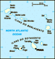
Location: Western Africa, group of islands in the North Atlantic Ocean, west of Senegal
Geographic coordinates: 16 00 N, 24 00 W
Map references: Political Map of the World
Area: Total: 4,033 sq km land: 4,033 sq km water: 0 sq km
Area - comparative: Slightly larger than Rhode Island
Land boundaries: 0 km
Coastline: 965 km
Maritime claims: Measured from claimed archipelagic baselines territorial sea: 12 nm contiguous zone: 24 nm exclusive economic zone: 200 nm
Climate: Temperate; warm, dry summer; precipitation meager and very erratic
Terrain: Steep, rugged, rocky, volcanic
Elevation extremes: Lowest point: Atlantic Ocean 0 m highest point: Mt. Fogo 2,829 m (a volcano on Fogo Island)
Natural resources: Salt, basalt rock, limestone, kaolin, fish, clay, gypsum
Land use: Arable land: 9.68% permanent crops: 0.5% other: 89.82% (2001)
Irrigated land: 30 sq km (1998 est.)
Natural hazards: Prolonged droughts; seasonal harmattan wind produces obscuring dust; volcanically and seismically active
Environment - current issues: Soil erosion; deforestation due to demand for wood used as fuel; desertification; environmental damage has threatened several species of birds and reptiles; illegal beach sand extraction; overfishing
Environment - international agreements: Party to: Biodiversity, Climate Change, Desertification, Environmental Modification, Hazardous Wastes, Law of the Sea, Marine Dumping, Ozone Layer Protection signed, but not ratified: none of the selected agreements
Geography - note: Strategic location 500 km from west coast of Africa near major north-south sea routes; important communications station; important sea and air refueling site
Advertisement
The information here has been derived from Public Domain Sources such as the CIA World Factbook. No liability can be taken for any inaccuracies.
Tot: 0.05s; Tpl: 0.007s; cc: 3; qc: 10; dbt: 0.0181s; 1; m:domysql w:travelblog (10.17.0.13); sld: 1;
; mem: 1.1mb
 The uninhabited islands were discovered and colonized by the Portuguese in the 15th century; Cape Verde subsequently became a trading center for African slaves and later an important coaling and resupply stop for whaling and transatlantic shipping. F...