Advertisement
Published: March 16th 2008
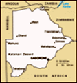
Gaborone is an odd city. It was built from scratch as a capital, but despite it’s modern origins, it seems to have sprung up with little forethought or planning. The land area that it covers is vast, and long taxi or combi rides are needed to get anywhere. Much of the population live in the widely dispersed suburbs, now organised into numbered ‘blocks’ some of which are themselves as large as small towns. Dividing these blocks are major highways that cross each other at great ‘circles’ (the local name for roundabouts).
In theory, all the streets have names. In practice though, most of them are missing any clue as to what they might be. There is also a great lack of maps to be found. Indeed, many of the locals I asked didn’t seem to really understand the use of a map, let alone why I would want one! That being said however, everyone was very helpful when asked for directions, although on at least one occasion I ended up in a completely different place than I’d intended!
There is poverty here, but it doesn’t seem as extreme as in other places in Africa. No one asked me for
 rtp077-0405
Drainage ditch in Gabs.money, and I saw no one lying disconsolately by the roadside. Even the curio sellers seem content to let you come to them.
Scattered across the city are modern shopping malls boasting well known names such as Shoprite, Woolworths, and Nando’s. The largest of them even has a multiscreen cinema, although the picture quality is nothing to boast of. Pressed up against many of the shop fronts however are the same style of chaotic looking local markets that you can find anywhere on the continent, with colourfully dressed locals selling almost anything you can imagine from fresh fruit to used tyres - often on the same stalls.
I found hardly any good restaurants; although I imagine the big hotels all have them. Most people eating out seem to do so from the various fast food chains; KFC, Nando’s, Steers, Beares, and even one called Bimbos!
Many of the people seem to be quite ignorant about their own country, blaming the high rates of unemployment on their large population. In fact, Botswana has one of the lowest population densities in the world with a total population of less than 1.5 million! The country is also one of, if
not the, richest on the continent with an annual GDP many first world countries would be proud of.
The wealth results from three principle areas: A low impact, high cost, tourism policy attracting some of the richest safari goers in the world: Strict disease control practices that protect the extensive, productive and healthy beef herds: And, most significantly of all, the world’s largest and most prolific diamond mines.
These mines, operated by a public-private partnership called Debswana and consisting of the Botswanan government and De Beers, are now located inside what are effectively, heavily fortified towns. The highway passes close by, but the only access is by private road and no one, at all, goes in or out without permission from Debswana.
Their new corporate headquarters being built in Gaborone is a vast glass fronted edifice that would look entirely at home in any first world city.
There isn’t really much to see as a tourist, although I did my best. The city isn’t geared up for casual visitors at all. There are hotels, and expensive ones at that, but they are aimed at the business traveller. The guesthouse, come hostel, that I stayed in only
rtp077-0417
The house in which the imfamous Jaimeson raid was planned by Cecil Rhodes. Now part of Gaborone Botanical Gardens. opened last year. It was however, clean, reasonably priced, and run by a very helpful young lady. If you ever need somewhere cheap to stay here, then search on the web for “Backpackers House, Gaborone”. The website has all the details on how to contact, and find the place.
After much searching, I eventually found an old “visitor’s map” of the city. Only the major roads were there, but useful buildings such as the bus and railway stations, shopping malls, hotels and embassies also featured. Framing the map were pictures and short descriptions of local attractions. Unfortunately… although these attractions were shown on the map with little orange stars, nowhere was there to be found any link between individual stars and the attraction they represented! I could see a little cluster of orange stars out to the east, but whether they represented the craft market, war graves, yacht club, etc., was impossible to determine.
By trial and error, and far more luck than judgement, I eventually found my way variously to the National Botanical Gardens, the National Museum, and a former colonial fort and prison. The latter, though listed as an attraction, appears now to be just a
rtp077-0424
Part of the communications network used by Nasa to talk to it's shuttles. It was retired after the loss of the Challenger and ended up a museum piece in an obscure corner of the botanical gardens. few whitewashed brick buildings isolated behind a fence. The museum in the centre of town and the Botanical Gardens near the suburb of Tlokweng, both proved interesting and well laid out however. They are also entirely free to get into.
I’m not sure I’d go back unless I had to, but I’m glad to have seen the place. It’s completely safe to wander around and the locals are almost all extremely helpful. It would however have been easier at times to be able to speak Setswana as standards of English are extremely variable.
Advertisement
Tot: 0.073s; Tpl: 0.011s; cc: 6; qc: 46; dbt: 0.0477s; 1; m:domysql w:travelblog (10.17.0.13); sld: 1;
; mem: 1.1mb


Ken
non-member comment
Truth
Nice read about our city. Atleast you saw some positives here! lol